NUFC05
Football
Moor Edge, Football Ground
54.995214, -1.614135
Jesmond
Opened:
Unknown
Closed:
Unknown
Repurposed
Condition:
Home Teams/Clubs:
Last Updated:
28 Oct 2024
Jesmond Association FC, Newcastle West End (1885 - 1886)
HER Description
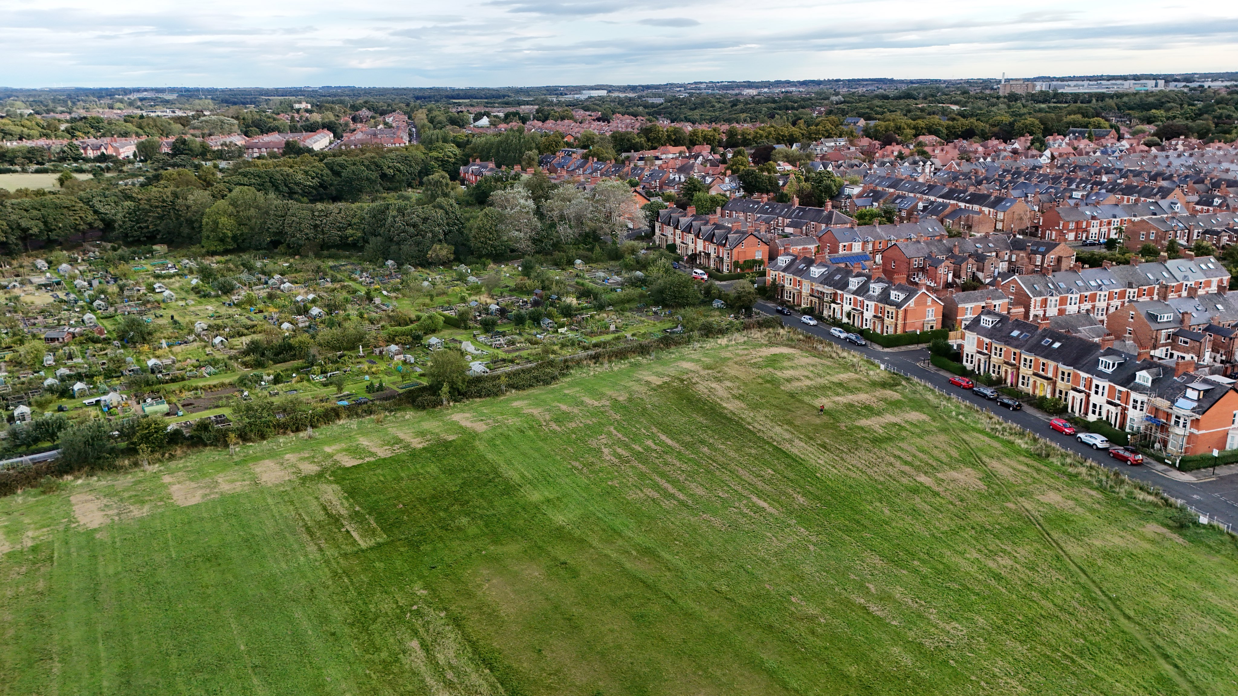
NEHL - A ground was situated on the Moor Edge, in between the present Ilford Road and West Jesmond Metro Station, for purposes of football.
We certainly know Newcastle West End played here before moving to what became St James' Park in 1886. Up until the summer of 1885 West End FC made use of the Town Moor, likely between the racecourse, to host their football matches. However, it was banned after damage to the ground presented after it hosted a temperance festival (which became the Hoppings, first hosted in 1882). There was little herbage, especially due to the dry weather, as merry go rounds, other amusement rides and footfall chopped up and damaged the earth much like how it does today. The erections, glass and paper scattered across the ground and post holes in the ground made it a difficult site for grazing. "Artificial food" had to be bought in for the cows, and the price of milk spiked as the price was put on the city.
As a result, West End and a number of other football clubs had to seek a new home. Moor Edge, likely home to Jesmond Association, became a temporary salvation until ground "at the foot of the Leazes, opposite Gallowgate", was leased for four years. Men were employed in levelling and erecting railings from the September of 1886.
The West End club collapsed in 1892 due to ill luck and financial woes, citing payments to "good-for nothing Scotchmen" as the ruin of the club. The ground was taken on by the East End directors and henceforth changed their name to Newcastle United.

Ordnance Survey, 1898

The ground was situated at the allotments, once named "Moor Edge". Taken in May 2022
Have we missed something, made a mistake, or have something to add? Contact us

The site has remained playing fields since, though the ground may partially stand on the allotments shown here in 1947. Source: Historic England Archive (RAF photography) raf_cpe_uk_2352_fs_2142 flown 4 October 1947
Historic Environment Records
Durham/Northumberland: Keys to the Past
Tyne and Wear: Sitelines
HER information as described above is reproduced under the basis the resource is free of charge for education use. It is not altered unless there are grammatical errors.
Historic Maps provided by


