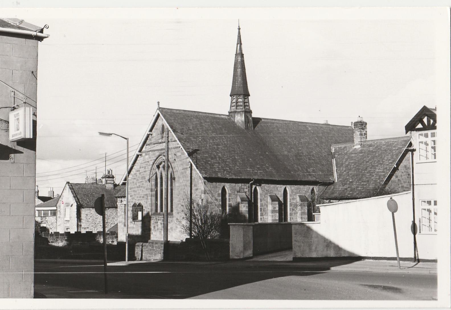
West Auckland Wesleyan Methodist Church
West Auckland
Last Updated:
19 Sept 2024
West Auckland
54.632455, -1.718641
Site Type:
Chapel, Place of Worship, Sunday School
Origin:
Status:
Extant
Designer (if known):
J W Taylor
Now a private residence

This is West Auckland’s beaaautiful Wesleyan Church on the road up to St Helen Auckland. Its proof that a little flèche really makes the world of difference in elevating a building!
The chapel was built in 1893, superseding a back lane chapel dating from 1827 off Front Street. Previous to that, the Methodists here met in an upstairs room which also posed as the day school under the mysterious name of the “Black Hold”. The congregation here was founded in West Auckland all the way back in 1770, so a very kind standing community like thanks to the copious pits influencing inward migration. Both were inadequate and as the village grew, so did the worshippers. Therefore a new site was sought.
The land was bought from Sir William Eden of Windlestone Hall (whose son was Anthony Eden!) at a cost of £100 - purchased thanks to it being “the best plot in the village”. It was designed by J W Taylor of Newcastle to seat 250 adults, as well as a Sunday School for 350 kids. Taylor also designed the Dacre Street Congregational church at Morpeth and the Wesleyan Chapel at Ushaw Moor.
It’s designed in the Early English style with overhanging roofs. The interior was fitted out with pitch pine and diamond quarry glass - even featuring heating, lighting and hot water which was still an uncommon occurrence at the time! It’s absolutely beautiful and you can tell plenty of money was put into it - especially against other Wesleyan chapels.
It was still a Christian centre in 2009 but by 2016 it was a private residence. The conservatory extension added to the north Sunday School wing was added before conversion.
Listing Description


The Ordnance Surveys shown depict West Auckland between the 1890s and 1910s. The first was surveyed only a few years after the church was built, and depicts the Sunday School extension as a separate portion on the north side. It's quite clear to see the original medieval green with the newer developments branching off of it. Of course the Picture Theatre was one of the larger constructions in the village at the time, but even the terraces northwards were far more uniform and spaces than some of the 18th century units against the green. You'll also notice Post Office Square is still in situ - a cluster of dwellings within the green itself (https://x.com/neheritagelib/status/1836083663139668209).
The village smithy was still operating into the 1910s but has been demolished. You may also notice the street was previously called Millbank which will come more evident with the map below.

Back in the 1850s the street, near the site of the chapel, ran over the course of a mill race which provided the street the name Millbank. The race has been entirely filled in and covered over, but the course can still be seen by the field boundaries on the eastern side. The chapel was a garden at this stage behind the Front Street, but the National School stood adjacent. This had stood here since at least the 1840s, with Anglicans being the dominant purveyors of education at the time rather than the state.

The church in July 2024

The church around 1973 still operating as a place of worship. Taken by Peter Singlehurst, copyright status unknown (please contact if any issue)