Vigo Railway Station (S&T)
Chester le Street
Last Updated:
4 Aug 2025
Chester le Street
54.880574, -1.562205
Site Type:
Railway Station
Origin:
Status:
Repurposed
Designer (if known):
Now a public bridleway

A station which was totally wiped off the map by the 1860s was Vigo, serving a very small hamlet east of Barley Mow. It stood here, or just on the other side of the bridge.
This section of the line was opened with the rest of the line in the 1830s, but operated as an inclined plane. This means passengers would get off the service at Biddick Lane and board some smaller carriages to make their way up the peak. The carriages were hitched onto a rope or a horse, and trundled their way up and came down to the station by gravity. This made for a clunky logistical nightmare and one that was totally inefficient too which makes clear why the railway was not successful. By the 1840s it had swapped to locomotive working, and the original company later folded and owned by the Pontop & South Shields Railway.
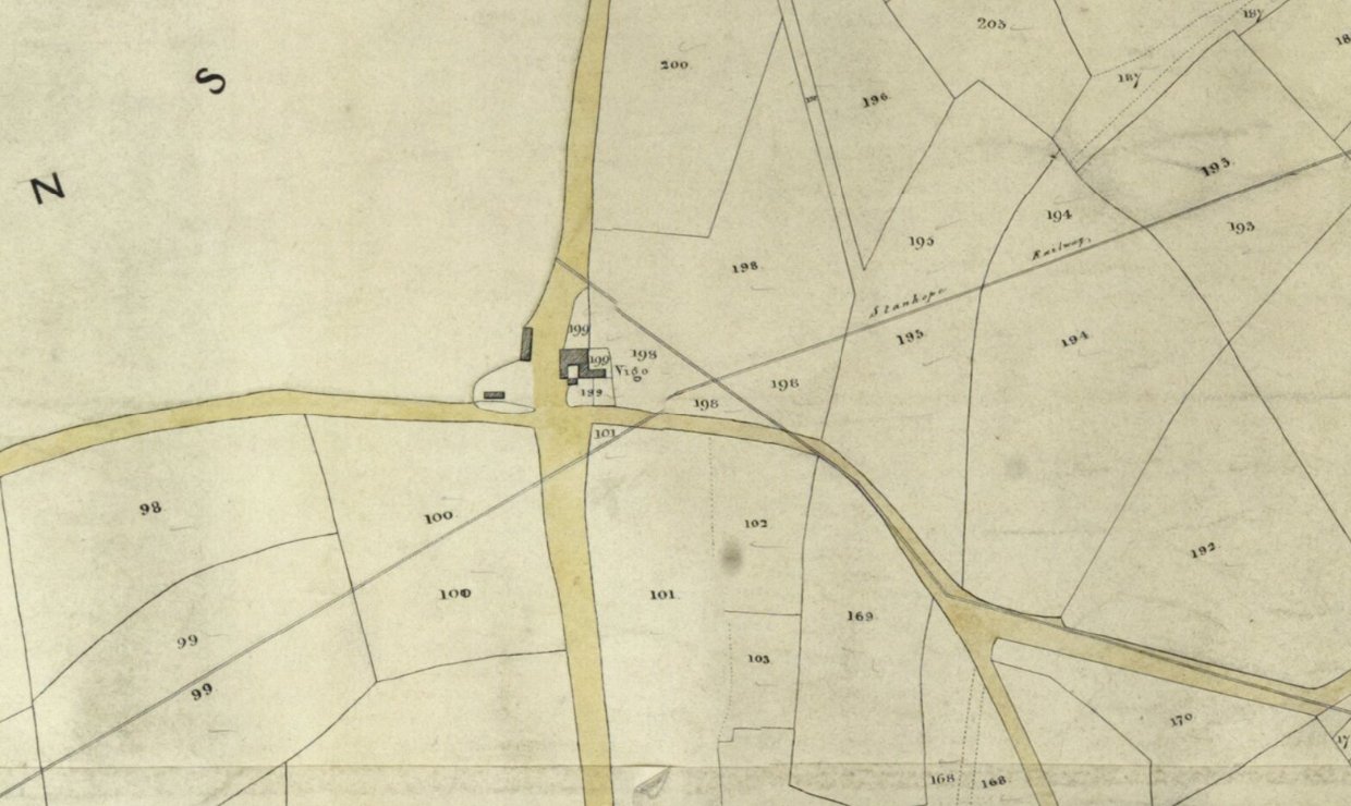
Vigo was also a crossing point for a very early tramway which was removed by the 1850s, and we gain a rare insight on this Harraton tithe map from 1847. This connected staiths at Fatfield to a long lost pit west of Birtley, though the rest of the waggonway was retained at Harraton. (Plan from Durham University). Vigo itself was quite literally a farmstead with a terrace likely for the agricultural workers. However, there were coal pits very close by and there are footpaths leading to them. The Vigo placename in Durham is first mentioned in 1824 and is likely, for some reason, named after the city in the north west corner of Spain.
Given its age, its difficult to give more detail especially on its layout. It will certainly have been primitive, likely without a platform. It closed in 1853, but was used for a decade in the 1860s. From there the station closed forever.
The foundations base for the Vigo main and tail haulage engines were still extant into the 2000s as per records at Beamish, and may still be there today though I didn't see a trace.
Listing Description


The two plans illustrated show the Vigo Station site in the 1840s and 1850s. Interestingly there are contrasts between, for example we see a much earlier waggonway crossing the Stanhope & Tyne towards an old coal pit east of Birtley. This then led on to Harraton then staiths at Fatfield. There was also the earthworks of the old Beamish Waggonway which led to the same destination, but by the 1890s utilised the Stanhope & Tyne as seen below.

The line in the 1890s was double tracked and powerful enough for seamless locomotive working without ropes and engines. Harraton Colliery was at this stage collected via a eastern spur instead of a seperate waggonway, allowing connection to South Shields rather than Fatfield. They were made redundant given the depth and with of the Wear at this point.

Site of Vigo Railway Station in July 2025

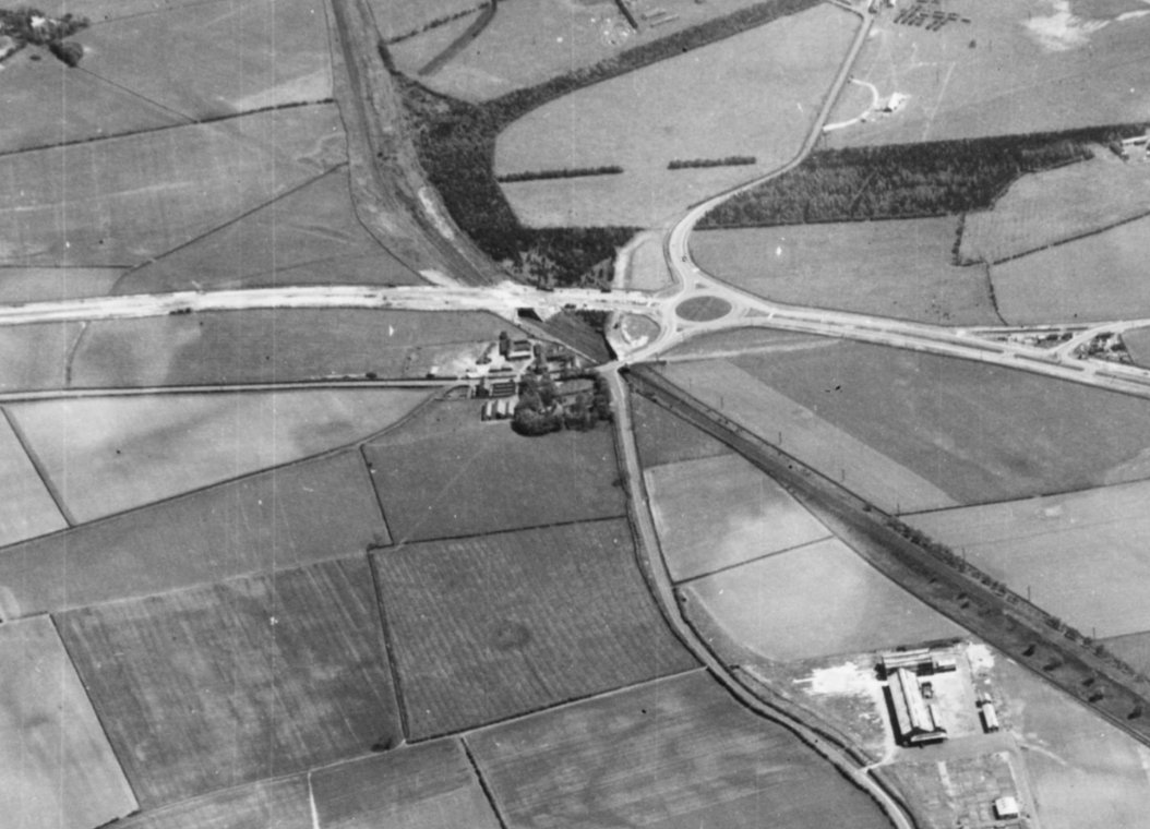
The site of Vigo Railway Station and Vigo Lane. Source: Historic England Archive (RAF photography) raf_1cu_ah_o_ah505 flown 27 May 1942