The Nine Pins, Saltwell
Gateshead
Last Updated:
27 Jun 2025
Gateshead
54.938523, -1.607286
Site Type:
Dwelling, Farm, Pub
Origin:
Status:
Extant
Designer (if known):
Currently a closed pub

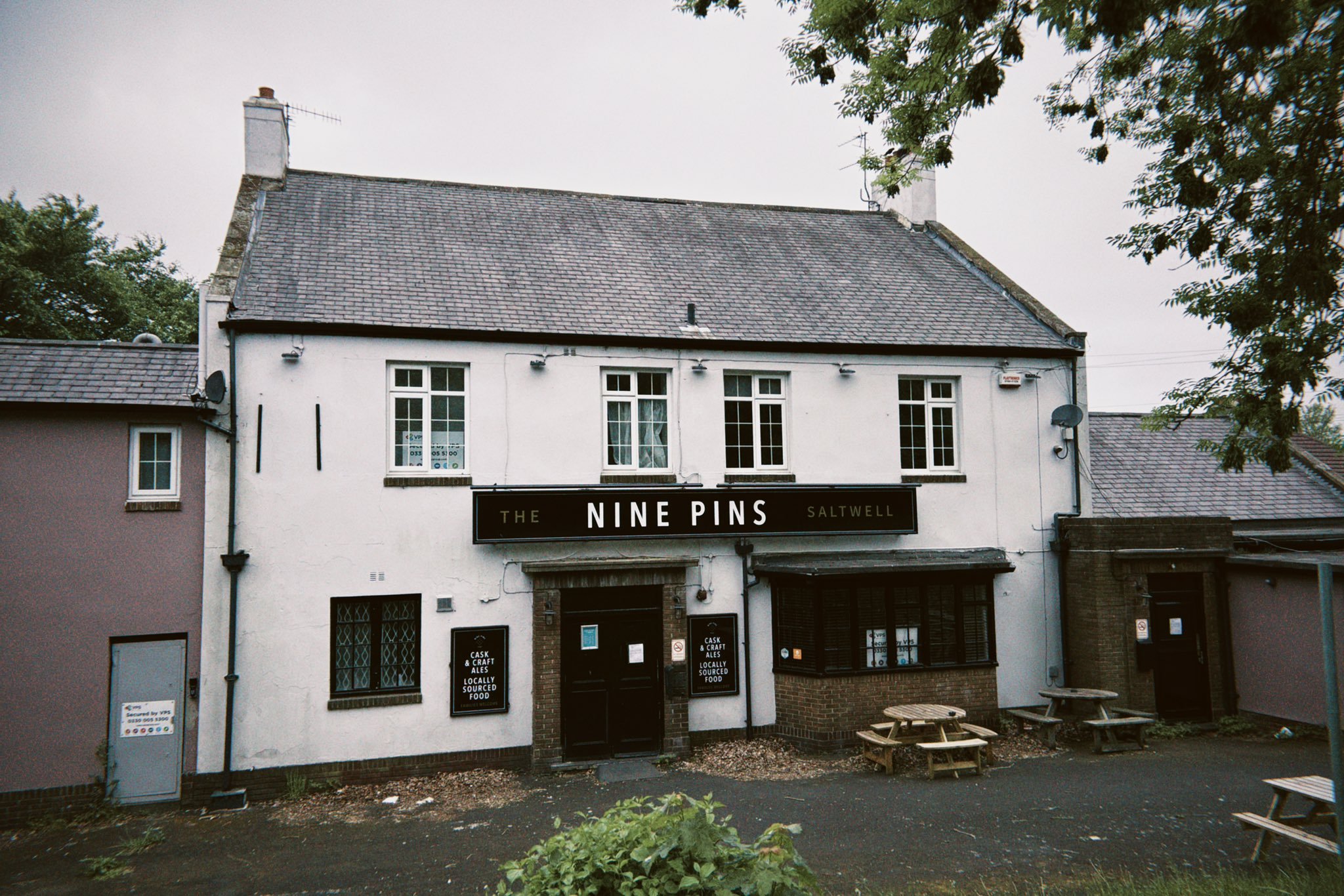
The Nine Pins between Bensham and Low Fell has only been a pub for a short period of its life. For some 130 years prior this place served as a fancy private residence for one of gentrifying Gateshead elite.
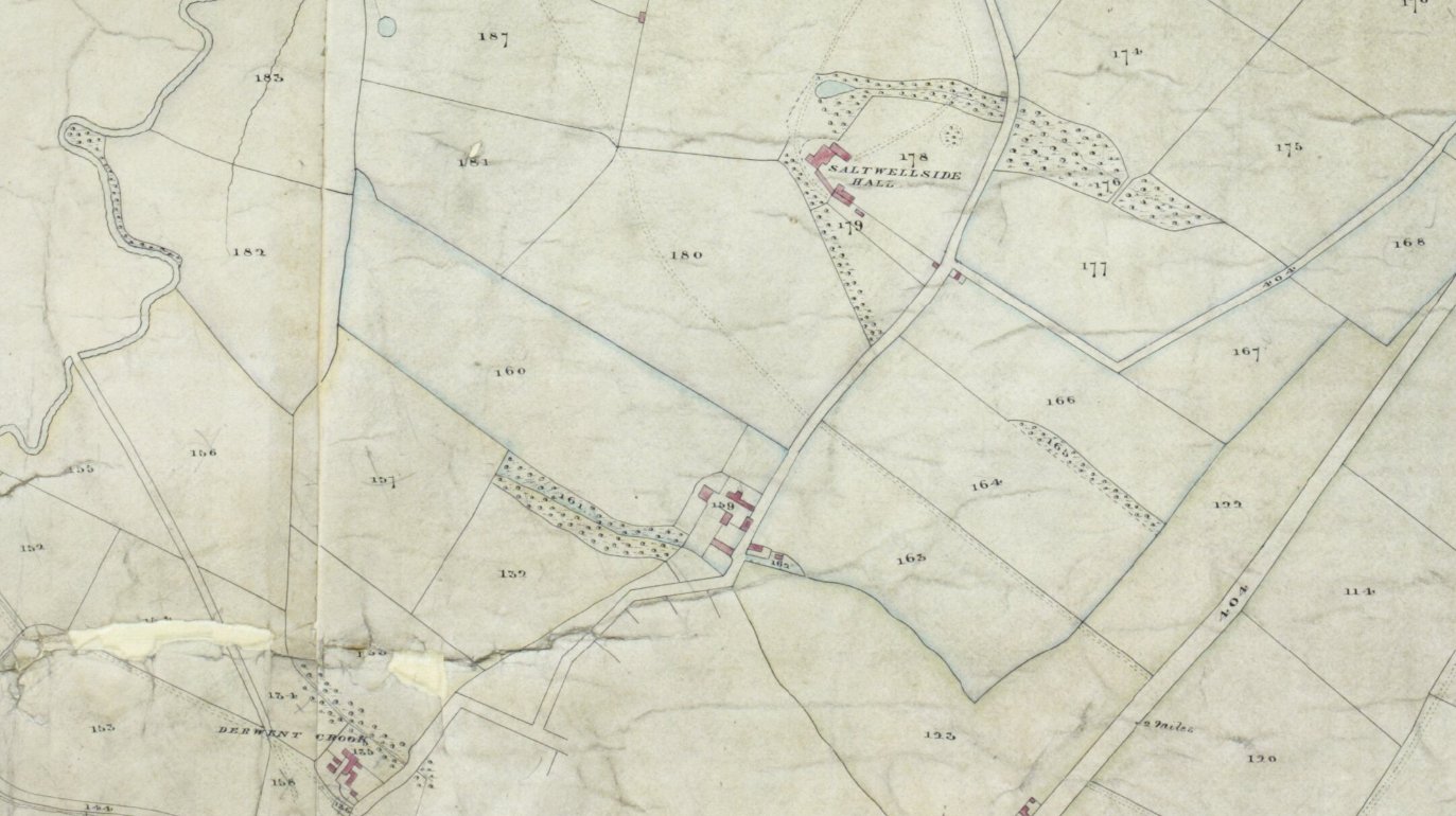
This place was originally known as Saltwell Cottage, and sat on the Saltwell Dean which winded down the valley to Derwent Crook. It's certainly been here by the 1830s and was part of a larger farmstead owned by Thomas Robson. The 1838 tithe map produced by Andrew Stobart provides us a nice view, which literally features our building on it. It's to the left of the '159' in the middle of the map.
From the 1850s, the Robson family divvied up the estate to erect nice new villas for the local gentry, and hence why we have so many large properties down here today. Just under 100 acres was provided for the project which appears to cover those to the east and north east. This site remained though and was also put up for sale in 1854. It featured dining & drawing rooms, 5 bedrooms, 2 kitchens, a dairy & cellar. The adjoining buildings featured stabling, hay and corn lofts, a coach house, yards, gardens and still retained 18 and a half acres of old untouched grassland.
It remained a farm into the 20th century, and was put up for let again in 1913, advertised as ideal for the retail milk business. By the 50s though, all the surrounding buildings were knocked through for the modern residential developments we see today and this sole homestead remained.
The Nine Pins was opened in 1976, and I think coined after the nickname for the path that ran from here down the Team Valley to the railway - there were 9 posts obstructing vehicles using it. There's a few sources online to say this place was rebuilt in the mid 20th century, but maps indicate the structure is the exact same dimensions. It's hard to tell with the render, but I'd argue it's much older. The jury is out!
Listing Description


The maps shown here display the Nine Pins, or what was then known as Saltwell Cottage from the 1830s through to the 1890s. Our site is at number 159, which helped folk reading the apportionment understand what the land was and who owned it. The Nine Pins specifically is the rectangular building on the south west corner of the site, facing what is likely stabling and sheds against the burn. It was very rural by this time, and over the next century it was slowly chipped away for large town villa development and, eventually suburbia.

The Saltwell Cottage can be seen fully enclosed between modern housing developments and a realigned road, though the original is still in situ with housing on it. The Ninepins lane is also shown, which curves round the estate then takes a sharp turn under the railway to reach Armstrong Street in the north west.

The Nine Pins in May 2025, unfortunately closed at this stage.

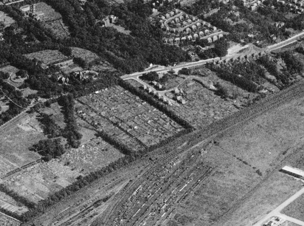
Saltwell Cottage can be seen between the trees in the foreground, with the Ninepins lane running next to it down to the railway. This is when the housing developments were taking fruition.
Source: © Historic England. Aerofilms Collection EAW010298 flown 24 August 1947

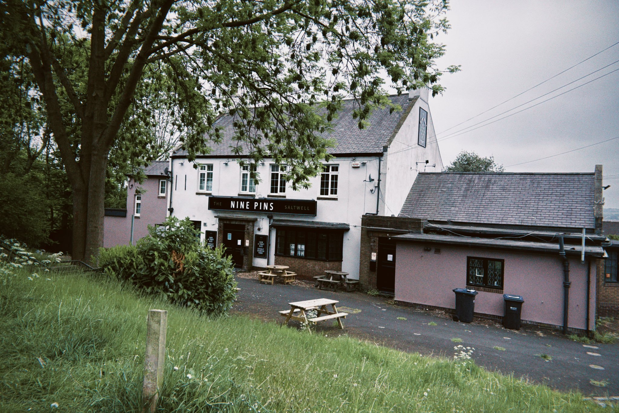
Modern extensions have been added to both sides of the building.