The Chichester Arms, South Shields
South Shields
Last Updated:
31 Jul 2025
South Shields
54.986444, -1.431297
Site Type:
Pub
Origin:
Status:
Extant
Designer (if known):
Still operating

The Chichester Arms popped up in the 1870s in the area that became Chi, named so after Henry Pelham - the Earl of Chichester who transferred church lands in Shields for public use. These became the North and South Marine Parks.
It stands on the ancient and well trodden crossroads from Laygate Lane over to Westoe and Jarrow, making it an ideal site for a refreshment stop and hotel. In 1879 it was owned by RS&D Crosthwaite, who owned the Low Brewery from 1852. This was situated where Brigham & Cowan would later stand, with the dock still in situ. They most likely built this pub to help assert their presence across the borough. It also appears to have been a Freemasons haven, given the use of the square and compass on early advertisements.
It was upmarket from the get go too, and was a fully licensed establishment rather than a beer house. Such offerings included Bass, Guinness, Hennessey's and Martell's brandy, Scotch and Irish whiskies, champagne, wines, liqueurs and cigars. National newspapers were also offered with use of a large room for club or lodge meetings free of charge. At this time in 1880 it was leased by R H Thompson, who also operated the Grand Theatre at Mill Dam.
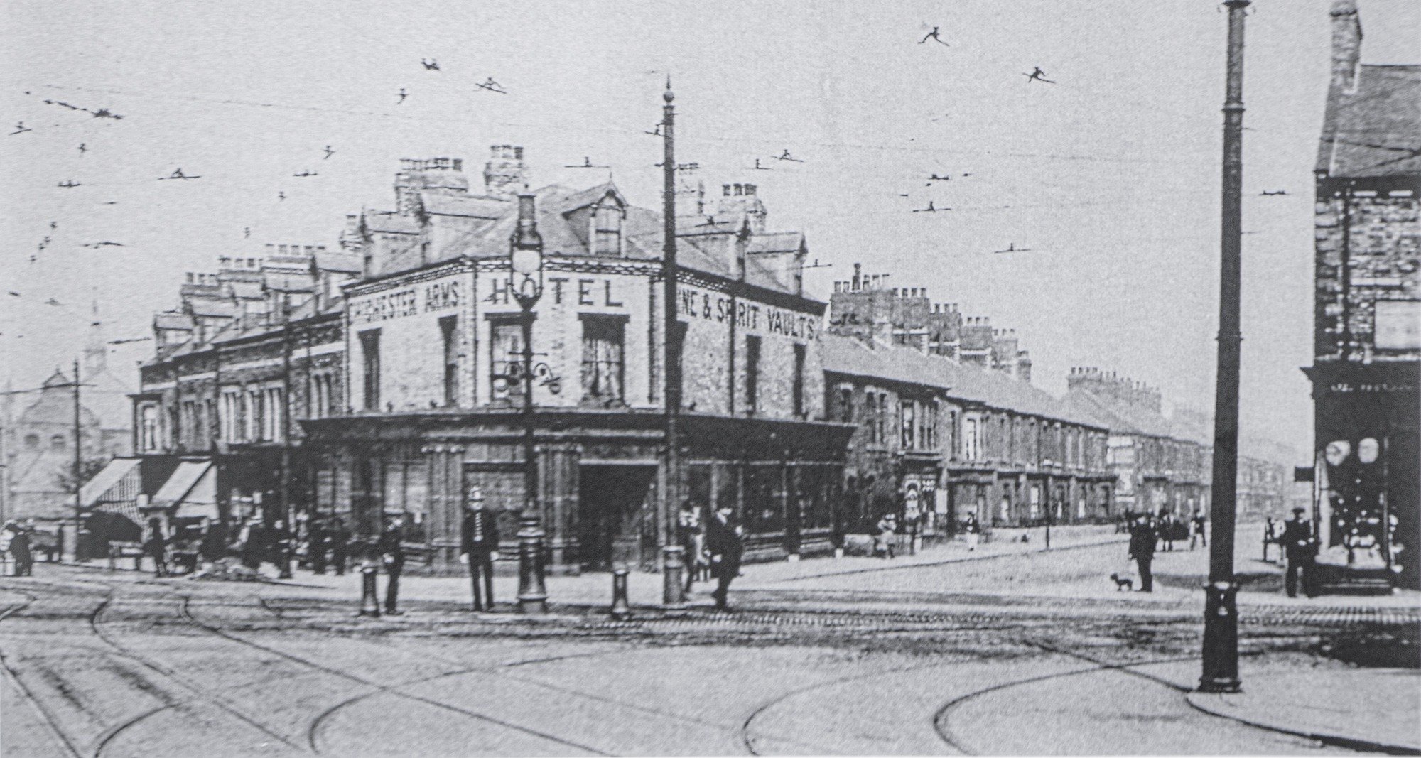
The pub underwent a £100,000 refurbishment in 1988 after it had fallen into a "sorry state of decline", and from there it has remained open, though somewhat rationalised given the removal of the loft windows.
Listing Description


On this series of maps we're going to work our way backwards, from the 1950s through to the middles of the 19th century. The Chichester sits in the centre of these surveys.
Compared these two maps today - much is the same bar the railway which is now the Metro was still operated by British Railways. However there are extra tracks across the map. The line which leads from north to south on the west side of the map was partly pulled up and developed on by the 50s. This was the original Stanhope & Tyne Railway - later the Pontop & South Shields. Most of the Metro line uses this route until it reaches Simonside, though you'll notice today it curves over what was the Refuse Despatch Station to reach the South Shields, Marsden & Whitburn Colliery Railway to Tyne Dock. This is a relatively modern doing from when Metro claimed the railway.
The Corporation Tramways also had their offices and depot here, right between the current Chichester Metro Station and the Dean Road Bridge. This later became the bus depot after trams became defunct.

Our point of reference on this 1862 map is the crossroads, where the Chi went on to be constructed. As noted above, it makes for an ideal site given the intersecting from Jarrow, Westoe and South Shields itself. The Chichester area sites between the esteemed grand houses of Westoe and the more grounded industrial terraces of Laygate Lane, built for the workers of Hilda Colliery. Many of these old houses and works likely used the sandstone that was extracted from this exact spot.

The Chichester Arms in July 2025

The Chichester Arms Hotel as it was in the early 20th century, with tramways included. Unknown original source.