St Paul's Church, Waterhouses
Waterhouses
Last Updated:
21 Jul 2025
Waterhouses
54.761147, -1.719757
Site Type:
Church, Place of Worship
Origin:
Status:
Extant
Designer (if known):
C H Fowler
Still in use as a church
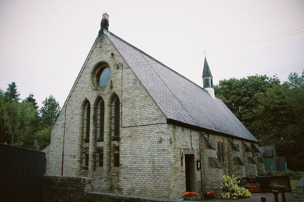
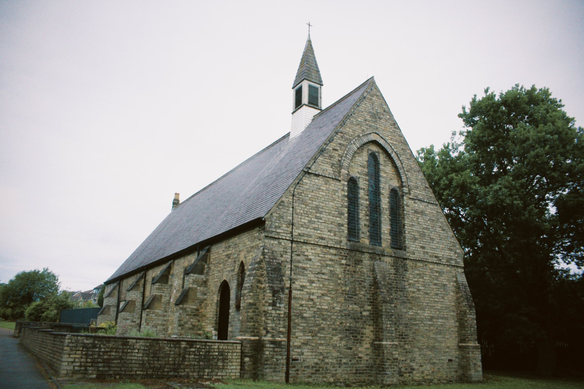
There is just something SO beautiful about the pit village church. The architecture of medieval England using the materials derived from the coal seams, picked away by the very men who went on to worship in them. St Paul’s at Waterhouses is such a fine example.
The nave and chancel was constructed in 1868, with gradual extensions and additions over the course of the next half century. Its inception makes it a very early effort by the Anglicans to assert their presence in an environment where they’re much less favoured. It made for a breeding ground of these gorgeous designs, like that shown in recent days. They competed for the hearts and minds for the pitmen and wives, and this certainly was a great and expensive effort.
It was opened by the Bishop of Durham, with services previously held in an old rickety cottage - very possibly the old High Water Houses that the settlement was named after. Lord Boyne, who owned vast quantities of land in Durham (and has a good few pubs named after him here), granted the site and provided a handsome donation for its construction.
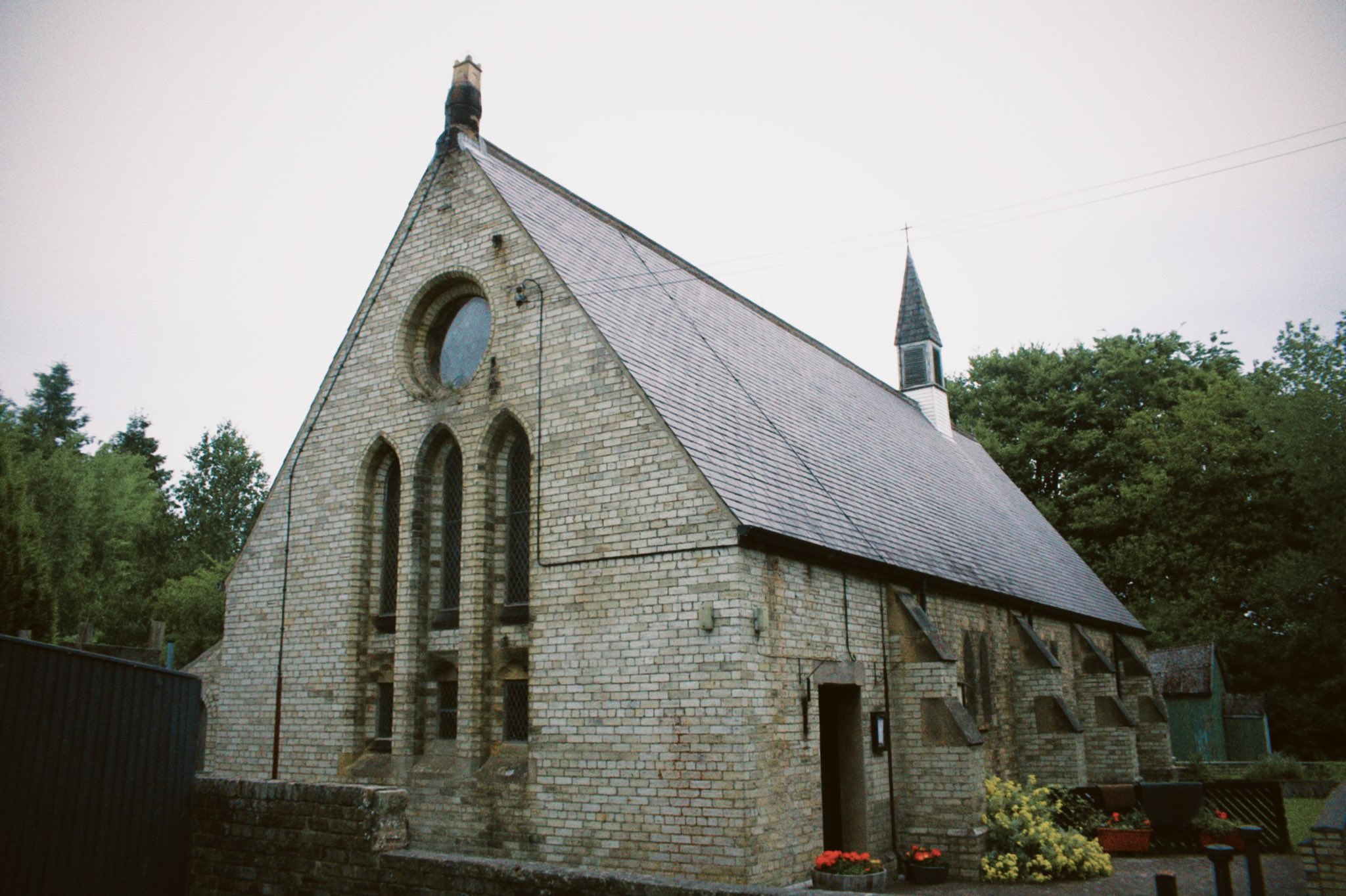
It is entirely built of firebricks produced at the Pease’s West Colliery Brickworks over at Bank Foot near Crook. This cream glaze is a common sight in these parts, adding to a charming vernacular. The Early English influence comes in the form of this narrow lancet windows under an enclosing arch, with smaller lancet windows sandwiched in by the buttresses on the sides.
With a capacity of 200, it was designed by C Hodgson Fowler - a man no stranger to anyone with an interest in North East churches. You’ll find his works at Spennymoor, Sunderland Bridge, Dalton le Dale, Belmont and Harton.
The grounds also feature a part original Sunday School/church hall made of corrugated iron. It's been here since the 19th century, but years of wear has rendered the building unusable for the general public.
Listing Description
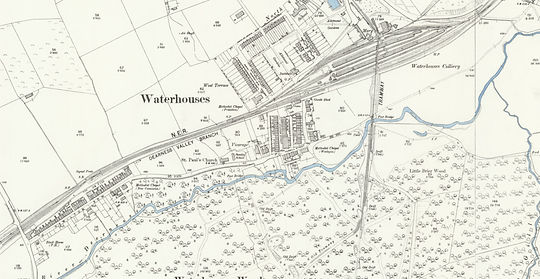

Both the Ordnance Survey maps shown depict Waterhouses from the end of the 19th century through to the inter-war period. The village had reached its zenith about a decade or two prior with the operations of the colliery already in full swing. A great extent of the village stood on the northern side of the railway and pit, with much of its infrastructure like schools and institutes over the road from the colliery. These days there is no standing building left on this half, with only the football ground a real trace. There are however still kerb stones and minor visual traces as per information from Peter Laurence.
The 1930s map adds to the picture, with a web of drifts tangling round the village. A fire engine station was added next to the Wesleyan Church, alongside a more recognisable colliery recreation ground with a bowling green and tennis court. Only the football ground remains extant.

We gain a good understanding of how the village was built up if we refer to the Ordnance Survey produced over the 1850s. Waterhouse Colliery, later "Waterhouses" given the proximity of both the Low and High Water Houses, sat near a series of small streams and the North Eastern Railway. Such allowed for a constant source of water alongside a logistical connection to the wider world. The only thing lacking was a population, which would come from folk migrating into the new built terraced housing.
The western elevation of St Paul's, with its lovely composition of local brick. Taken in June 2025
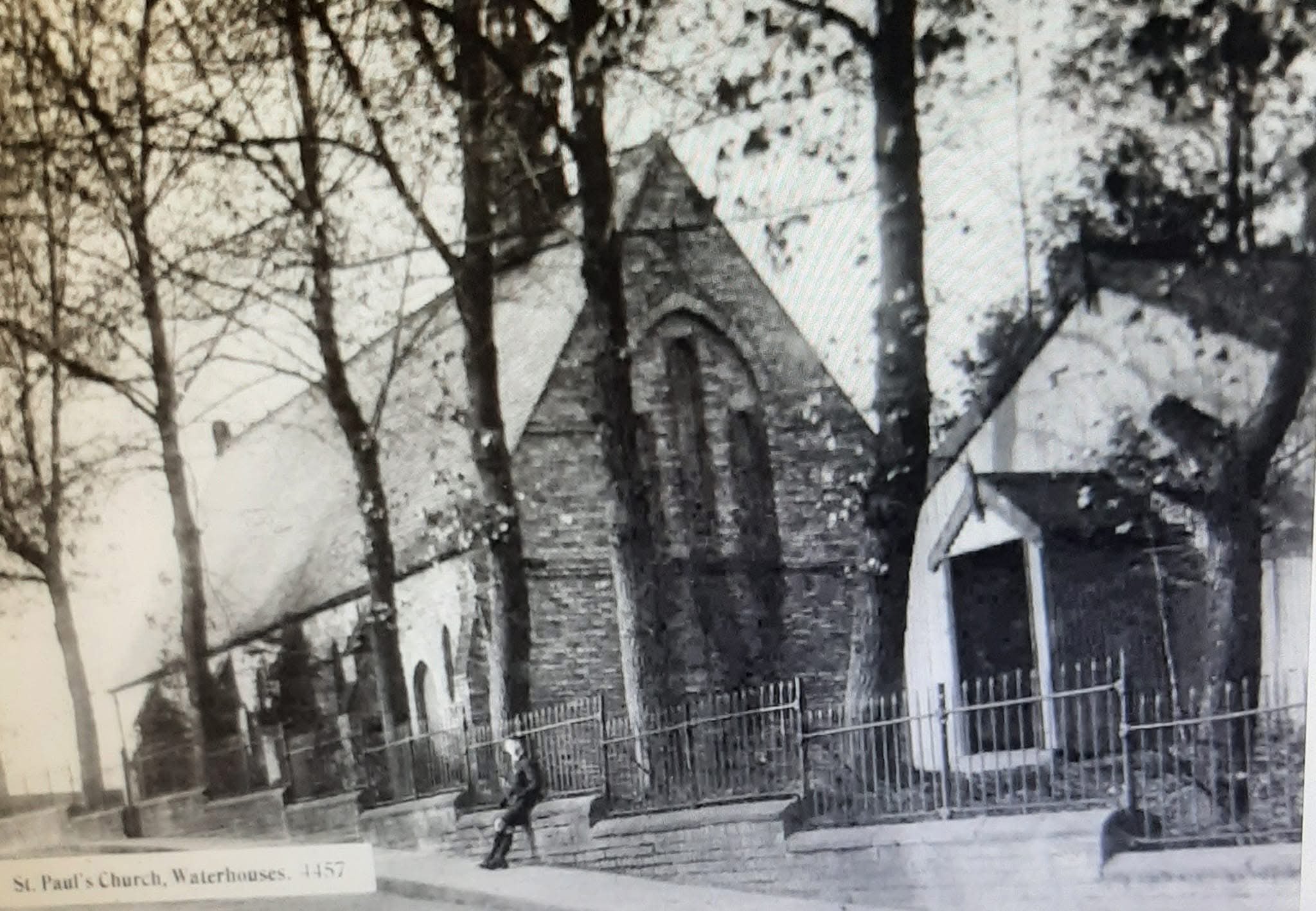
A postcard of the Sunday School/church hall and the eastern elevation of the church. Unknown original source.
The same eastern elevation, with its buttresses and lancet windows the striking features, in June 2025