Newcastle
Sailors Bethel
Last Updated:
28 Nov 2023
Newcastle
This is a
Chapel, Place of Worship
54.971634, -1.591112
Founded in
Current status is
Extant
Designer (if known):
Thomas Oliver Jnr

Grade II listed
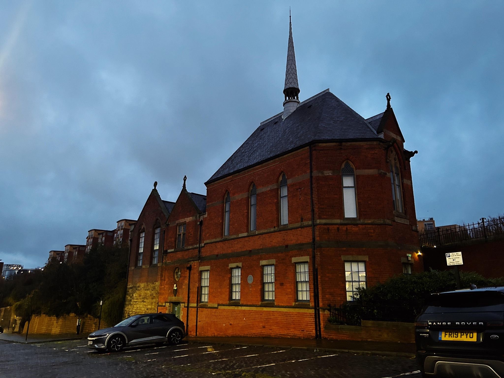
The Sailors Bethel - a beautiful little non-comformist chapel built in 1875 for local residents and the vast melting pot of nationalities and communities who docked on the river.
The Newcastle Sailors Society who advocated for this building had already been around since 1845, having supported the need for sailors to have their own place of worship irrespective of denomination. Services were held prior to this building at a Sailors Bethel on the "New Road", which I presume is City Road. A pub next door were expanding, resulting in great need for its own space. Before that, a building at the Milk Market near Sandgate was also used as well as a building at Manor Chase.
The foundation stone for the building, designed by Thomas Oliver Jnr, was laid in the August, providing accommodation on the ground floor with the upper floor the bethel with a "small vestry for the use of the missionary". The foundation stone included a bottle with 3 newspapers, a list of the subscribers, a copy of the public appeal for subscriptions and the names of the trustees - These will all still be there!
Thomas Oliver is the son of Thomas Oliver Snr, the main who designed Grainger Town and much of Newcastle's ironic architecture. Leazes Terrace, the Royal Arcade and Blackett Street are all credited to his father.
The 200 seat chapel itself was opened on 12th April 1877 at a cost of £2000, while the Sunday School was added in 1900. It shortly became a Danish church after the Second World War after gaining intrinsic ties to the Scandinavian community in the previous decades. Given the wharfs of Malmo, Norway and Hamburg were located directly underneath, it made perfect sense for the building to provide a spiritual home for those crossing the North Sea.
Of course, it was also the subject of Lowry and Norman Cornish. It is also used these days as offices
Listing Description (if available)


Both Ordnance Survey maps above illustrate the Quayside area from the 1890s through to the 1940s. The area had densified over the course of centuries, however great change was still being seen here at the turn of the century. Only a few years after this map, the Quay extension works took place which relocated Horatio Street to hug the Ropery Bank. This provided further space for the Quay warehouses and railway to reach Spillers Mill alongside the new low level Glasshouse Bridge.
The Sailors Bethel was sat between Tyne Street and Horatio Street, the former all but demolished on this side apart from the cobbles outside the building. Tyne St exists in a form as access for the new build apartments.
The 50 years after saw an intensification of warehouses, railways and industry as the Tyne grew to be a modern stopping point for ships and cargo. We can see huge contrast to the first Ordnance Survey map below.

The OS map of the 1850s shows the area before the Sailors Bethel was built. A building does occupy its spot, though I haven't been able to ascertain what it is. It's also called Nelson Street - the name was likely changed to Horatio Street to avoid confusion with the street in the city centre and went for the most apt change. This was a time before the North Shore was really a dock - more a producer and exporter. Ships were built here as well as coal being shipped next door to the slipway from Spital Tongues Colliery. The entire configuration of the area was vastly different.

The Sailors Bethel on an early November morning in 2023

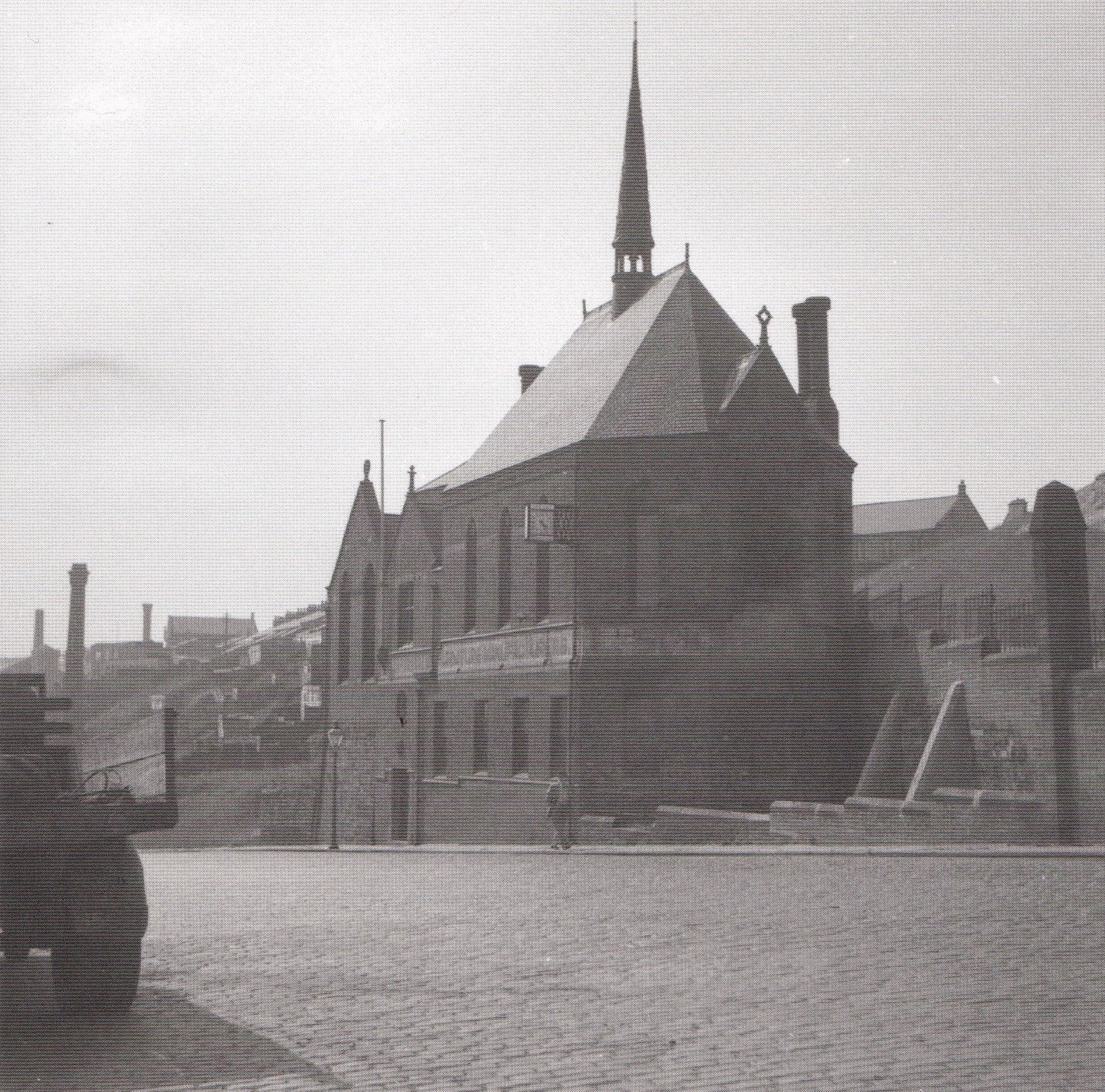
The bethel in 1956. Source unknown.

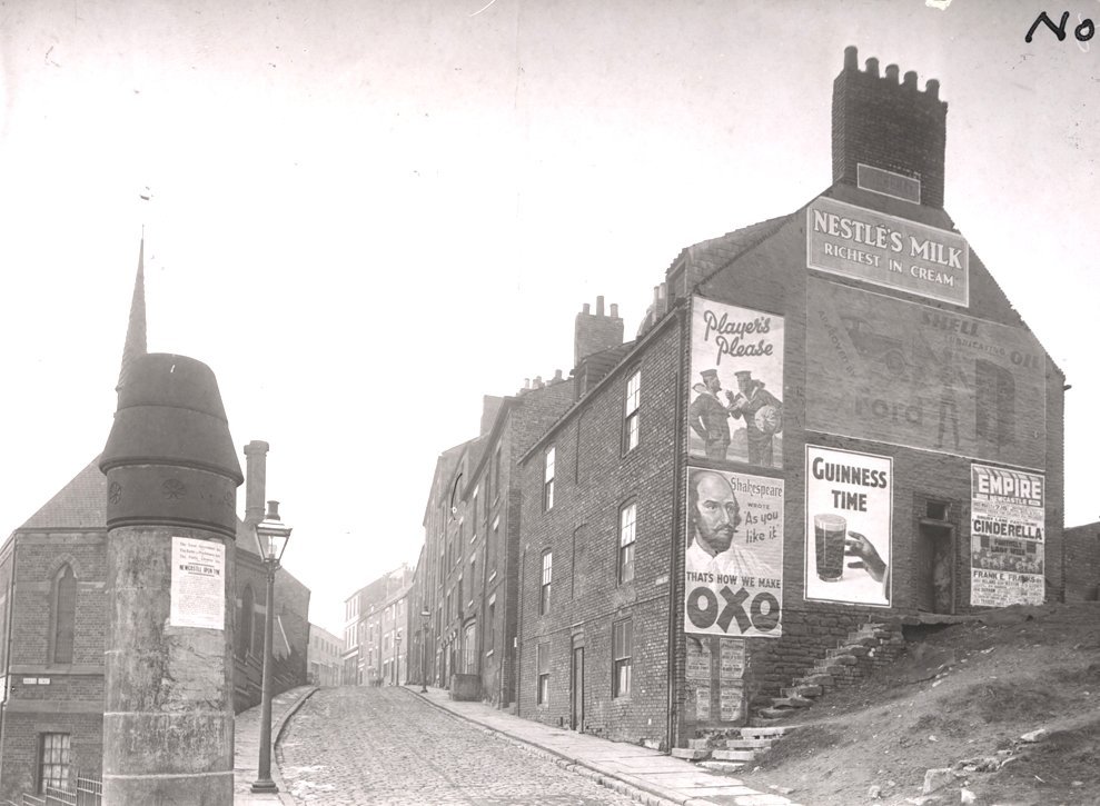
The bethel in 1935, on the left of the shot. Source unknown.
