
Penshaw Bridge (Fatfield Bridge)
Fatfield, Washington
Last Updated:
30 Apr 2024
Fatfield, Washington
54.880022, -1.515054
Site Type:
Bridge, Crossing
Origin:
Status:
Extant
Designer (if known):
David Balfour
Still in use as a road bridge

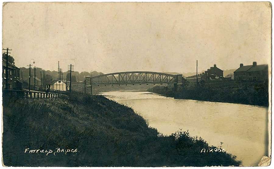
The Penshaw Bridge is a lovely addition to the portfolio of arches over rivers in the North East. In the traditional green, this one sits over the Wear between Fatfield and Mount Pleasant. It’s the oldest surviving road bridge on the Wear from here to the sea.
It was built in 1890 and opened in 1891. Before this, you’d have to catch a ferry either at Penshaw staiths to the east or walk over a Ford at Chartershaugh, a long lost mining village. Both were impractical, especially in bad weather or with a heavy load to transport.
It was opened by John Lambton and cost £8000 overall for both the bridge and the approach roads. This was funded by the Houghton and Sunderland District Highway Board as well as its counterparts at Chester le Street, Gateshead and South Shields. Public subscription also contributed (imagine that nowadays?!). It was originally the main road from Washington to Houghton until the more recent Chartershaugh Bridge opened in 1975.
It was designed by David Balfour of Houghton, a civil engineer renowned for his expertise on coal staiths, shipyards and tramways.
Listing Description


The Ordnance Surveys show Fatfield Bridge just after opening and in the 1910s. Worm Hill Terrace was yet to be developed as the access road was specially built for the bridge. You'll also notice further housing sprung up to on both sides of the river, given its attractive location as a crossing point. The riverside villages of North Biddick, Fatfield and Penshaw Staiths were all still in situ, though the Bird in the Bush has been demolished. Its rubble and bricks can still be seen in the soil.

Before the bridge there were two primary ways of crossing the river here - a ferry at Penshaw staiths or Biddick and a ford at Biddick, which crossed one of the more narrow points of this part of the river. Neither were particularly practical so the need for this bridge was paramount. You'll notice the extensive industry here too - staiths, lampblack works (soot for inks etc), breweries and mills.

Fatfield Bridge in 2024
The bridge in 1955, courtesy of Raggyspelk
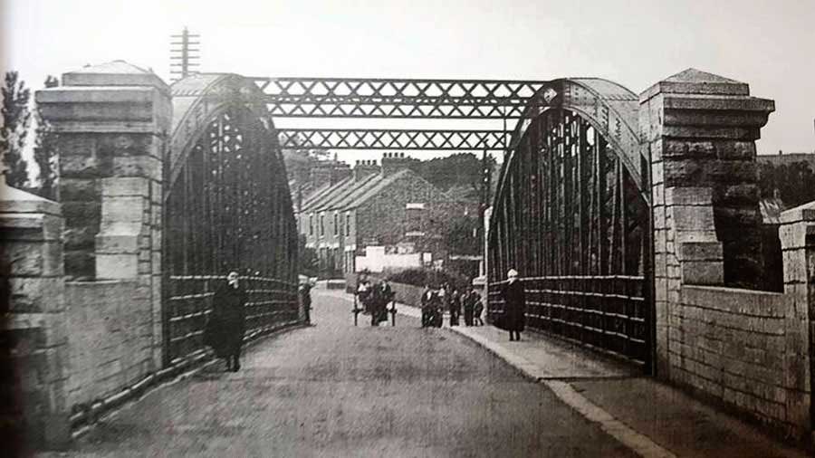
The crossing from the Penshaw side looking towards Worm Hill terrace in the 1910s. Courtesy of Raggyspelk