Old Rectory, Houghton-le-Spring
Houghton-le-Spring, Sunderland
Last Updated:
7 May 2024
Houghton-le-Spring, Sunderland
54.842056, -1.470885
Site Type:
Pele Tower, Rectory
Origin:
Status:
In situ
Designer (if known):
Listed Grade II*

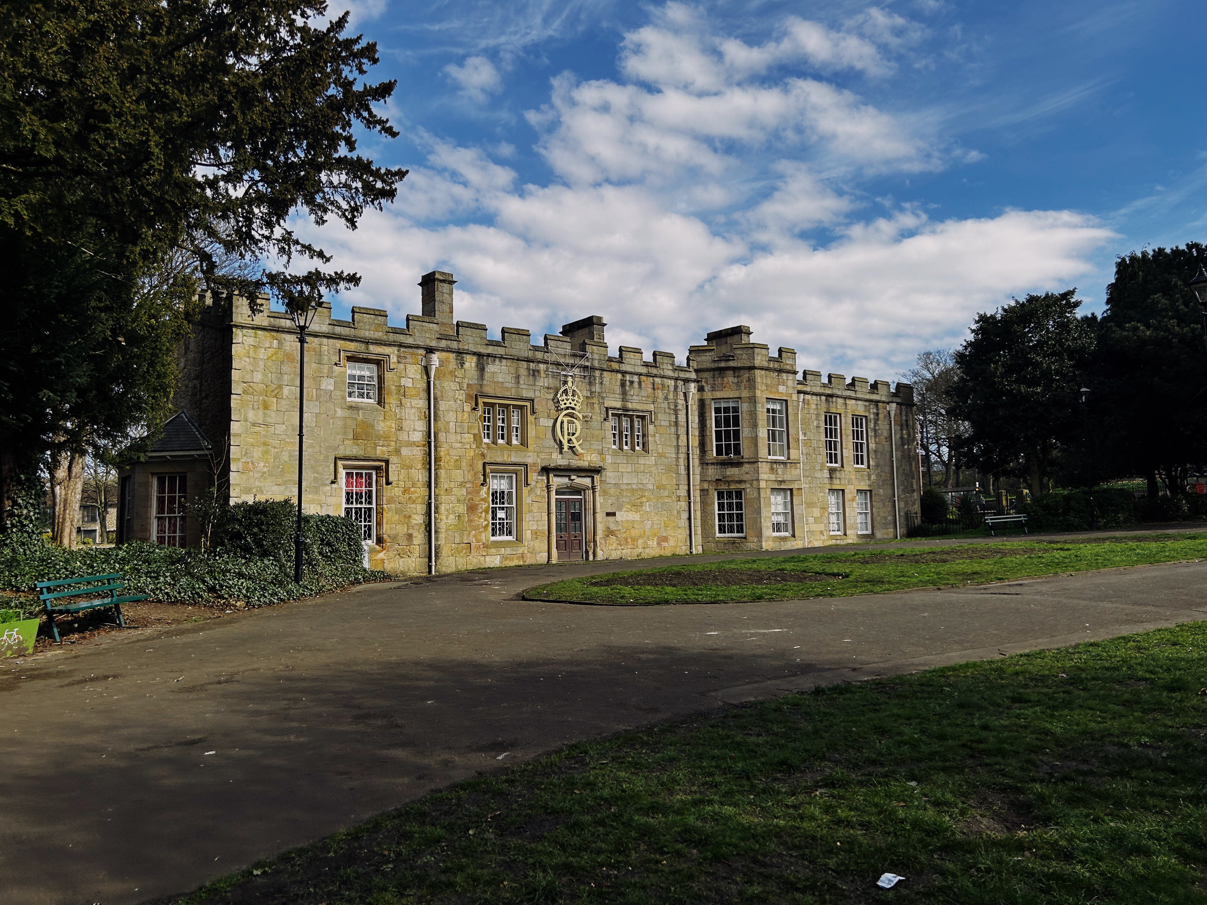
Houghton-le-Spring’s Old Rectory is the stunning centrepiece of the town’s historic offering.
What we see today is a composition of alterations beginning from the early 17th century through to the 20th. However a rectory (which is the residence of a clergyman), has stood here since at least the 14th century.
An older construction was built around a Pele tower, common even this south thanks to the constant skirmishes with the Scots in the north. Ludworth is a good example of a surviving fortification. They even fortified it after it was turned into a rectory in 1483.
George Davenport became rector in 1664 and built it again from the ground up after a period of dereliction, extending it on both sides and even adding a personal chapel. This has been demolished a century and a bit later to add the wing extension.
Nowadays this is offices for Sunderland Council, and the council do a brilliant job keeping this place pretty and clean. Even had the fountains on at 9am!
'A three-storey pele tower was constructed with external stairs by Rector Kelyng, who was responsible for the fortification of the building in the 15th century. The tower was demolished in the late 18th century as part of Thurlow's alterations. It was described by Thurlow in 1792 as a stone tower covered in slate to the south west of the house. 40ft by 20ft [12.2 x 6.1m] containing a cellar floored in stone, a lodging room with deal floor, plain ceiling and paper hangings. It also contained a servants' garret with deal floor, plain ceiling and bare walls. The tower is shown on the 1774 Glebe Map by Dixon.'
- Sitelines
'Houghton’s most famous son was Bernard Gilpin, the ’Apostle of the North’, so-called for his evangelising expeditions in the borderlands of Northumberland. Gilpin was rector here for twenty-five years from 1558, a time when Houghton le Spring was then one of the largest parishes in England. Despite the status this gave him, Gilpin was a generous champion of the poor, a brave and principled man unafraid of the religious establishment even in those dangerous days.
Gilpin lived in the Old Rectory, just across the road from the church. When Grimm drew it, the rectory was still very much a medieval building. The tower, seen through the arch of the gatehouse range, was probably the solar block – the owner’s private chamber – attached to its hall. A licence to crenellate, that is, make it a defensible structure, was granted in 1483.
The battlemented building that remains today, now local council offices, was much altered during the 19th century. The tower is no longer recognisable and the gatehouse has gone too, though its echo survives in a Victorian archway, just across the road, giving access to the churchyard.'
- British Library
Listing Description


The two maps above illustrate Houghton le Spring in the latter half of the 19th century, much later than the original construction date of the rectory. The first map was surveyed in 1857, and shows the Rectory just south of Houghton Burn in the main centre of the village. Houghton was a considerable settlement even at this time, being a major stopping point between Sunderland, Durham and southwards.
The rectory is visible on the 1898 map, and had built up considerably since decades prior. Houghton Pit had expanded and the miners terraces sprawled to Sunderland Street. Reservoirs seem to have been constructed to provide fresh water to the local populace also.

The 1921 Ordnance Survey shows Houghton as a similar size, though the Grasswell area has significantly increased since. The splendour of Rectory Park is still pride in place the centre of the village.

Undated illustration of the Rectory and the Pele Tower. Its medieval appearance is striking. Sadly the features of this image are now unrecognisable and have been substantially altered or demolished. This is the case for the gate house in the foreground.

Undated illustration of the Rectory and the Pele Tower. Its medieval appearance is striking. The features of this image are now unrecognisable and have been substantially altered. This is the case for the gate house in the foreground.

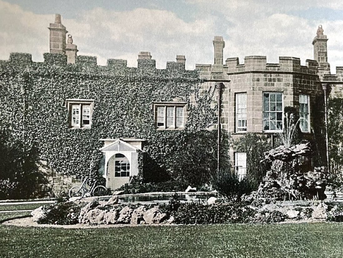
Frontage of the Rectory, undated. Source: Houghton Heritage Society