Neville's Cross Inn
Durham
Last Updated:
2 Sept 2024
Durham
54.771525, -1.594991
Site Type:
Pub, Coaching Inn, Hotel
Origin:
Status:
Extant
Designer (if known):
J G Burrell
Now an Italian restaurant

Just down the road from the cross is a pub named after it, capitalising on its heritage and significance in the city.
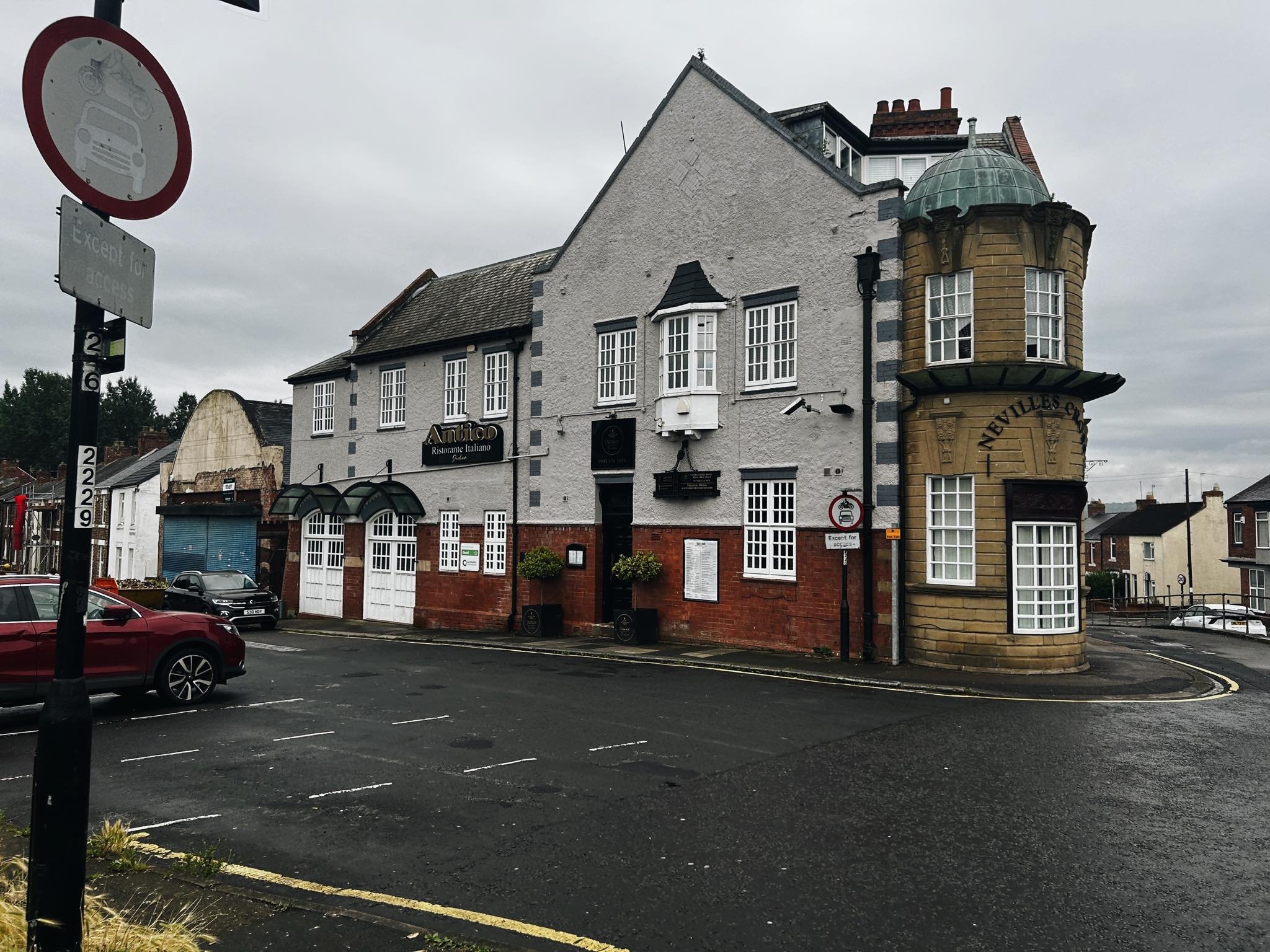
The Neville's Cross in is an interesting composition of this odd sandstone turret-like feature nestled between a more typical brick building. Given its position on a significant crossroads between Langley Moor and Sunderland Bridge its probably been an inn of some sorts for centuries, not least gives its proximity to a toll house.
I can trace it back to 1854, but it may well have operated under a different name beforehand. John Raine, who owned the pub in this year, was offering freehold land for sale here perhaps to fund these extensions or because he was skint after building it. Either way, this directive perhaps led to some of the buildings still situated here.
As we always discuss, the pub was a centre for sport and activity. It was the site where many runs were hosted often for gambling purposes and prize money. It was also the scene of many crimes and deaths. There's record of a 48 yr old woman found frozen to death on the doorstep here in 1897, as well as a man attempting suicide outside it too. The pub was quite often told off for fights and overly drunkenness also.
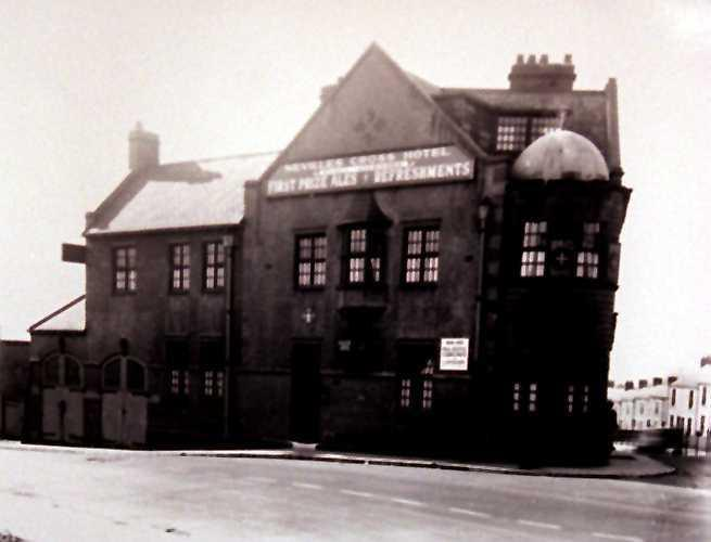
The building we see today is from 1907, when it was newly erected. The previous building was "not adapted to modern requirements and the demands of an increasing population", not least to the owners the City Brewery who ordered its razing. Mr J G Burrell was architect, a man also president of the Durham Amateur Rowing Club, who also designed numerous church halls in Durham as well as showgrounds and hospitals.
The building is faced with Lumley brick, and the feature is made of coursed ashlar with a copper dome. From opening there was a lift to a billiard room, a private sitting room, a club room and four bedrooms. There was even a motor house to house two posh vehicles to get people in the boozer as well as stabling.
Listing Description


Both Ordnance Survey maps shown here depict the area around Neville's Cross from the mid to late 19th century. You'll notice many features around it named after it - the cottage, toll house, public house we're discussing and the bank leading to Stonebridge and Langley Bridge. This was a central crossroads just outside the town between the Great North Road and the way to Brancepeth into the city and north towards Newcastle and Scotland. It's little surprise the battle took place here. It was rural though, and even by the 1890s it was little utilised. Some housing was built on the bank, and villas were placed on the battle site itself. alongside the Mission Church opposite Neville's Cross.
The pub was pre-rebuild, so appears to be a corner unit.

The 1919 Ordnance Survey shows the fringes of the town expanding into Neville's Cross as industry, collieries and the railways reached their greatest extent. Most of these terraces survive.
You'll also notice the enlargement of the unit after the rebuild. It now forks southwards where the showroom was built after 1907 and has swallowed up some of the rows located adjacent.

The Neville's Cross Inn in 2024

Undated photograph of the hotel, perhaps 1920s. Unknown original source.

Aerial view of Neville's Cross Bank and the hotel in 1948. Source: Historic England Archive (RAF photography) raf_cpe_b_uk_10_v_5094 flown 28 March 1948