Harperley Hall
Harperley
Last Updated:
22 Sept 2025
Harperley
54.705147, -1.803995
Site Type:
Country House, Police Station
Origin:
Status:
Extant
Designer (if known):
Listed Grade II

This is the new Harperley Hall - a hidden Georgian gem nestled at the foot of the Weardale hills.
As we’ve noted this replaced the former Low Harperley, an incredibly old construction. This was completed for Marmaduke Cradock, one of the senior members of the landowning family very much intertwined with the Durham Bishops and the wider ecclesiastical nobility.
It went on to play an important part in the areas railway history. George Hutton Wilkinson Esq lived here, who was president of the Bishop Auckland & Weardale Railway, upon opening. In fact, it cuts right through the park close to the banks of the Wear. His fingers had already been in the railway pie as part of the Great North of England Railway board which ran the mainline from York to Darlington. He also had interests in mines at Greenhead. Harperley Station was, at first, his private platform.
At the eve of WWII, 260 schoolchildren from Tyneside were evacuated here at the permission of Colonel Stobart - a family made from coal money but ended up Lieutenant Colonel in the Durham Light Infantry. Specifically, secondary school children from Jarrow were staying here in apparently bad conditions. The food had all tasted like vinegar and none of it was properly cooked, though I’m sure they’d have complained less if they knew what was coming…
By the end of WWII, and just after Prisoners of War worked these lands, this place became a training school for the Durham police and remains under police operations today.
-
The grounds are also known to feature industrial activity even since prehistoric times. A potential flint working site was found in 1955, and a large quarry stood right next to Low Harperley too.
The grounds once featured a deserted medieval village named “Blakhall” on local plans from 1676, a good century before any hall was built here. It could be from this time, but the thing is no one actually knows. Theories suggest it could have been a Roman bloomery, a kind of furnace, which is plausible given they were certainly mining around Weardale. It could well have been part of this “Blakhill” village too, though that was slightly further north.
Maybe we’ll find an answer one day, but at present all we know is that this mount covered with turf is a slag heap, filled to the brim with iron.
Listing Description


These maps shown are the Ordnance Surveys illustrated in the 1850s and the 1890s, showing the full Harperley Hall estate. There are various points of interest including the various circular plantations, one of which includes the smelt working site described above, as well as a potential prehistoric ringed enclosure. That, or another industrial working. This one sits just beyond the Harperley Dene which forms the estate border from south to north east, and makes for a boggy climb through as I well know. The lands also feature Black Hall, the site of a deserted medieval village for which these industrial workings may be associated.

There is only marginal change by the maps surveyed just before the beginning of WWII, and the eve of constabulary ownership. I've expanded the scope of this map to include Harperley Station, which was the hall's original private station including a mission hall also. Low Harperley is also in view, where the (potentially) medieval manor remains.

Harperley Hall from the south in July 2025

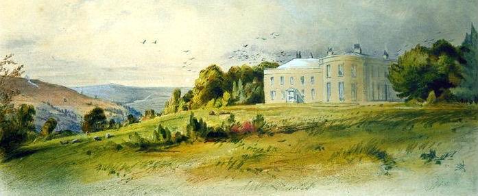
An unknown painting of Harperley Hall also from the south, though facing north west. Original source unknown.

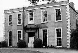
A view of the front facade during police ownership, likely in the 50s or 60s. Source: Northern Echo