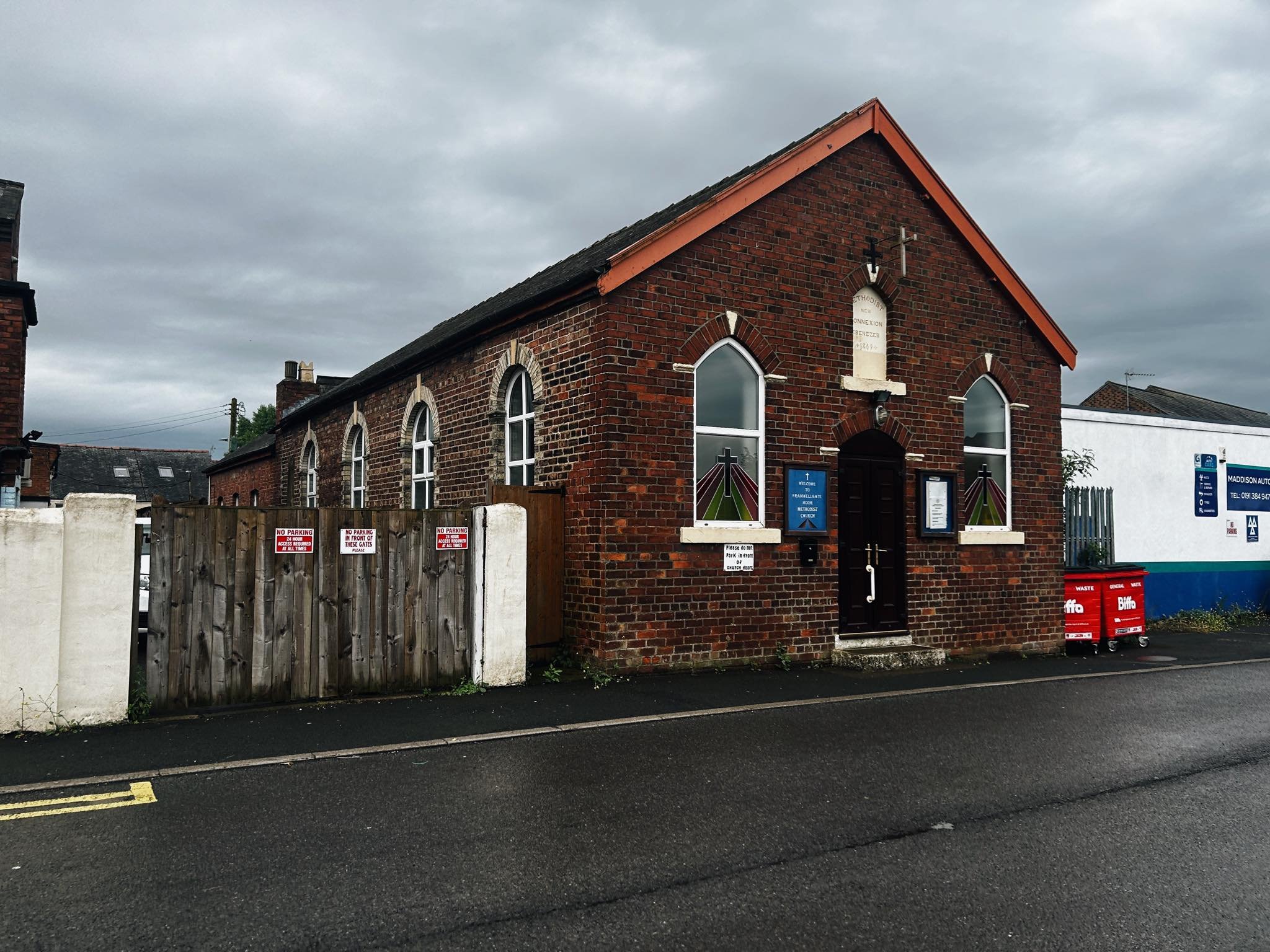
Framwellgate Moor Methodist Chapel
Framwellgate Moor, Durham
Last Updated:
2 Sept 2024
Framwellgate Moor, Durham
54.794644, -1.590751
Site Type:
Chapel, Place of Worship
Origin:
Status:
Extant
Designer (if known):
Mr Rutter
Still serving as the area's Methodist Chapel

A paragon of pit village Methodism down an unbeknownst side street at Framwellgate Moor. This New Connexion chapel is a perfect example of a modest little mid/late Victorian place of worship still fulfilling its original purpose to serve the local community.
Framwellgate Moor previously had 3 seperate places of worship - this, a Wesleyan chapel and the St Aidan which is a more typical CofE construction. The Wesleyan, once opposite the Granby, predated both the others having stood here since at least the 1850s but was knocked down around the 40s.
This one is fairly similar, but dates from 1869. The New Connexion congregation was an offshoot of Wesleyanism focused on democratising and representation (complicated, I know). By the mid 20th century I'm sure the Methodists reformed and worshipped here, especially after the pit closed.
The foundation stone was laid in April 1869 by Mr Robinson Ferens. He was part of the huge coal and brick dynasty in partnership with the Love family with their imprinted bricks are quite well known due to the obvious attractive surname. In fact, Joseph Love donated £50 for the construction as well as providing the services of an architect - a Mr Rutter of Brandon which is the other side of the city. He was also brother of Alderman Ferens, who Ferens Park is named after.
The site was purchased from the Mayor of Durham John Forster and built at a cost of £200, seating 150 persons.
Listing Description


The Ordnance Survey maps shown depict Framwellgate Moor between the 1890s and the 1930s (when the second map was surveyed). The village underwent considerable transition through this period from a pit village to satellite settlement of Durham. This is quite evidence considering the clearance of pit rows to more modern social housing in their place, and the encroachments of developments to the south. There is a couple features indicating its mining heritage alongside this chapel though, such as the number of working institutes and clubs. The sheer extent of inns and pubs is interesting also thanks to its status as a historic stopping point on the Great North Road.

It's worth going back in time even further to 1861. Framwellgate Moor at this time had been a mining settlement for a few decades, and though many of the inns had been there the rows had just started to form. Note "Dike Row", "Pump Row" etc as well as the Parochial School and Methodist Chapel - all typical features of a mid 19th century pit village with streets given typically suitable names. Miners will have formed the path in the top of the map north east to the colliery. Our chapel was not to be constructed for another decade or so after this map was surveyed.

Framwellgate Moor Chapel in 2024