Crook Miners Rescue Station
Crook
Last Updated:
24 Jul 2025
Crook
54.724016, -1.749512
Site Type:
Miners Rescue Station, Fire Station
Origin:
Status:
Extant
Designer (if known):
Use unknown at this time

This little building outside Crook took me by surprise as I instantly thought it looked like a Miners Rescue Station - similar to that at Ashington. To my total surprise, that's exactly what it is!
This was the areas colliery rescue station, providing the industry an emergency service on hand in case of explosion or disaster. They were critical in providing immediate support & relief, and popped up in the early decades of the 20th century after the Mines Accidents (Rescue and Aid) Act of 1910. This was one of 3 in Durham & Northumberland opened in 1912 by the Coal Owners Association - the one at Ashington, one at Houghton le Spring and this one after a pilot at Scotswood the year before. This follows the first ever of their kind down at Atherton in 1908.
Each station received a petrol Merryweather engine which could travel at 30mph, with a capacity to pump 350 gallons per minute. They also featured rescue dresses, portable telephones, and even canaries to detect the presence of gas. All 3 had the ability to reach 350 collieries within a 10 minute radius, and the new fangled petrol engine far exceeded anything that came before. This was real investment.
The building itself featured training galleries and a drill ground, as well as houses adjacent for the firefighters to live nearby with their families. These cottages still remain.
This station covered the area until 1956, and a special arrangement also meant they provided cover for the general area. I'm not entirely sure of its use these days, but its certainly well kept. Personally, I think it deserves a listing as much as any early 20th century building.
Listing Description


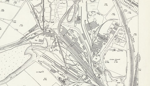
We're going back in time with each map for this one, starting with the 1930s then back to the turn of the 20th century. You'll see the area was crammed to the brim with industry and railways, as this was specifically the site of the Peases West Brickworks, as well as the entrance to Pease's West Colliery and a drift at Roddymoor. It was also home to the Bank Foot Coke Oven, established in 1850 until 1960 providing work for around 2000 men. It made for the perfect site to place a colliery rescue station given its locality to so many pits, but it could also reach many others on the Durham coalfield in a very short amount of time. The fireclay works were closed by the 50s, but opposite was a recreation ground for cricket, tennis and bowls. The Roddymoor drift was operating, utilising the line originally leading to the Emma Pit.
A power station was also placed here in 1909, which provided electricity to County Durham as well as Newcastle upon Tyne.

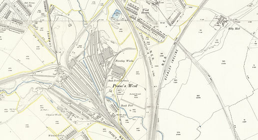
There was no miners rescue station anywhere in this century at all, but this map from the 1850s provies coal was the cornerstone of this area for years prior. Our site was the Peases West Fireclay Works at this time still, with the endless lines of coke ovens opened shortly prior. Coke was incredibly important in metal production, but it meant Pease could also sell off the by-products like tar and chemicals to nearby supply chains.
You'll notice a couple other collieries nearby which had disappeared off the maps by the 1890s - White Lea Colliery, New White Lea Colliery and the Lucy Pit.

The Miners Rescue Station in June 2025, featuring its larger fire engine door rather than its previous archways seen below.

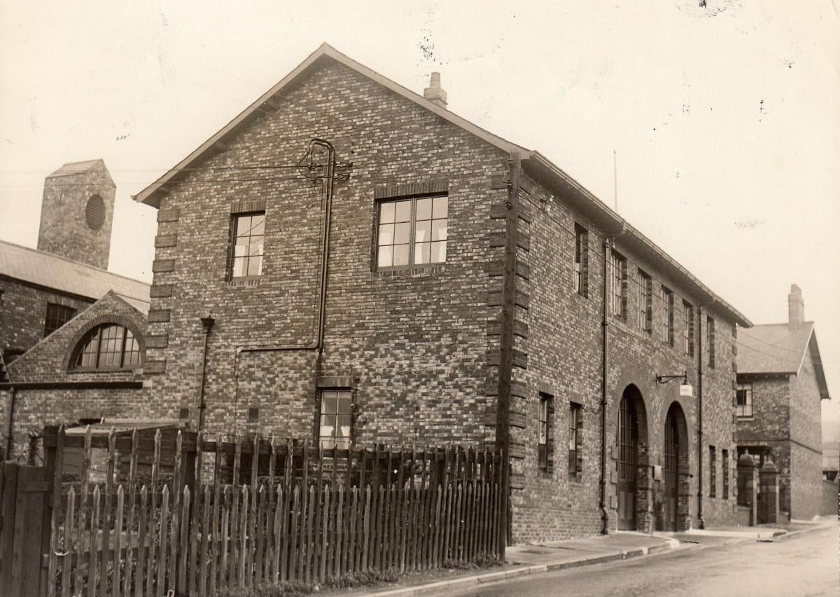
The Rescue Station in the mid 20th century, which follows exactly the same design as that at Houghton. Unknown original source.

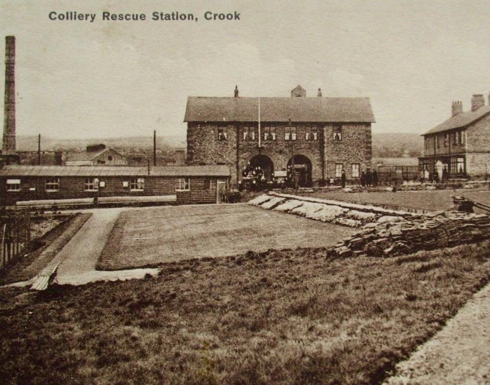
The Rescue Station adjacent to the recreation ground which opened in the 20th century. Unknown original source.