Clayton Road Wesleyan Methodist Church
Jesmond, Newcastle
Last Updated:
28 Oct 2024
Jesmond, Newcastle
54.985673, -1.606499
Site Type:
Church, Place of Worship
Origin:
Status:
Demolished
Designer (if known):
J J Lish
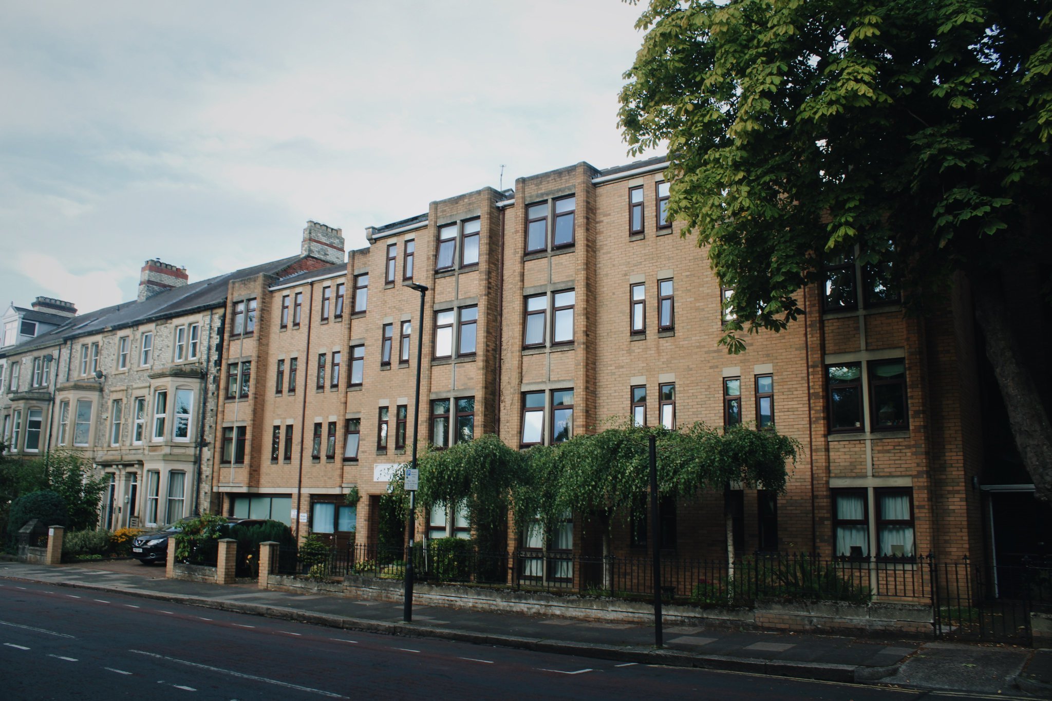
Now private dwellings

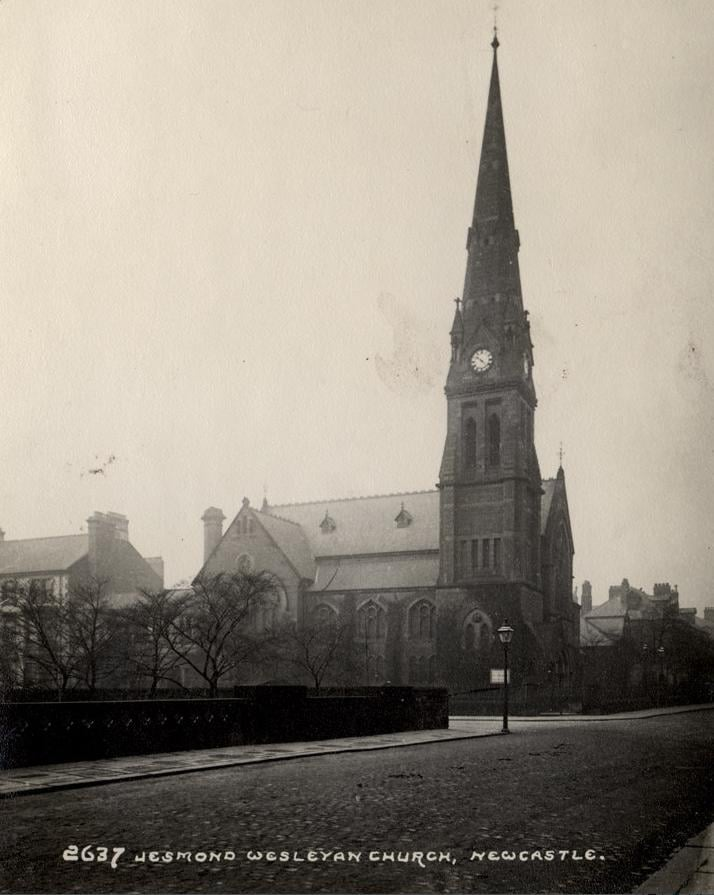
Clayton Road in Jesmond was home to one of Newcastle's many lost churches. This one was up there with the most stunning.
Jesmond, given its affluent roots, was a very pious area. In fact, it feels like there's a church or synagogue down every corner. This was the second church on this site, with a tin tabernacle erected here in 1877 as an overflow to the Brunswick Chapel off Northumberland Street.
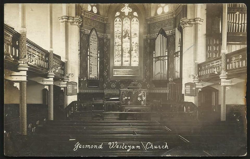
This one came 6 years later, built in the modified Gothic style. It was a huge upgrade on the previous with vestries, classrooms and a lecture hall making it a real spine of the affluent congregation. It seated 830-850 and was designed by John Joseph Lish, who also designed Gosforth's Wesleyan Church as well as the Presbyterian Church in Jarrow. The furnishings looked beautiful, with stained glass and carved work adorning every floor of the church.
The foundation stone was laid by Bishop Matthew Simpson, an American Abolitionist who was a friend of Abraham Lincoln and gave the sermon at his funeral. Abolitionists were often present at foundation stone ceremonies of Wesleyan churches. It's well worth taking a read of his Wiki page.
Many names you recognise were members of the church. Arthur Munro Sutherland was a lifelong member as well as the Fenwick's and Bainbridge's. Sadly though, the congregation shrank over time meaning there was little chance of anyone keeping up the maintenance of this church. The richest moved away from the city, and it was demolished in 1983 - ironically its centenary, and replaced with aged homes managed by the Methodist church. The congregation blended with the chapel at St George's Terrace.
Listing Description


Both of these maps illustrate Jesmond and the surroundings of Clayton Road just after it boomed as middle class suburbia. Both the Methodist Church and the Church of Humanity on Eskdale Terrace snuck on to the street as the houses were being constructed. The area between Clayton Road and Haldale Terrace was the next to be developed, and by the 1910s it was also occupied by terraces. It appears a large townhouse did occupy the spot, but either wasn't completed or was partially demolished.
The 1910s map does not look dissimilar today, apart from the Central Motorway which was to slice through the south west corner of this map. There has been some developments in pockets of this area, but features like the Royal Grammar School and Jesmond Station do still remain. Portland Park is now vastly reduced thanks to the now disused art deco bus station, and Brandling Park has also been altered.

We're turning the clock back to the 1850s when this was surveyed, and this was just before the spread of Newcastle's suburban boundaries. Clayton Road wouldn't be built for another couple decades. This whole area was dotted with farmland and townhouses. Friday Farm still managed the surrounding land (a farm that I've never seen a photograph of), though Brandling Village was well establish by this time.

The site of Clayton Road Methodist Church in September 2024

The church in 1912. Source: Newcastle Libraries

An early shot of the interior. Source unknown.