top of page

Wolsingham

Bradley Hall

Last Updated:

19 Sept 2025

Wolsingham

This is a

Fortified House

54.720486, -1.833031

Founded in 

12th century

Current status is

Partly Preserved

Designer (if known):

4076554724_b6df6c95d4.jpg

Scheduled Monument

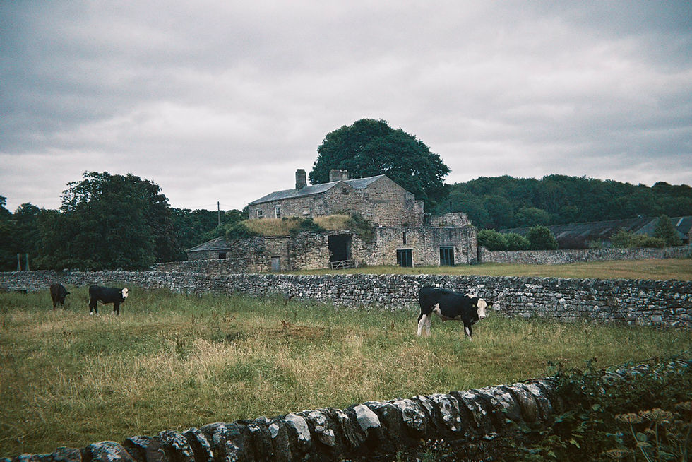
There are certainly still remains of Bradley Hall, as you can see below in front of the late 18th century farmhouse.

Bradley Hall was a fortified Manor House, surrounded by a trapezoid moat with its own construction composed of thick outer walls to protect it from marauders and rival families. There were, after all, threats from every direction in these times.

It was first mentioned in the Boldon Book of the 1180s and at that time was owned by the Bradley’s - a somewhat mysterious landowner family who held vast plantations ending up with branches all over the country. Bradley Hall (or Bradley Castle as it’s mentioned sometimes) was their primary seat for some years, though by the 14th century ended up in the hands of Bishop Langley. He was one of the lands more important men, having twice been Lord Chancellor. He crenellated this site, which effectively means he fortified it with long ditches and a moat, though it also retains underground passages and vaults.

It went through many hands in the centuries thereafter - Baron Eure a notable example who loyally defended these lands (and attacked the borderlands) as Commander of the North during uprisings and the Rough Wooing. The Tempest Family also owned it alongside a vast portfolio of other properties in Durham.

You could talk about this place forever given the constant extensions and remodellings, but it’s worth noting it has a quite smart water management system that still exists from the Elizabethan times, which flushed water through drains to rid of waste.

The existing farmhouse today dates from the late 18th century and was an addition to the house which has since been ruined.

Listing Description (if available)

The monument includes the remains of a moated site, the ruins and remains of a fortified house, a pillow mound and a series of fishponds of medieval date, situated on the left bank of the Bradley Burn, a tributary of the River Wear. The fortified house is a Listed Building Grade II. In 1183 the estate was mentioned in the Bolden Book, when it was held by the Bradley family. In Bishop Hatfield's 14th century survey it was held by Roger Eure of Witton. The son of the latter was granted licence to crenellate the house in 1431 by Bishop Langley. The estate later passed to the Tempest family and after the Rebellion of 1580 Elizabeth I granted it to the Bowes family, with whom it remained until 1844. The moated site, trapezoidal in shape, measures a maximum of 110m east to west by 125m north to south within a broad ditch up to 7m wide and a maximum of 1.8m deep. On the west, north and north eastern side, the moat is a prominent steep sided feature. The remainder of the eastern side has been infilled but it survives below ground level as a buried feature. The south side of the moat has also been infilled but it is visible as a shallow depression for part of its course. A regular inner bank of stone and earth, which is between 1.2m and 1.6m high and between 6m and 9m wide, flanks the moat for most of its course. A more discontinuous outer bank is also visible measuring between 6m and 10m wide and standing up to 1.6m high. The original entrance into the island of the moat is thought to have been at the north western corner. The island of the moated site contains slight earthworks of uncertain nature and the north western part shows a pronounced rise in level; the latter is thought to reflect the greater number of structures within the moated site placed near the original entrance in the north west corner. A drainage ditch which was cut across the moated site in 1951 revealed the existence of a cobbled area interpreted as a courtyard. At the south eastern corner of the island of the moated site there are the standing and earthwork remains of a fortified manor house thought to be of 14th century date, re-modelled in the late 16th or early 17th century. The medieval fortified house is thought to have been of courtyard plan in which at least three ranges were placed around a central yard. The east range houses the present farmhouse. The south range is visible as a rectangular ruin of large undressed sandstone measuring 30m east to west by 11m north to south and standing 5m high. The remains of a chamfered plinth are visible on the south, east and west faces. This range includes four barrel vaulted compartments. The interior west wall of the south range contains an original fireplace. A pointed medieval doorway with a square window above is visible in the north wall of the building and to the west there is another, now blocked, opening. Also in the north wall are at least two further pointed doorways, all blocked. The west range of the fortified house is visible as a pronounced but spread bank, 0.3m high, running north from the west end of the south range. A bank of slighter proportions at right angles to the latter is thought to represent the north range of the fortified house. The remains of an underground passage with two branches survive, and entry is gained through a rectangular opening situated outside the south eastern corner of the moat. From here a semi-circular passage faced in sandstone blocks, 1.4m high and 0.7m wide, runs north east for approximately 22m before it is blocked by fallen masonry. Some 3m before the blockage, a second passage, 0.7m wide and 1.1m high and roofed with sandstone slabs, branches off in a westerly direction for approximately 48m when it ends near to the north east corner of the east range of the building. Some 31m along the course of this passage a third passage joins from the north; this passage, which is 0.7m wide and only 0.5m high, can be followed for some 6.5m before it becomes blocked by fallen masonry. The lower passages are thought to be an integral part of the water management system associated with the late 16th or early 17th century re- modelling of the fortified house. They are clearly later in date than the filling in of the eastern arm of the moat and the subsequent construction of the garden. The main east-west passage is thought to have served as a drain for the house which was flushed with water from the northern branch. The purpose of the higher arched passage and its destination are uncertain. Some 25m north of the northern side of the moated site there is a linear mound 8m long by 2.5m wide and standing up to 1m high. This has been interpreted as a medieval pillow mound. Immediately to the south of the moated site there is a row of at least three enclosures, each one 40m square, bounded by low banks spread to an average of 8m wide and standing to a maximum of 0.5m high. These enclosures are thought to be the remains of a series of fishponds which were fed with water from the south side of the moat. Each enclosure contains the remains of broad ridge and furrow cultivation between 4m to 5m wide which runs parallel with the enclosures. The ridge and furrow represents ploughing of what at certain times of the year were dry ponds. A number of features are excluded from the scheduling; these are the present farmhouse housed in the eastern wing of the fortified house, the associated stone garage, all stone walls, fences, gate posts and electricity supply posts, the surfaces of all hard-standing areas and all stone or wooden sheds; the ground beneath all these features is, however, included.

Though the first map is fragmented, the 1839 tithe plan of Wolsingham provides us an early glimpse into Bradley Hall. At this time the site only featured two buildings - the main farmhouse and the adjoining ruins as well as presumed stables and gardens to the east. The moat remains are not shown as it's fairly rudimentary, but the farm at Low Bradley and Old Park farm are presented. These are given slightly more detail on the 1861 Ordnance Survey map where we now see half the preserved moat and the other ancillary buildings which make up the complexion of the site. What I presume to be the Elizabethan water system is shown running through the field on the east side which had entirely disappeared by the 1890s as seen below.

The 1890s map shows little change bar a small extension to the outhouse on the north side and the closure of Bradley Mill on the beck. Alongside the hall, the area became known for its chalybeates, or spring waters which you'll see in the grounds of the hall as well as the sulphur spa on the beck itself. Folk will have visited here from the local area to take in its supposed properties which could improve health and wellness.

4076554724_b6df6c95d4.jpg

Bradley Hall's ruins and the farmhouse in July 2025.

4076554724_b6df6c95d4.jpg

Another angle of the farm in July 2025

4076554724_b6df6c95d4.jpg

bottom of page