Bonded Warehouses
Newcastle
Last Updated:
8 Dec 2023
Newcastle
54.966460, -1.613672
Site Type:
Warehouse
Origin:
Status:
Extant
Designer (if known):
Grade II listed

The Bonded Warehouses on Close. Alongside that at Love Lane, are remnants of the Quayside’s industrial golden age.
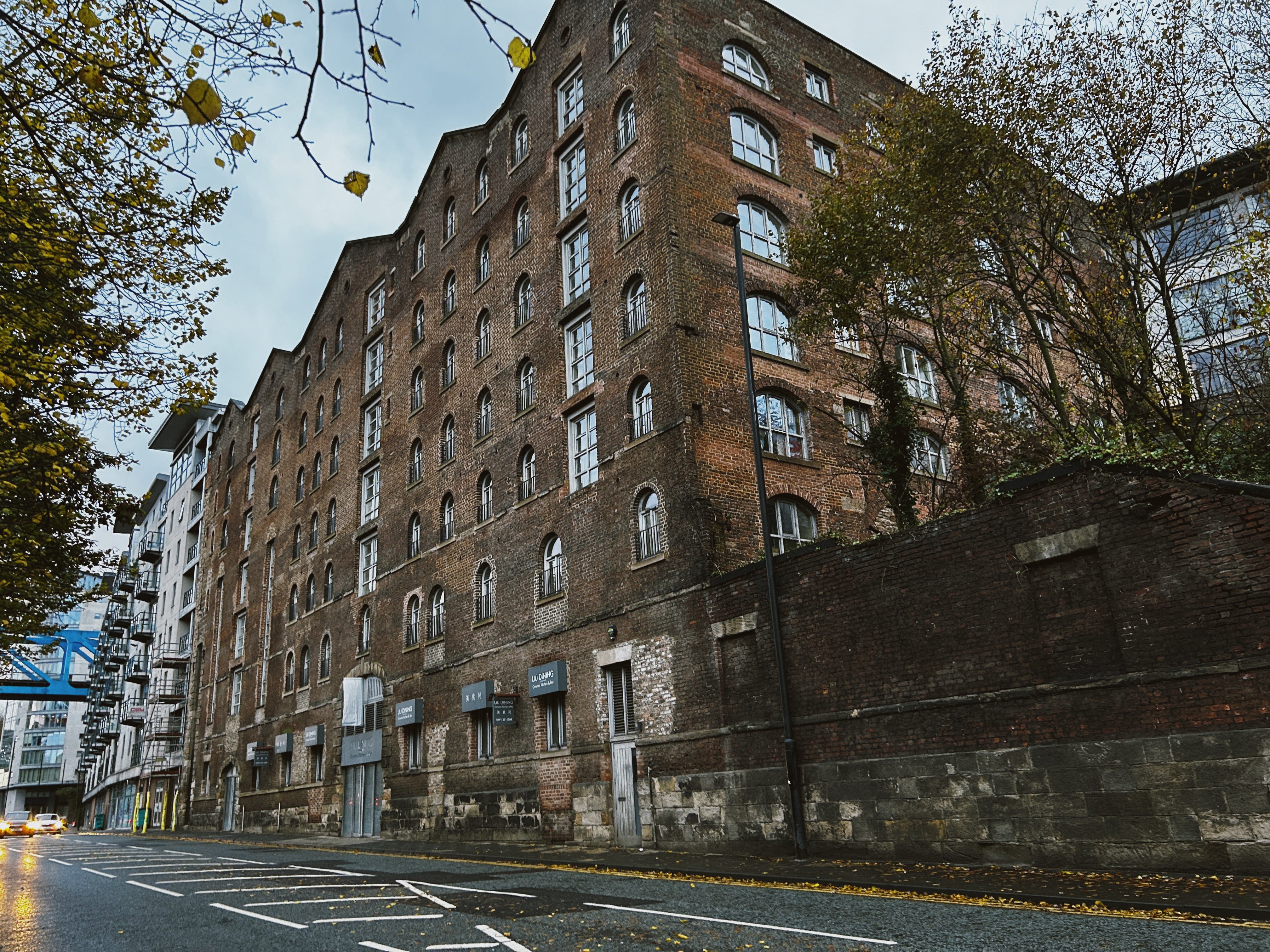
This 7 storey warehouse was built in the early 1840s for Amor Spoor - a builder and cabinet maker who owned a few buildings round here. The merchant is buried at Elswick Cemetery.
Mr Spoor actually went bankrupt before the building was completed, leading him to put the building up for sale before it was completed (I suspect the scale and cost of the warehouse is a considerable factor). The advertisement in the Newcastle Journal of 17/04/1841 notes it contained "Seven Floors, each about 44 feet square", and provided an "easy and ready Access to the higher Parts of the Town".
It does however appear that Spoor retained the warehouses (which previously extended across the whole of Hanover Street), as an advertisement by himself is shared in the Newcastle Journal of 28/10/1848. It may be the case he leased out parts of the warehouse for various industries. For example, this specific piece is marketed for spirit merchants and importers who had already patronised part of the site. The wording of the piece, which "begs to inform", may highlight the financial precariousness of Spoor in needing to fill the space in the warehouse.
It ended up in the hands of the Lange Brothers, who later owned Heathfield House near Saltwell Park. They were German shipbrokers, merchants and insurance brokers, but dabbled in Tyneside’s lead industry.
The warehouses fell into disuse in the late 20th century, and was ravaged by fire and vandalism. Plans were submitted in the 90s to renovate the warehouses at a cost of £800,000. They’re now apartments. Despite being on the quiet side of the Quayside these days, it really does elevate the personality of the city with its imposing brick elevation.
Listing Description


Though the Ordnance Survey of 1864 lacks the detail of the later version, it still provides a great glimpse into a dense and industrious Quayside. The Bonded Warehouses were squeezed into a small slice of land between Hanover Street and Close, highlighting the demand for real estate during the halcyon days of Tyneside trade. It was backed on one side by the great engine works of Stephenson at the rear, and the various mills on the riverside.
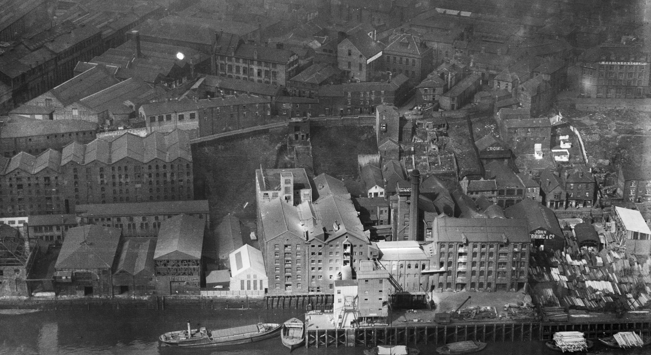
The 1890s gives us clues as to what industries were operating. The warehouse provided ample room for traders and merchants to store their output for sale in the area. The Close will have been deafening - engineering works, great corn mills grinding the flour with the railways behind would have creating a melting pot of sound. Not least, the Forth Banks Power Station was just down the road, with the first steam turbine-powered station in the world.

Despite the city and the Quayside experiencing great transitions, this part of the river stayed relatively similar. More amenities cropped up such as public houses, and more industries scattered the area. The building will have surely been reaching a point of disrepair by this time, given its intensive use and scale.

The front elevation of the warehouses facing the river in 2023. Only the eastern portion remains.

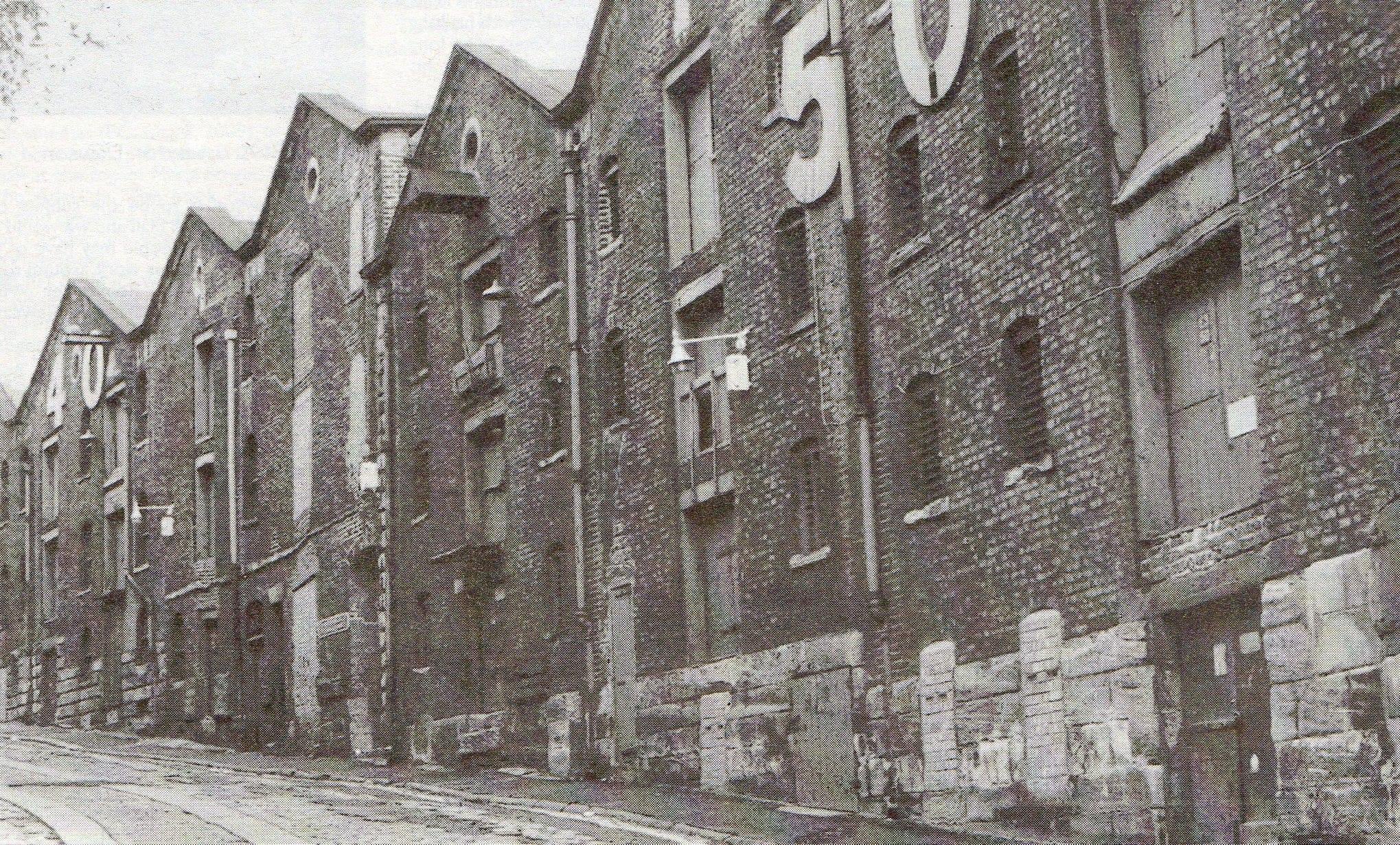
The warehouses facing Hanover Street can be seen here in 1910, already looking rough. Large numbers were affixed, allowing easy designation for users of the site. Unknown source.

The warehouses can be seen on the left of this shot, which makes clear the density of industry in this area at the time. Source: Historic England. Aerofilms Collection Historic England Photograph: EPW009977 flown 10/04/1924