Boldon Railway Station (S&T)
Boldon
Last Updated:
4 Aug 2025
Boldon
54.941611, -1.466647
Site Type:
Railway Station
Origin:
Status:
Repurposed
Designer (if known):
Now a public bridleway

If you walk to the roundabout past the big shops at Boldon, you'll reach this cycle path which leads southwards towards the edge of Sunderland and Washington. This is the original 1830s alignment of the Stanhope & Tyne Railway, and where Boldon's second station was situated.
When the Stanhope & Tyne was built it cut through fields rather than settlements. As a result, it was a small distance from West Boldon itself and therefore stood on the fringes of the village. This might be why it didn't open with the line itself, instead services formally stopped here from around 1842. This is noted as the West Boldon station in the Durham Chronicle, with the first being the Cleadon Lane station in 1839. (now East Boldon Metro).
It was certainly a modest affair, and only operated until around 1853. If there were any platforms they will have been constructed of timber. I don't think there were any station buildings either, just two sheds which pre-date the station but were retained. One of these may be the coal & lime depot, which went on to be rebuilt at Beamish. Services at this time ran from Darlington, along the Leamside Line to Boldon, then Brockley Whins and Newcastle.
Its last appearance in timetables was in 1853, but remained in use as a goods station until 1967. Until the 1910s the station remained permanently staffed for drop offs and deliveries, but the coal cells went defunct in 1951. From thereafter there was only occasional use of the siding facilities.
The site is now retained as a public bridleway between Boldon and Hylton/Washington.
Listing Description


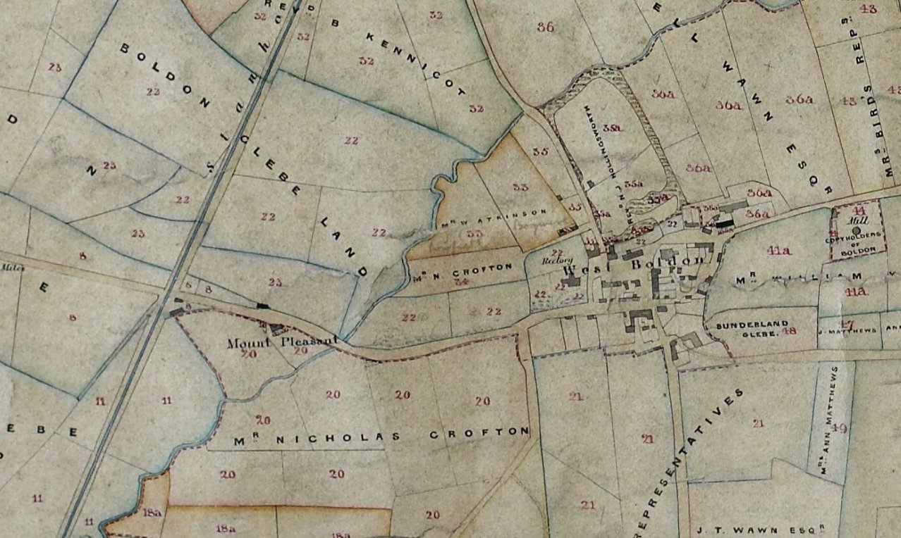
These maps show the west of Boldon and the Stanhope & Tyne railway from the 1830s through to the 1850s. It's rare we get a glimpse of a railway this early, and the tithe plan reveals the level crossing with the same coal & lime depot we find at Beamish predating some assumptions of its age online. You can see the same two buildings are still in situ on the 1850s map (published 1862) with a track leading straight inside. This map was when the station was out of use for passengers.

The 1890s map again presents a very similar picture, but a small branch can be seen leading into an unknown facility with a weighing machine.

The Boldon station site in July 2025

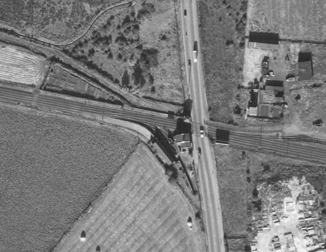
Historic England Archive (RAF photography) raf_540_1381_f22_0299 flown 7 August 1954

The coal cells at West Boldon, now rebuilt at Beamish. 1965. Source: NEG1583, Beamish Collection