Blyth Water Works
Blyth, Northumberland
Last Updated:
28 Nov 2024
Blyth, Northumberland
55.100225, -1.513455
Site Type:
Reservoir, Water Works
Origin:
Status:
Extant
Designer (if known):
Now part of a larger nature reserve.

This is the south end of Blyth at Newsham, next to the newly reopening railway. This square reservoir, in a small patch of land near South Newsham, was constructed to provide fresh water to a fast growing populace.
It was constructed in the mid to latter half of the 1850s by Sir Matthew White Ridley who was the High Sheriff of Northumberland, the MP of Northumberland North from 1859 and one of the largest landowners in this area.
Blyth was undergoing a huge expansion at this time. The town itself and the villages of Newsham, Crofton, Cowpen and Bebside saw lines of terraces being knocked up as the collieries kept on being sunk. There were nearly a dozen at this time, and given the shipbuilding industry was also strong in Blyth at this time a fresh supply of water was critical to a healthy and productive workforce. This reservoir, plus a couple at South Newsham only a few years later, provided the whole town with the infrastructure required to prop up a fast growing pit village.
There was actually a small railway which linked the Blyth & Tyne to the reservoir from its inception. This was to shuttle in materials and the like to an engine house which pumped water over to the town. The line can still clearly be seen today.
Listing Description


These Ordnance Survey maps illustrate the Blyth Water Works as they were in the 1850s and 1890s. There is quite literally no difference. From the west, you'll see the extant Blyth & Tyne Railway just south of Newsham leading to New Hartley, with a single track branch leading leading east to the water works which provided materials to the site. There's also a set of cottages - at least 3, who were likely responsible for the day to day running of the water works (or could be railway workers). The engine house, responsible for pumping water, can be seen as well as what appear to be old quarry workings to the south.

The 1924 map again displays little significant change. The branch line is still in situ and the Water Works operated by the Blyth Urban District Council. A path can be seen directly from the water works to Lysdon Farm which still operates.

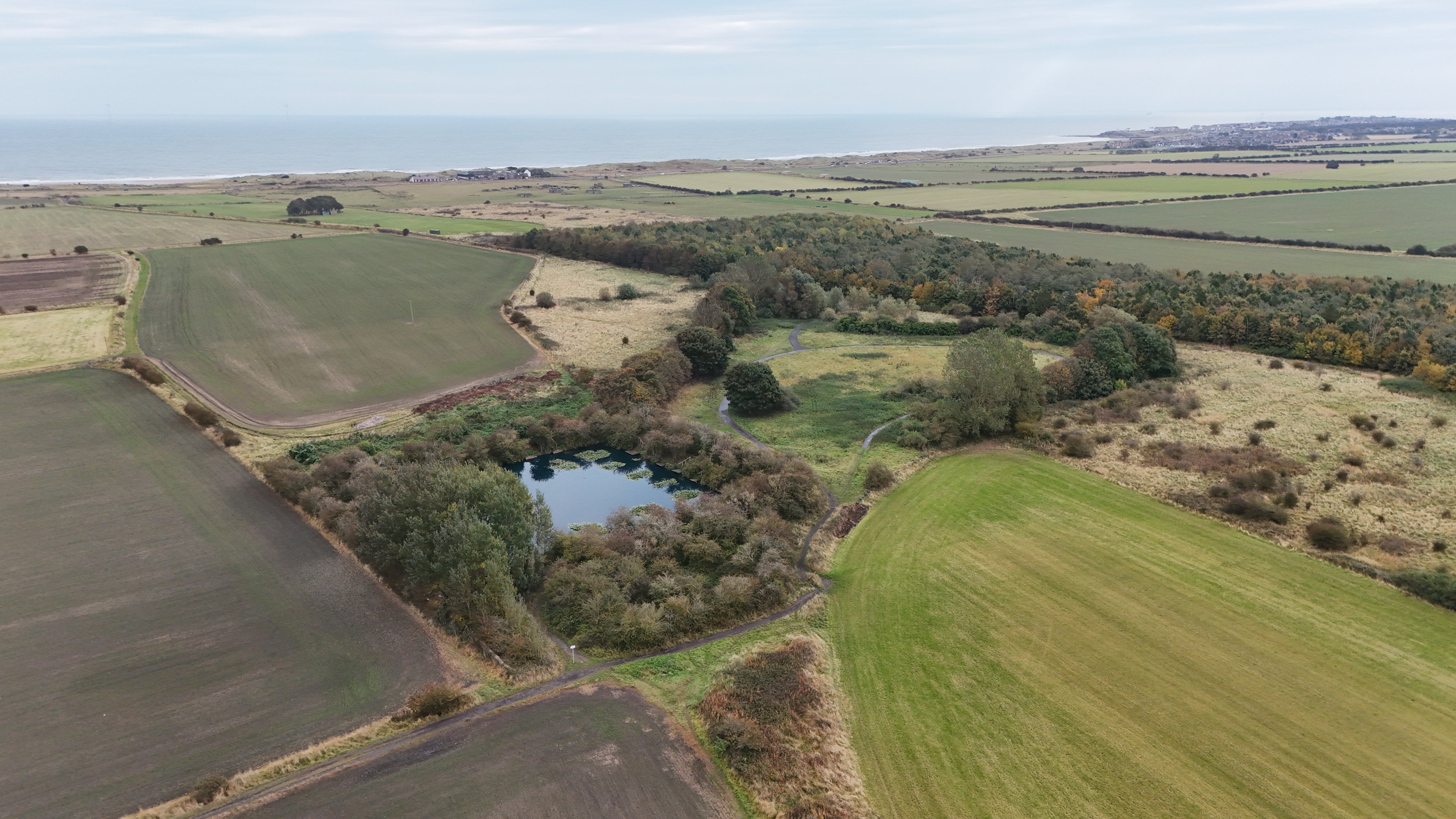
The Blyth Water Works site looking south east towards Seaton Sluice

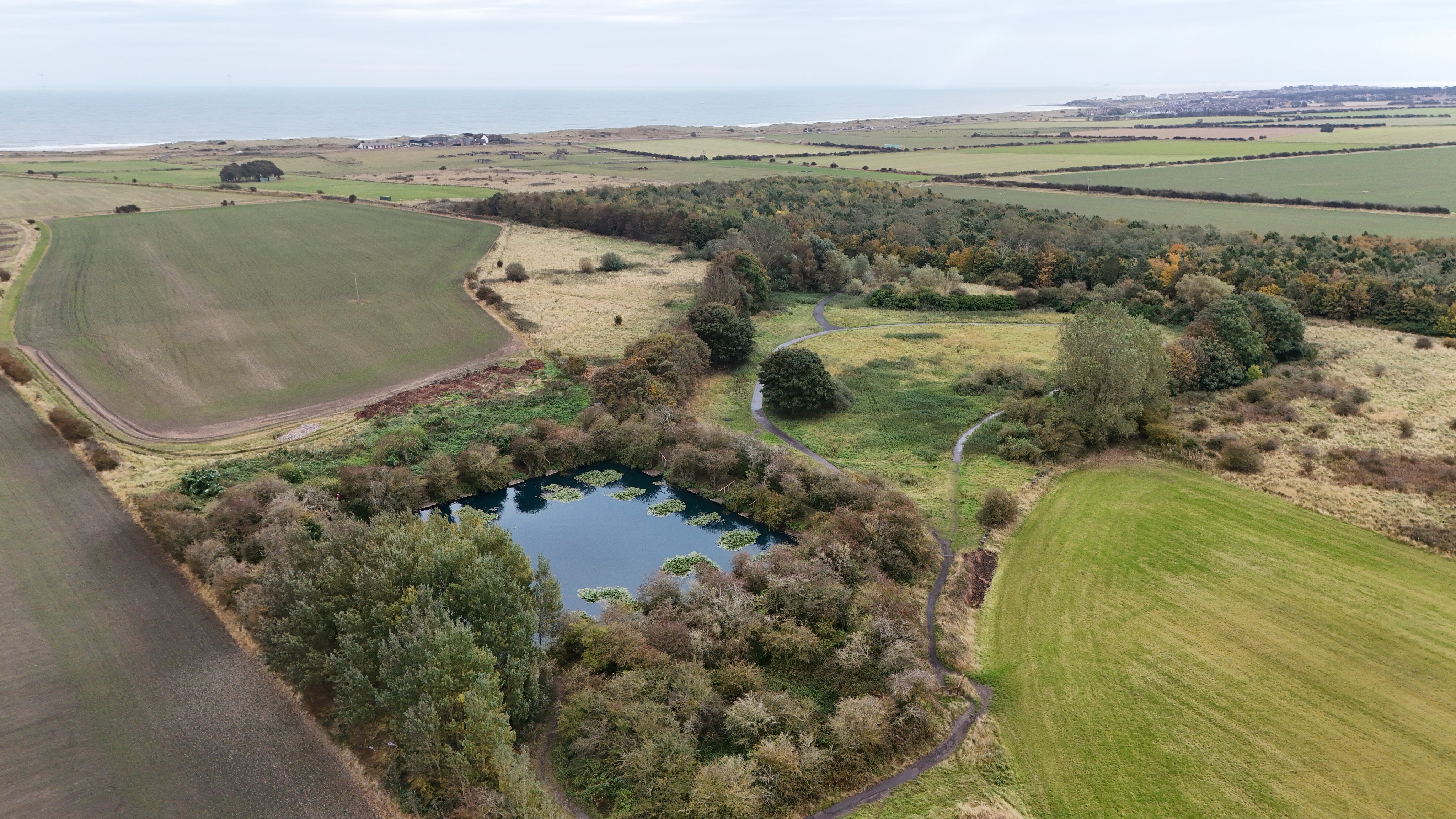
A further close up of the square reservoir. The engine house stood just beyond on the small rectangular patch of green when the path junction lies. Taken in October 2024.

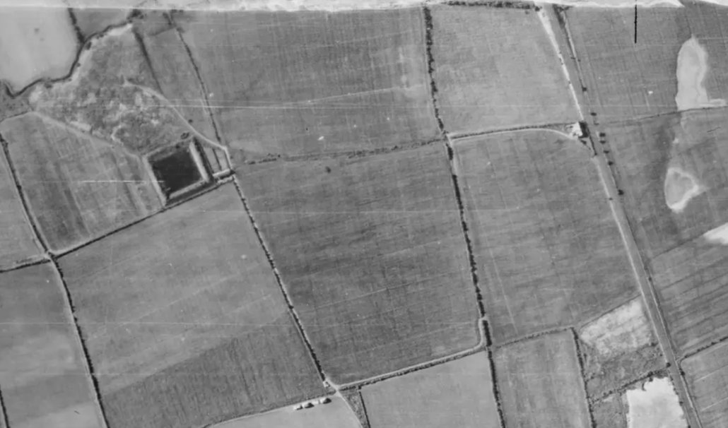
Aerial view of the railway and water works in 1947. There is seldom change in the century it was dug, which can still be said today.
Source: Historic England Archive (RAF photography) raf_cpe_scot_uk_221_rp_3434 flown 27 June 1947