Abbey Mill, Alnwick
Alnwick
Last Updated:
27 Feb 2025
Alnwick
55.419862, -1.716874
Site Type:
Mill
Origin:
Status:
Partly Preserved
Designer (if known):
Only stonework and boundary walls survive

A corn mill stood on the eastern periphery of the abbey complex, and we’re aware the monks operated two separate sites from their inception. This is certainly the site of one, which continued operations until the 1920s.
The Abbey Mill was a fairly large site adjacent to the Canongate Bridge leading up to the Great North Road. For the monks to establish self-sufficiency, they probably worked the rushing waters of the Aln to produce flour for themselves, or to sell to the town and the local gentry. It’s a bit similar to glebe lands, I suppose, where the church would maintain the running of the church by farming or establishing modest enterprises to ensure its longevity.
After the dissolution, the mill ended up in the hands of the Earl, and would then be operated purely on a commercial footing. He wouldn’t necessarily run it, but he may have leased it out to a local miller and then charged him rent. Quite often in these times too, tenants of the local gentry were forced to use a certain mill – enforcing a monopoly. This was called the mill soke – a practice which only ended in the 19th century.
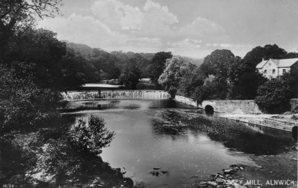
The structure we see on the right-hand side of the postcard below probably dates from the late 18th or early 19th century, given the scale. There was a small mill race and sluice system, which would turn a large water wheel. My photo and the postcard below show the southern portal of both the sluice and the mill race.
In the 1880s, it was owned by Thomas Lough, who sold flour and French yeast at this site alongside other foreign flours like Hungarian, American, and German flours.
By 1889, a hydroelectric system was installed here which powered Alnwick Castle only a few years after Cragside. Swan’s electricians had already successfully fitted lighting apparatus some eight years earlier, though this would provide a permanent power source. Dynamos and a turbine were fitted here, and conductors were conveyed along Canongate Road, through the fairy grounds, across Walkergate, and the Peth to the Falconers Tower. The work was carried out under the direction of Mr W Attwaters, who previously oversaw similar work for Mr Joseph Mosely – a Manchester rubber merchant.
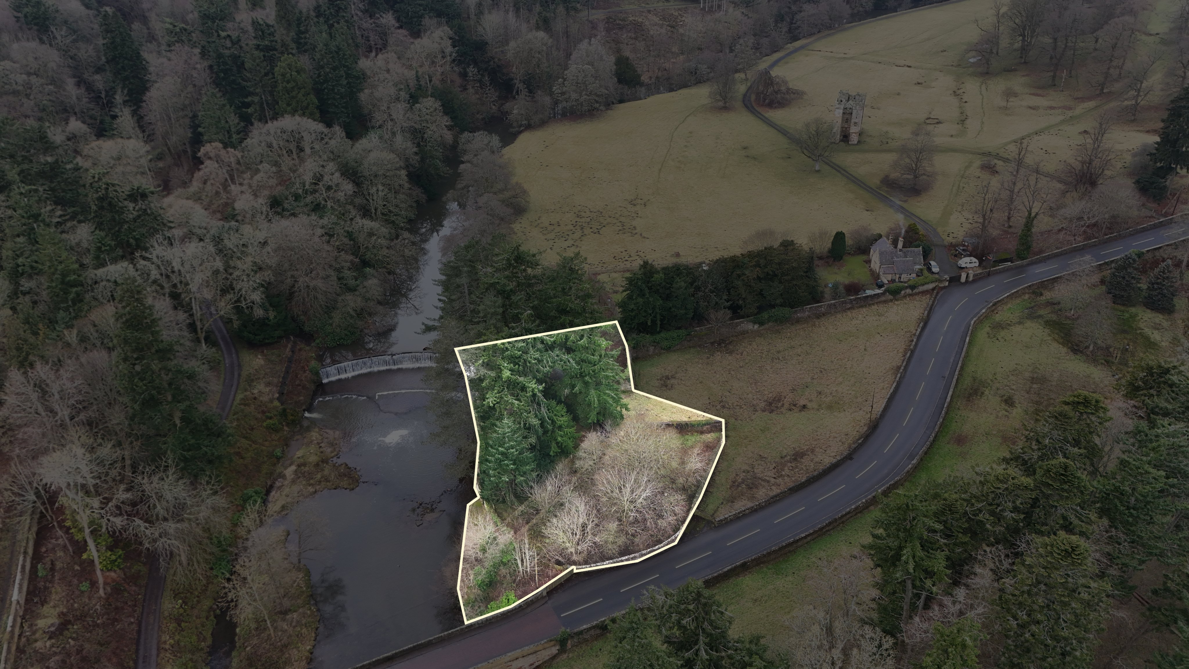
The mill went out of use by around the 1920s, though the hydroelectric system was used until the 1940s when the mains were finally fitted. The mill was demolished sometime after, and today all we see is the boundary wall and the stonework against the Aln.
Listing Description


The maps illustrated depict the banks of the Aln north of Alnwick from the mid to the late 19th century. The large and impressive Abbey complex is portrayed alongside the Abbey Mill , which grew in size during the half century. The mill race and sluice are omitted from the first map, but are well detailed on the 1890s iteration showing some sort of pipe system from the sluice into the main building. There is also a small footbridge onto the island severed by the race. The sluice on the south bank was a salmon ladder and still exists today.

The mid 20th century Ordnance Survey shows the site after clearance, though the mill race and sluice are still extant alongside the salmon ladder on the south side. As noted by the modern photograph on this page, the stonework lies in situ exactly the same as shown here. The ruin in the bottom right is a cow house dating from at least the first half of the 19th century. Modern satellite images do imply there is a structure still there, but it's difficult to confirm exactly.

The Aln, with the abbeys mill race and sluice system, in February 2025

The Aln from the same perspective as above around the 1920s. Unknown original source.

The exact site on the Aln from above, taken in February 2025