N11942
Ellington Colliery
Ellington
55.216810, -1.554838
Opened:
Closed:
1909
2005
Entry Created:
3 Sept 2021
Last Updated:
21 May 2024
Reclaimed
Condition:
Owners:
Ashington Coal Co. Ltd. (1909 - 1947), National Coal Board (1947- 1986), British Coal (1986), R.J.B Mining PLC. (1994 - 2001), UK Coal PLC. (2001 -)
Description (or HER record listing)
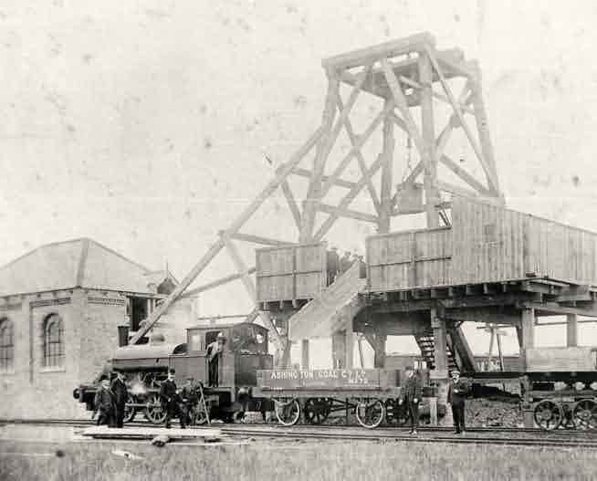
Ellington Colliery opened in 1909 when it was owned by the Ashington Coal Company Limited. It has changed ownership several times during the 20th century and is currently owned by UK Coal plc. The pit is finally set to close in 2005 after thousands of gallons of water flooded the mineworks. (Written pre closure)
NEHL - Ellington Colliery was a fairly late pit, opening in 1909 between the villages of Ellington and Lynemouth. The Ashington Coal Co. commenced operations in 1910 utilising two downcast shafts, an upcast shaft and a mac-access drift.
The colliery was constantly plighted by water which led to its demise. Over a million gallons were pumped out of the pit daily, resulting in around 3 tons of water raised for every ton of coal. It was also plighted by safety issues. In 1913 there was a fire in the pit shaft, and countless fatalities were experienced in the first decade of operation. Falls, wagon crushes and derailments plagued the complex within 10 years - highlighting the unsafe working conditions.
A small colliery village developed to the north of the pit featuring 3 rows and allotment gardens. Most local amenities were retained at Ellington where there was a school and institute.

Ordnance Survey, 1898

Ellington Colliery, 1995. Source: mining-europe.de
Have we missed something, made a mistake, or have something to add? Contact us

Sinkers at the Ellington Colliery pithead, 1910. Source: Northumberland Council
Historic Environment Records
Durham/Northumberland: Keys to the Past
Tyne and Wear: Sitelines
HER information as described above is reproduced under the basis the resource is free of charge for education use. It is not altered unless there are grammatical errors.
Historic Maps provided by
