
3984
Walbottle Colliery
Walbottle
55.002462,-1.724221
Coronation Pit
Opened:
Closed:
1820
pre-1890s
Entry Created:
3 Sept 2021
Last Updated:
28 Oct 2025
Redeveloped
Condition:
Owners:
J. Lamb, Potters, Jobling's Trustees (1850s), R. O. Lamb (1860s), Terale & Kirton (1880s), Kirton, Rowell & Dodd (1880s), Walbottle Coal & Firebrick Co. (1890s), Lemington Colliery Co. Ltd. (1930s)
Description (or HER record listing)
There’s very very few collieries in the North East which are still materially evident of their former presence. I could probably count on one hand the sites which anyone would know was a pit. Many have been landscaped, redeveloped or simply reclaimed as agriculture. This one on the Chapel House estate is one such which has been remoulded into a public park.
This is the old Walbottle Coronation Pit, named so after the crowning of George IV in 1830. It was these kinds of sites that induced the need for urban sprawl all the way west from Newcastle, as all of this was once fields, farms and country houses. It was an incredibly attractive area to set up an industry - cheap labour, the skilled minds to construct what’s needed like a Newcomen engine or a waggonway, and the river Tyne down the hill.
The owners of this particular pit owned a string of workings at Blucher and Walbottle, employing upwards of 400 people. The coal here was used for all sorts but namely fire clay, which produced the bricks to build the endless rows and factories of the west end.
This was an early closer - gone by the 1880s and hence why we don’t have any photos of it as far as I’m aware. Still, the site remains as does the route of the Waggonway down to the Tyne.

Ordnance Survey, 1865
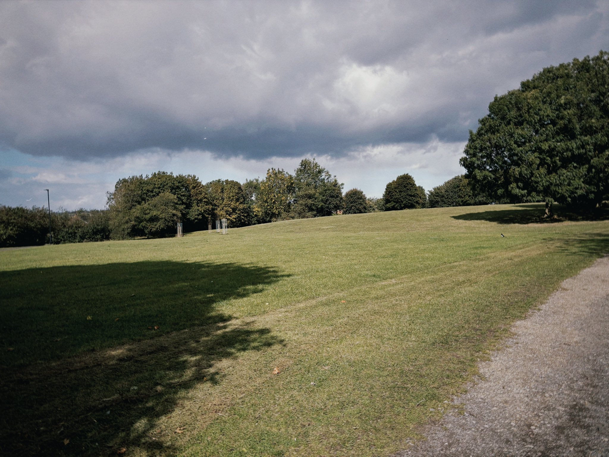
The site in September 2025
Have we missed something, made a mistake, or have something to add? Contact us
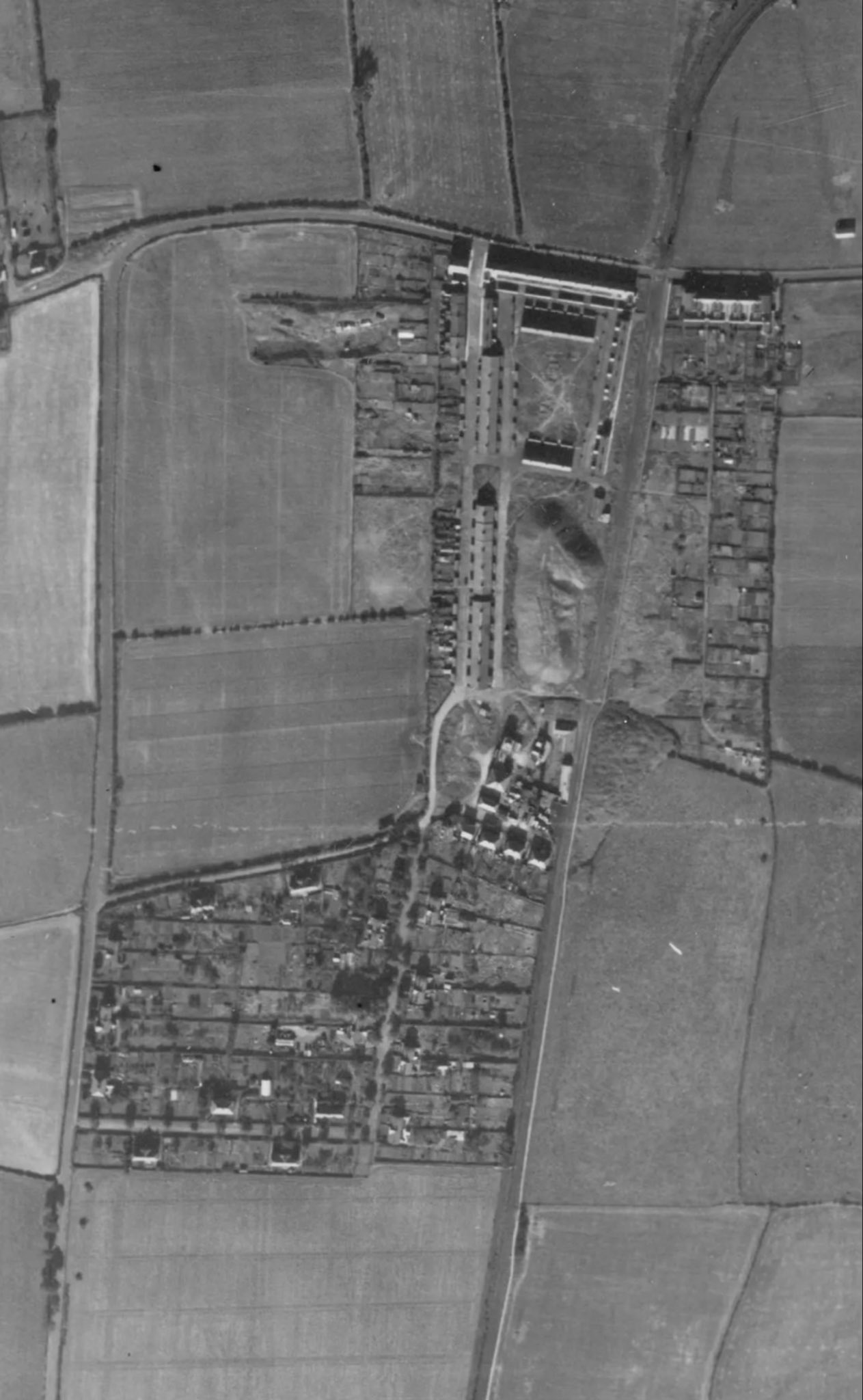
The site of the Coronation Pit, with its legacy pit village and heap, in 1947.
Source: Historic England Archive (RAF photography) raf_cpe_uk_2352_fs_2132 flown 4 October 1947
Historic Environment Records
Durham/Northumberland: Keys to the Past
Tyne and Wear: Sitelines
HER information as described above is reproduced under the basis the resource is free of charge for education use. It is not altered unless there are grammatical errors.

Historic Maps provided by