Whitley Quarry
Whitley Bay, North Tyneside
Last Updated:
9 Jan 2026
Whitley Bay, North Tyneside
55.036484, -1.446542
Site Type:
Quarry
Origin:
Status:
Extant
Designer (if known):
Parts of quarry now filled in by reservoir.

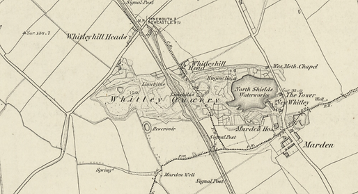
Whitley Quarry was also variously known as Whitley Lime Kiln Farm, Marden Farm or the Maudiln Pits. The 1st edition Ordnance Survey Map shows limekilns and an engine house within the site. A reservoir, belonging to North Shields Water Works also lies within the quarry. The earliest records show a John Dove leasing the site in 1663. By around 1825 it had 12 lime kilns, including one battery of 6, 3 old kilns, a windmill, smithy and an internal wagonway system. It used the Whitley Wagonway to transport materials to the Tyne. Before the establishment of the railways it was probably the biggest lime producer in Northumberland. By 1850 it was in decline, with the flooded portion in use as a reservoir. Retrieved from Sitelines
Listing Description


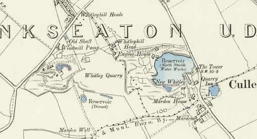
By 1850 the quarry had been closed and filled in as a reservoir to be used by the local water works in North Shields. This continues in the second edition but seems to have been slightly extended. The quarry works to the west have been partially landscaped. The railway, which can be seen in the previous edition, has at this point been dismantled. This was the old Blyth and Tyne Line to Tynemouth, which has been constructed closer to the coast at this point. Cullercoats station can be seen to the west.

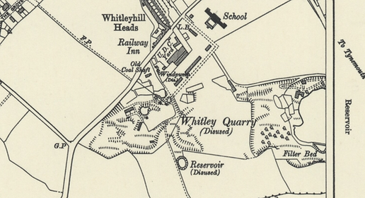
The scene in the 1946 edition is very much unchanged apart from the development of post war housing and local amenities like the school. The area is a beauty spot at this point, as seen by the trees lining the reservoir. The railway tracks to the north are sidings for Monkseaton Railway Station, but before being disjoined were the lines to Tynemouth.

Photograph of Marden Quarry, undated. The picture shows the quarry as the reservoir for the local water supply. The buildings no longer exist, which were north of the lake, but this scene can still be visited.