Theatre Royal, Wallsend
Wallsend, North Tyneside
Last Updated:
24 Mar 2025
Wallsend, North Tyneside
54.989826, -1.539487
Site Type:
Theatre
Origin:
Status:
Demolished
Designer (if known):
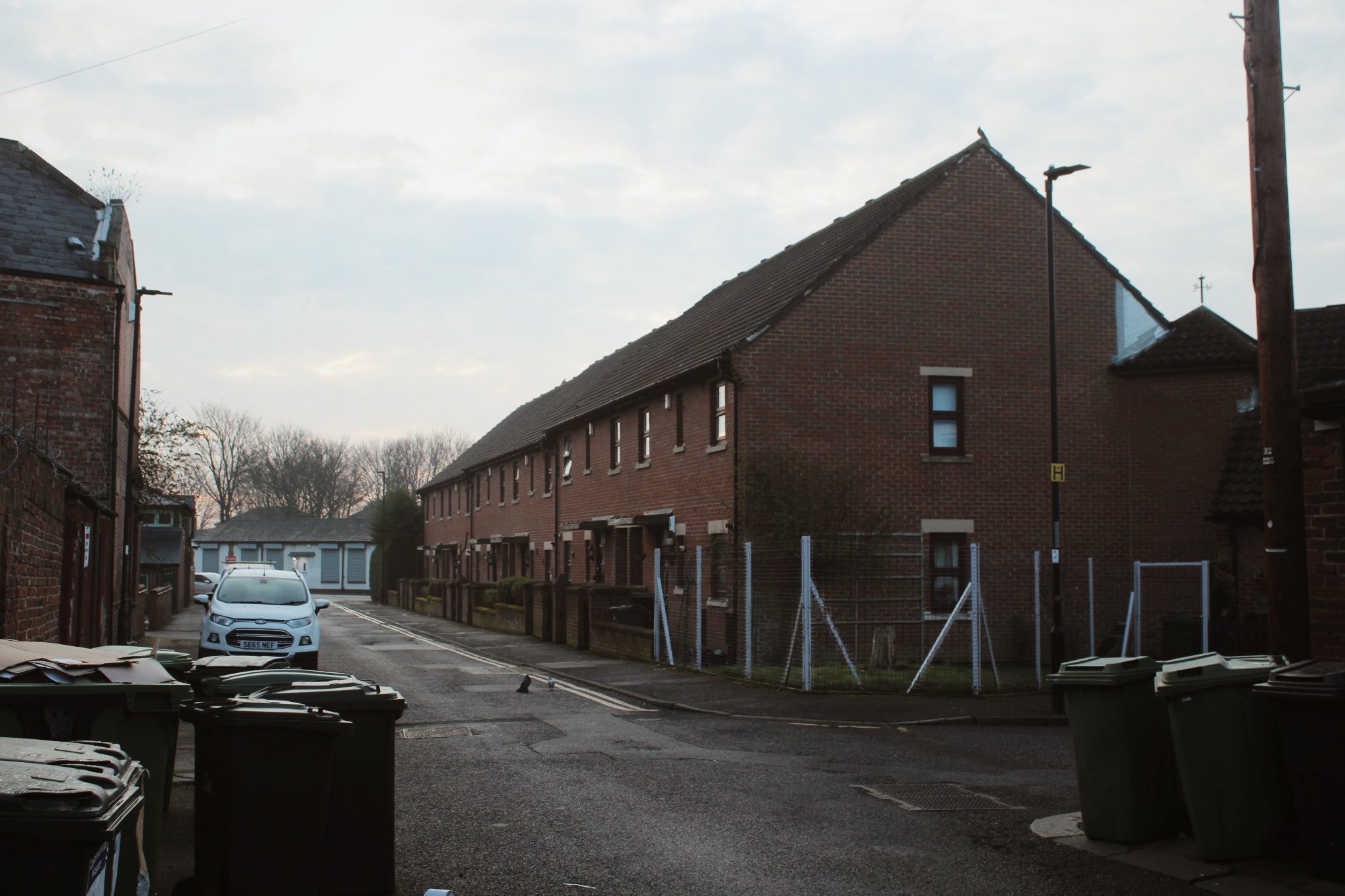
The site is now occupied by housing

So we’ll start with the same photograph as the end of the row houses was the exact site of one of Wallsend’s first theatres - one where Churchill spoke as he rose to political fame.
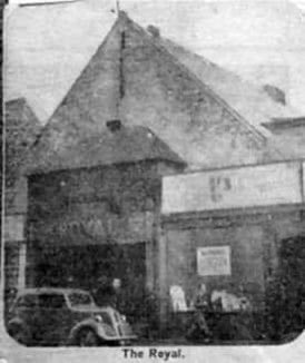
Wallsend’s own Theatre Royal stood here, a corrugated iron construction not exactly conforming to the grandeur the brand intended to present. It was built by a Mr William Cawthorn, a well known North Shields publican who owned the Sportsman’s Inn at Preston village alongside his role on the Wallsend UDC.
It stood here from 1893, and was actually coined the “corned beef tin”. Stan Laurel’s father Arthur Jefferson would be manager here for a short time, putting on all sorts of dramatic performances and pantomimes alongside trades meetings and political meetings. Concerts were also held with attendances upwards of 1400 - I have no idea how that many people could get crammed in.
Incredibly, I find Winston Churchill also spoke here in 1903 just two years after becoming an MP and a year before he crossed the floor to join the Liberals. He was here to speak to the Wallsend sect of the Primrose League, a Conservative organisation. Much of his speech was of little interest and was pretty dry around the military and navy. Lord Percy is also known to have spoken here in favour of James Knott becoming MP in 1905/06.
Relief committees supporting the needy and distressed in the district also used this place as an effective soup kitchen. Dinners of broth and bread were given out to up to 700 kids a day here. Such was the contrast 50 years prior, where Wallsend turned from an idyllic retreat for the industrial gentry to a dense working class town.
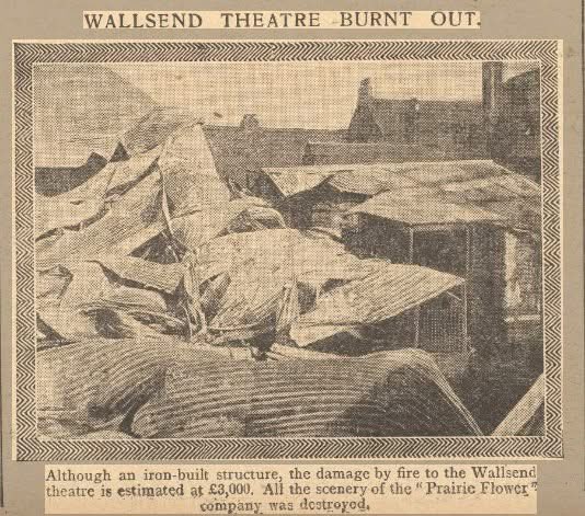
Sadly, this place burnt down in 1906. Given it was made of wood and iron it was a tinder box from the outset and is noted to have burnt like matchwood. The damage cost £3000 and was never rebuilt.
Listing Description


The two maps above illustrate Portugal Place, Wallsend between 1899 and 1921. The first map dates from the turn of the century further above, and labels the site as the 'Royalty Theatre' on the western side of the road. It seemed to be the only property on this side of the road with it being one of the last buildings in the town of Wallsend until Walkergate is reached.
As noted above the theatre did not last too long as was replaced by the Borough Theatre further to the east at Park Road. Portugal Place had built up with a few different sites, unfortunately all unlabelled on the map. The original building from the Ordnance Survey of 1899 is not featured, with it being destroyed by fire in 1906.

Site of the Royalty Theatre in March 2025

The only known photograph of the Royal while it was operating. Unknown original source.

The theatre and its hefty corrugated iron after it was sadly razed in 1906.