St Anthony's House
Walker, Newcastle
Last Updated:
25 Mar 2024
Walker, Newcastle
54.961322, -1.550979
Site Type:
Dwelling
Origin:
Status:
Demolished
Designer (if known):
The site is now Walker Riverside Park.

"St. Anthony's House was built in 1620 by Dame Dorothy Lawson, widow of Roger Lawson of Heaton. The house was close to a place where 'in Catholick times' a picture of St. Anthony was placed in a tree near the River Tyne for the comfort of seamen. Dorothy Lawson had a Catholic chapel in her house. She died in April 1632 and her body was carried in state along the river to Newcastle where she was buried with full Catholic ceremonies in the Protestant church of All Saints. After her death her son Roger sold the house.
The mansion was described as 'a seat most commodious for pleasure'. The house was set on fire by Royalist troops to prevent it being occupied by the Scottish army when they beseiged Newcastle. After the Civil War, William Bonner owned the house, followed by his son Thomas. In 1734 Anne Bonner married Thomas Leven. The house passed to Mrs Grace Ibbetson, daughter of Sarah Morton (nee Bonner). By 1781 it was owned by Henry Ibbetson. His father lived at Denton Hall in Yorkshire. A survey of St. Anthony's House dated 1781 shows an E-shaped group of buildings. At the north end of the estate there was a range of buildings around a farmyard. A road to the east led down to a ferry landing at the river. There was a melon-ground north-west of the house. Melons had been grown in England from the C16 in hothouses, in hot-beds and under bell glasses. On the west side of the house there was a tree-lined drive leading from a carriage turning circle. The drive left the estate through tall gate piers to join the Newcastle to Walker road. The gardens lay west and south of the mansion.
Between the house and east wall of the estate there was a 'scittle ground'. Skittles or Ninepins had been popular in the C17 and early C18 but bowls became more popular. A second plan also of circa 1781 shows the house in more detail. The southern range had been rebuilt as the principal elevation of the property, with a five bay, three-storey façade with a full-height canted bay on the eastern side. The brick building had sills and floor bands, quoins and wedge-shaped lintels probably in stone. The door had a pediment and probably columns. The canted bay window was also stone. The south range stepped back behind the canted bay and had a staircase tower.
A C19 photograph shows that the tower had two serliana (Venetian) windows with a tall central window with an arched head and a rectangular window on each side. St. Anthony's House resembled other C18 elite dwellings such as those on Charlotte Square and Dean Street in Newcastle, Wallsend Hall, The Red House and The Grange at Wallsend. Wallsend Hall had a stone canted bay window like St. Anthony's. The architect of St. Anthony's House is not known. It may have been John Carr of York who designed Denton Hall near Ilkley in Yorkshire, Chesters near Hexham and made alterations to Raby Castle. But St. Anthony's House does not have the external decoration (half-balusters, architraves and keystones) that Carr's houses tended to have. It is more similar to William Newton's designs. Dissington Hall by Carr and Newton has a canted bay window. John Dodds was an architect as well as a surveyor. He altered Chipchase Castle in 1784. Henry Ibbetson died in 1825. He left the house to his wife and two daughters. By 1827 the house was the residence of William Fryer. By 1858 it ceased to be a private house. It became the Ellison Arms Inn. The surrounding area was industrialised (lead works, a pottery and chemical works). The house was still present in the 1930s but had gone by the 1950s.
The site is now part of Walker Riverside Park." - Sitelines
NEHL - St Anthonys House was named after the engraving or illustration of the saint that was hung/presented on a tree facing the river, for seamen to pray and reflect for safe journeys in pre-Protestant times (probably pre-16th century). As a result, devout Catholic Lawson constructed a chapel on the grounds thanks to its religious heritage and the name has stuck ever since. There are sadly no remains of the house and the estate, which covered much of the area up Pottery Bank and Ropery Walk.
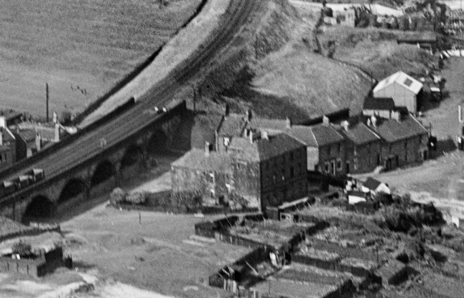
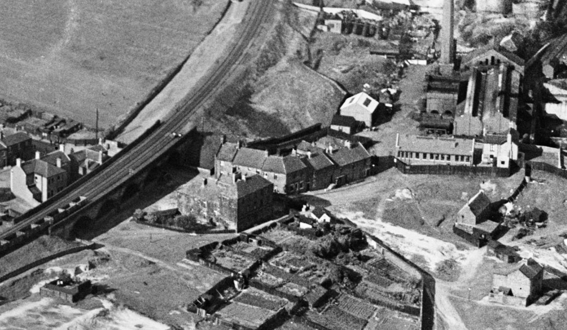
The HER listing notes it became the Ellison Arms Inn - this is difficult to believe as Ellison Arms stood just above the Riverside branch railway viaduct and stood until the 30s. St Anthony's House stood immediately south of the viaduct.
A detailed assessment of the mansion house has been written by Richard Pears. See here in the Archaeological Aeliana, Volume 43: https://archaeologydataservice.ac.uk/archiveDS/archiveDownload?t=arch-3433-1/dissemination/AAseries5/AA543typeset/archael543-241-248-pears.pdf
Listing Description


Both maps above illustrate St Anthonys House in the immediate vicinity of the village. Though less detailed, the Ordnance Survey of 1864 shows St Anthonys as quite a bustling village. It was enveloped by industry on both sides, with a small row of dwellings and pubs on what is now Felling View. St Anthony's Ferry was originally further east next to the Chemical Works. In later decades, it stood directly at the end of Pottery Bank.
The more detailed town plan from the 1900s provides a little more insight into the property. Its estate had been swallowed up by the railway and wider developments. It was pretty much on its last legs by this point, and was demolished just under 3 decades later. As with the rest of St Anthony's, it was all gradually demolished until the 80s.

This publication from 1947 shows an entirely different picture. St Anthony's House and the dwellings on Ellison Place have all been demolished, though the roads they stood on lay in situ. The site St Anthonys House stood on was laid bare, untouched by the allotments which grew around it. The housing developments of Walker encroached on this area by this time, leaving little distinction between the village and the rest of the area. Only the Ellison Arms, Lord Raglan and Methodist Church remained on Ropery Walk by this time, and pre-fabs were little constructed in the area.

An aerial shot from 1932 of Ellison Place and St Anthony's House. A small garden can be seen at the back of the property, the estate of which was drastically shrunk by this time. Previously, it covered most of the area seen. Source: © Historic England. Aerofilms Collection Historic England Photograph: EPW038769 flown 01/06/1932