Southwick Lime Kilns
Southwick, Sunderland
Last Updated:
3 Apr 2024
Southwick, Sunderland
54.917206, -1.392841
Site Type:
Kilns, Lime Works
Origin:
Status:
Partly Preserved
Designer (if known):
Listed Grade II

One silver lining of Sunderland lacking any modern development on most of its riverside is that there’s a lot of old industry sat dormant, as expressed in earlier posts.
This is probably the biggest remnant of the lot - the huge lime kiln complex at the bottom of Southwick. This was once called the Carley Lime Works.
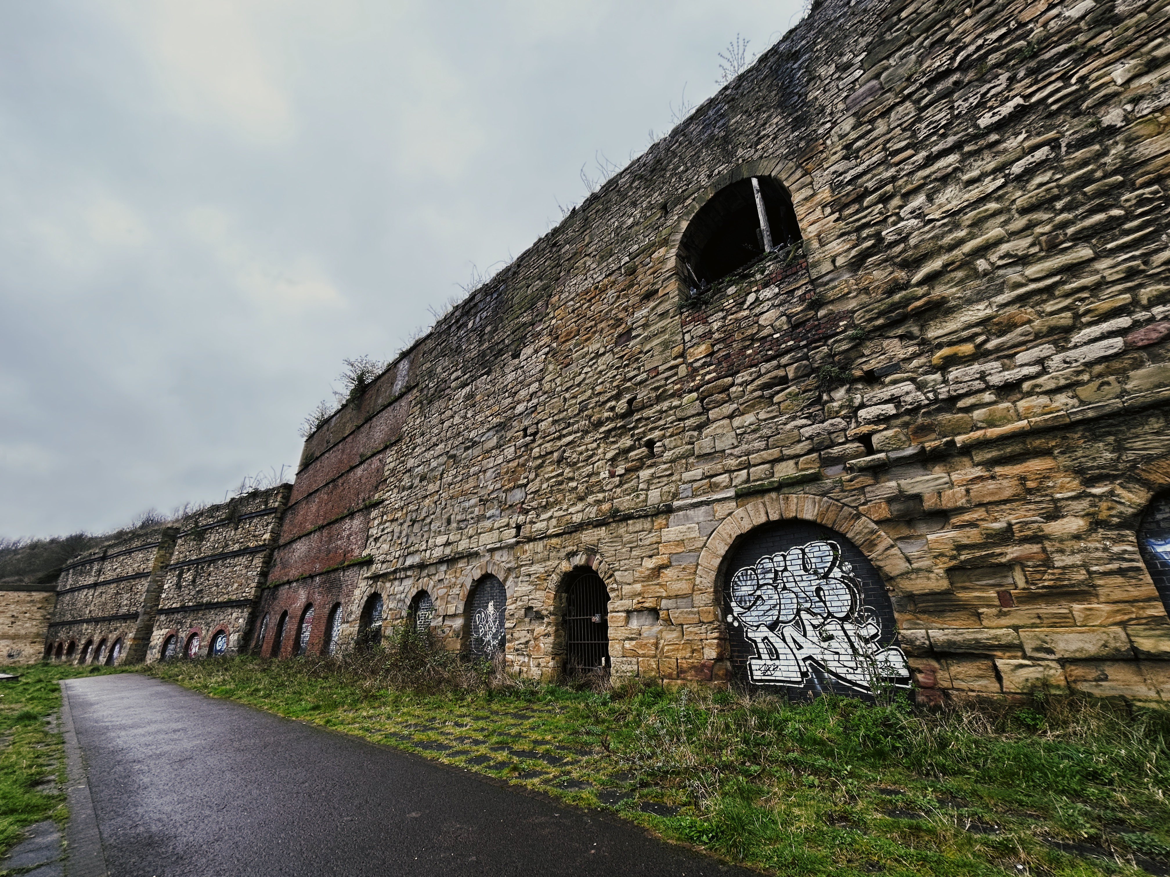
The structure is a patchwork of 18th and 19th century sandstone, limestone, brick and coursed stone. Emblematic of the quickly intensifying industrial demand through this period. The earliest are those on the left.
Limestone was brought down the Carley Hill Waggonway from the huge quarries near Fulwell. Here the stone and coal would be burned to make quicklime, which was used in all sorts of industries from construction to iron production. Much of this land was owned by the Dean & Chapter of Durham, who found this a profitable venture and leased the areas out for profit.
This was one of a number of lime works on the Wear. There was another at Sheepfolds Lime Works close to Wearmouth Bridge, which is shown in historic illustrations of 19th century Sunderland. In Southwick, there were limekilns around a few hundred metres upstream, which had its own lime waggonway at the west of the village green. This is shown on the 1839 tithe plan, and had totally vanished by the 1850s making it a rare and valuable insight.
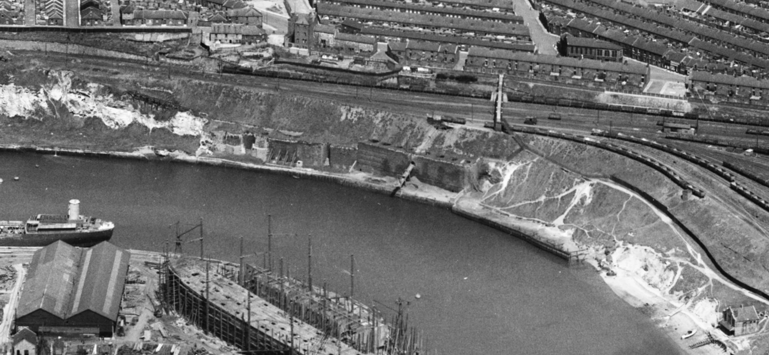
Interestingly, the arch on the upper level of the stonework may have been a chute from the railway to the river. Aerial photographs from 1946, inc. the one below, shows a conveyor belt-like structure from the top of the bank all the way down. Could this have been a waste chute, or a drop to ships?
Listing Description


Both of these early maps show Southwick between the 1830s and 1850s, the latter published in 1862. The rare insight into 1830s Sunderland shows the village of Southwick flanked on both sides by waggonways - the one on the right being the Carley Hill Waggonway to our lime works, and on the left a waggonway i'd not come across before from lime quarries west of Carley Hill, leading down Fern Avenue to Low Southwick to lime kilns on the Wear. This demonstrates how important the lime trade was in the area, despite totally vanishing by the 1850s.
The area started to develop by the map published in 1862. Rows of terraces were popping up for the various industries, and the village green at Southwick became enveloped by terraces, brick fields and shipyards.

The 1897 map depicts a sweeping transformation of the land from pocket industries to a widespread urban landscape. The staples are the graving dock and the lime works, inc. the railways that served the latter. Aptly, they are two of the only structures on this map that actually survive to this day. The housing is mostly all gone, as well as the railway.

The Carley Lime Works in 2024

A ground level view of the lime kilns, featuring the various bits of coursed stone and brick composition of the complex. The arch on the upper level featured the chute mentioned earlier.

The oldest kilns on the left are held up by joists as shown on this aerial from 1946.
© Historic England. Aerofilms Collection Historic England Photograph: EAW001030 flown 06/06/1946 (6 June 1946)