Park Methodist Church
Middlesbrough
Last Updated:
2 Sept 2024
Middlesbrough
54.565493, -1.241514
Site Type:
Church, Place of Worship
Origin:
Status:
Extant
Designer (if known):
W. J Morley & Son
Listed Grade II

Thanks to its status as one of the entrances into the town, Middlesbrough's Linthorpe Road is filled with grand classical-esque buildings constructed to blow away any visitor who made their way north. I certainly felt that way!
One such example is the Park Methodist Church, a stunning Wesleyan place of worship from the mid 1900s designed by William Morley. The Bradfordian delivered similar ecclesiastical projects in Scarborough, Kensal Rise and Beeston using this beautiful red brick and terracotta.
Wesleyanism was introduced to Middlesbrough when it bloomed from a village to Ironopolis - around 1828. The first was at West Street "over the border" in the original settlement, with sermons performed from a hut in a backyard. It later moved to the Market Place, and as the town grew further space was acquired at Linthorpe Road.
It seats 700 persons, and from the outset was dignified as a permanent landmark. The tower rises 80ft, and inside featured a school and guild room.
Listing Description


The Ordnance Survey maps shown here illustrate the area around Park Methodist Church between the 1910s and 1920s. Given it was on the periphery of a booming industrial town, it became the congregation of the towns elite. Terracotta and red brick dominates this urban landscape as well as the large villas for the wealthy. Albert Park fixed the areas position as one of affluence, attracting townsfolk through its amenities. A maze, archery ground, cricket ground, rifle range, athletic ground and boating lakes all raised the attraction of the neighbourhood.

Here's an impression of the area before Middlesbrough expanded into the area. Linthorpe Road is that shown slicing through the centre of the map, with few features except the cemetery and the brick field situated on what's now Park Road North.

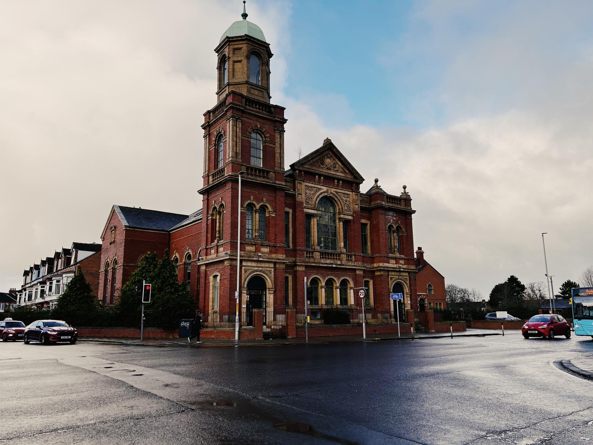
Park Methodist Church, 2024

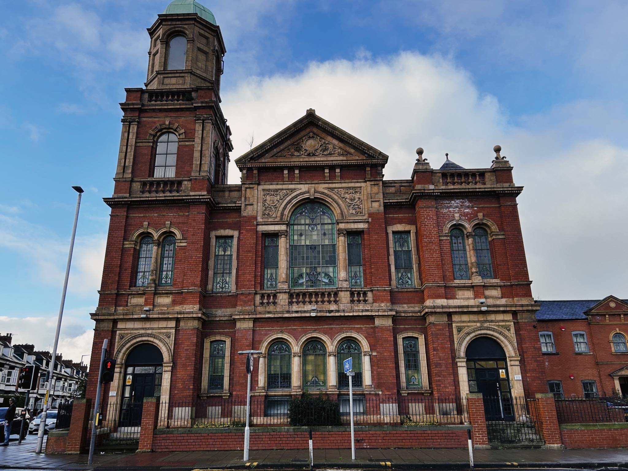
The front elevation of the church, 2024

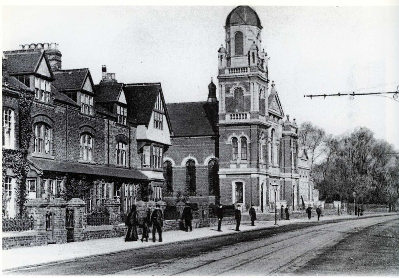
Undated shot of the church looking north. Source: Bolckow, Flickr https://www.flickr.com/photos/bolckow/3092338553/