Morpeth, Northumberland
Morpeth Court House
Last Updated:
30 May 2023
Morpeth, Northumberland
This is a
Court House
55.165119, -1.685525
Founded in
Current status is
Extant
Designer (if known):
John Dobson

Listed Grade II
Hop into Northumberland and you instantly bump into another John Dobson treat - the towering Morpeth Court House.
He designed it in 1822 and was originally the gate to a much larger complex. It replaced the older Gaol, with Dobson’s design winning a competition.
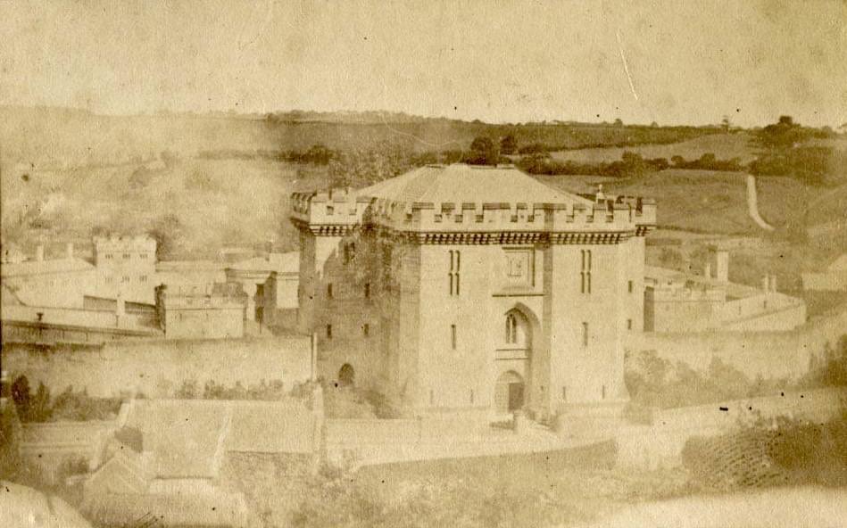
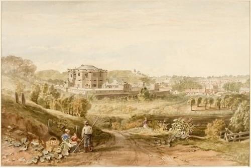
I’ve attached a map below which shows the octagonal Gaol behind the court house. It featured both male and female debtors prisons, a chapel and graveyard. It held on average 93 prisoners, with over 450 prisoners held here in total throughout its life.
The prison closed in 1881 with the prisoners moved to the Carliol Square Gaol in Newcastle. Everything was demolished but the Court House, and remained in use until 1980 when the court functions moved to Bedlington. It is important to note however a police station did remain on the grounds until at least the 1890s, though was vastly reduced in size and didn't make use of the surrounding grounds.
From there on they’ve been private residences. You can still make out the boundary of the jail today though.
The Historic England listing states:
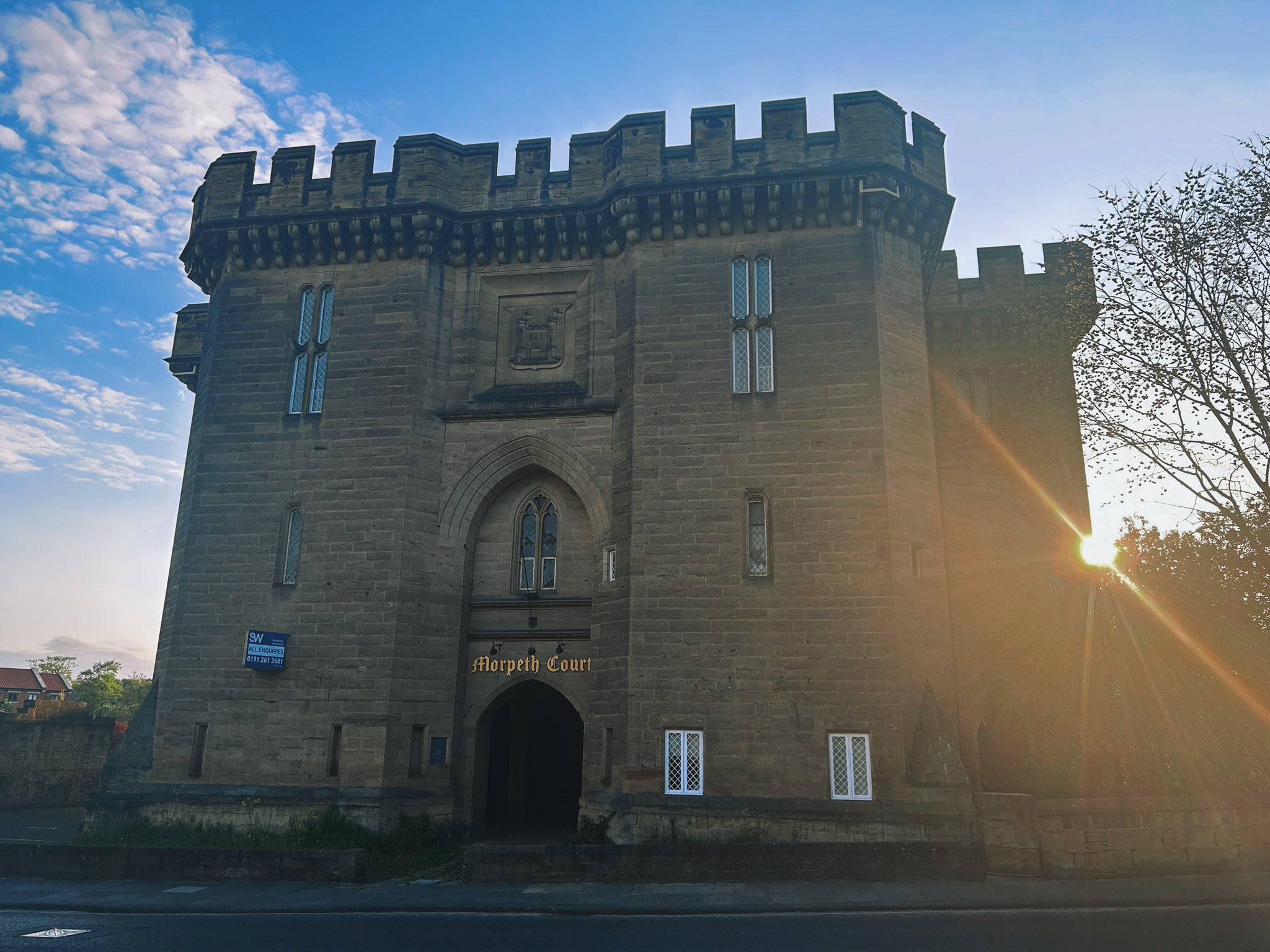
"Former courthouse, and gateway to former gaol; now restaurant and apartments. 1822 by John Dobson. Ashlar. Castellated Gothic style. Massive square front block with square side towers and 8-sided apsidal back. 3 storeys, 3 bays. Central Tudor-arched carriage entry in 2-storey pointed-arched recess with triple-chamfered arch; 2-light Decorated window on 1st floor and very large Civic crest on second floor. Canted outer bays have large broached buttresses at the corners. Small diamond-paned windows with shouldered lintels on 1st floor and large mullioned-and-transomed crosses with shouldered lintels on 2nd floor. Battlemented parapet on large close-set triple-stop corbels.
Vaulted passageway through building has one bay of rib vault then pointed tunnel vault with transverse ribs.
Interior: Gothic, stone imperial stair with plaster lierne vault. Former courtroom, now bar and restaurant, has elaborate Tudor-Gothic ceiling divided into 8 large triangles with large moulded principal ribs on arched braces; each triangle sub-divided by smaller ribs and cross ribs and with tracery at the apex. 8-sided, canted stone screen with 8 pointed-arched doorways, and pierced parapet with Tudor-rose panels."
Listing Description (if available)


Both maps above illustrate the immediate area around the Court House between the 1850s and 1890s. The incredibly detailed 1859 plan shows the Court House and Gaol during operation, including the roles of each portion of the prison. You can see the yards and cells clearly, but there was also a chapel, grave yard for deceased prisoners, labour shed for work and wash houses. It seems quite staggering to me all this will have fit in what now feels like a small plot of land.
The 1890s map tells a different story - this is after the closure of the Gaol when all functions went to Newcastle. The boundary of the gaol remains but is vastly reduced to accomodate the police station only. The environ's have relatively stayed the same as they have today, though part of the prison complex has been redeveloped.

Funnily enough, a school was built on the site which has since been redeveloped as Morpeth County First School. This is the point in which, apart from the structures themselves, the boundary of the gaol started to disappear. Urban sprawl started to occupy the land to the rear of the Court House which was previously farmland, but a prime location given its distance to the Railway Station.

Photograph of Morpeth Court House in 2023, retaining the Morpeth Coal of Arms on the 2nd floor.

Photograph of the Court House and Gaol at the rear from Haw Hill - likely 1870s or 1880s. Original source unknown.

Painting of the Court House, the Gaol and wider Morpeth from the South East. Original source unknown
