Monkton, Jarrow
Monkton Hall
Last Updated:
10 Jul 2023
Monkton, Jarrow
This is a
Mansion House, Hospital
54.966421, -1.502902
Founded in
Current status is
Extant
Designer (if known):

Grade II Listed
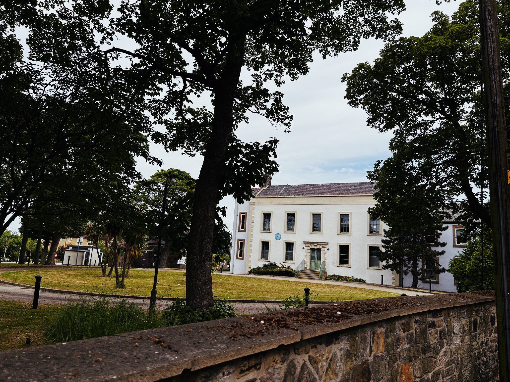
Monkton Hall is a beautiful mansion house standing on the western edge of Monkton village. The main building was completed in 1763, with a rainwater head deriving from this year as per the Historic England listing.
The estate was previously much larger, incorporating the land now occupied by Campbell Park Road and very likely many of the fields around it.
The hall was originally constructed for William Burn, who occupied the site for around a decade, and was put up for sale in 1770 with little explanation. It was then bought by the Major family who occupied the hall until the mid 19th century when William Snowball took over its ownership. Some might know the Snowball name from the Gateshead department store as well as the mining and firebrick enterprise his older bother James ran. Snowball & Son was opened by William in 1850 at Gateshead High Street, occupying the site until WWII, when they were forced to close their doors,
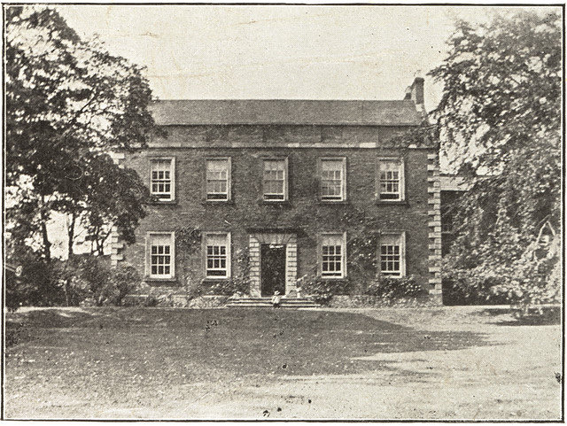
During Snowball's ownership the building was greatly expanded with extensions to the north and the east of the property. These are notable when comparing photographs modern and old.
The estate went through a couple of other owners. Local merchant George Carins was one as well as Francis Scott in 1903. Scott was a market gardener, and was the man responsible for turning the all into a hospital for the mentally disabled.
It was opened in 1907 as the "Monkton Hall Hospital for the Feebly Minded", and was a charitable organisation until the advent of the NHS in 1947. With this said, it does appear part of the hall was retained for hospitality purposes. A function was held for a Mr Chester, a well known resident of Monkton who was taking over a Sussex farm in 1914.
The building pre-dates the National Health Service as a care facility by some 4 decades. This makes it an important asset of the area's history concerning disability and neurodivergence.
One of the first reports in contemporary newspapers specifically regarding the hospital is the Jarrow Express in March 1917, when a party of singers from Hebburn entertained the residents earning "well merited applause". "Tasty snacks" also disappeared with the "promptitude of Huns on the Ancre".
It is clear Monkton Hall played a central role in the evolution of the village, and continues to do so today as a space for health care provision for those with learning disabilities in the South Tyneside and Sunderland area. A few blocks have been erected alongside the hall but the building itself retains personality and character as a centrepiece for the complex.
A sundial on the main elevation dates from 1773.
Listing Description (if available)


Both maps above depict the Monkton area between the 1850s and the 1890s.
The first map was surveyed in 1858, and shows the (at this time) modest Monkton Hall on an angle with a circular drive alongside the main lane through Monkton. Its estate can be seen with a wooded perimeter and open grounds to its west, with outbuildings on the northern perimeter popping up on the 1890s map. Much of the village appears similar to today, though there are subtle changes.
A Wesleyan Methodist Chapel appears to have moved eastwards next to the Pontop & Jarrow Railway. The cycling ground was also erected in the early 1890s on farmland.

Again, there had been very little change by the 1910s, as even the Lord Nelson hadn't been rebuilt until the 1920s. The Mission in the village was now illustrated and some terrraces had reached the east periphery of the village. It appears the Methodist Chapel had once again relocated slightly eastwards from the railway line.

Monkton Hall in 2023, with its extensions and fresh lick of paint on show.

The previous uncovered brick facade of Monkton Hall. The west wing extension hadn't yet been constructed.
