
Border Counties Bridge
Hexham
Last Updated:
1 Jan 2026
Hexham
54.982062, -2.120708
Site Type:
Bridge
Origin:
Status:
Partly Preserved
Designer (if known):
L Kirkcup & Co
Only the piers are still in situ
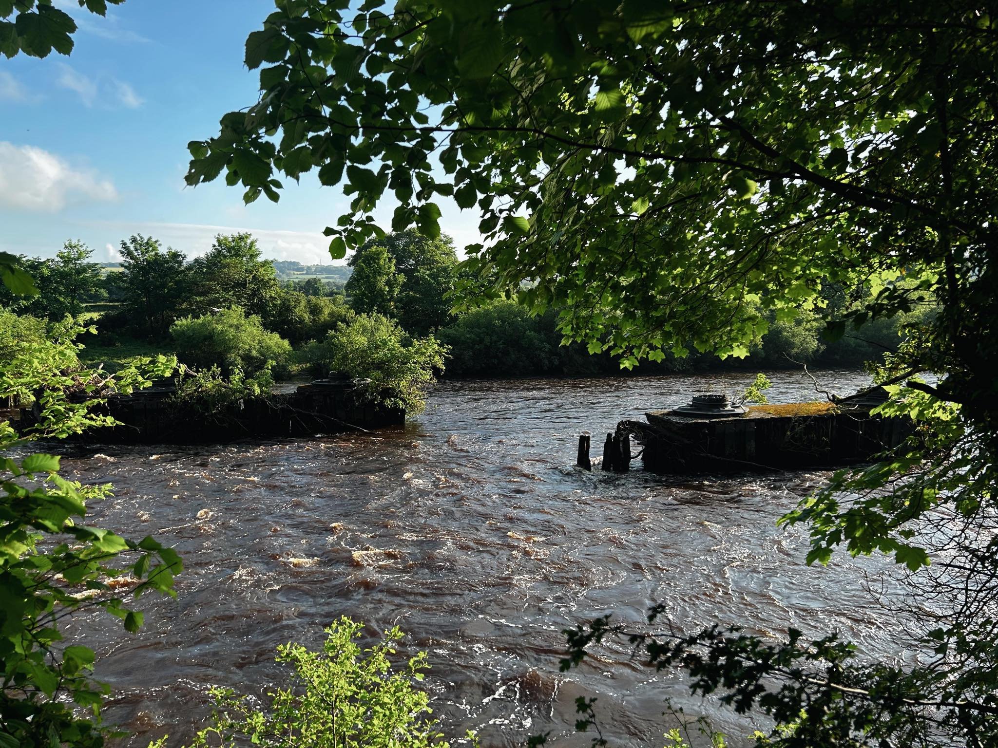
These piers standing defiant in the River Tyne at Hexham are the last remnants of the Border Countries Bridge, which provided the railway access to the depths of the Northumberland country.
From Hexham, you'd be able to catch a train all the way up the region to Kielder, Riccartonthen Edinburgh. The bridge itself was constructed in 1856 and is wholly made of iron and 4 concrete piers.
The bridge was designed by L Kirkup & Co, who were in fact shipbuilders at what's now St Peter's Basin, Newcastle. Lancelot Kirkup were actually only in business for a few years in the 1850s, but they were a fairly early iron builders and their expertise will have been seen as invaluable. After their business failed in 1857, a year after the opening of this bridge, Lancelot emigrated to Canada. Kirkup's shipyard can be seen on the Shipbuilding Archive here: https://www.northeastheritagelibrary.co.uk/shipbuilding-archive/ncl007/rogerson's-shipyard
The deterioration of the bridge was a major factor in the whole lines closure, and had structural issues from opening. Weight and speed restrictions were continuous, and part of it was damaged by floods in the 1940s. This bridge remained in use until 1958, and was demolished soon after. All that remains are the piers we see today.
Listing Description


The Ordnance Survey maps here illustrate the railway crossing between the 1850s, when the first map was surveyed, and the 1890s. Interestingly, back in the 1850s there was a railway shed on the north banks of the Tyne which was defunct by the 1890s. It had no actual road access, meaning it must have been a locomotive yard for the Border Counties rather than a goods yard per se? A boat yard was also cleared by the end of the century, but apart from this there is little change anywhere in this scene. Given the rural nature this my be expected at this time.

The Ordnance Survey map witnesses a small change in the industrial and urban makeup on the fringes of Hexham. A waggonway had been constructed to connect the drift at Acomb as well as the construction of a tramway adjacent to it. Tyne Green is also first acknowledged as being in use as a golf course alongside that just south of the railway junction.
Photograph from the riverbank of the piers in situ, 2024
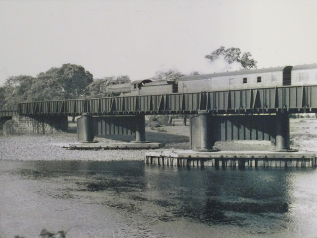
The railway crossing as seen in the 50s, with the piers shown as they were meant to be. Unknown original source.

The bridge can be seen here on this aerial shot from 1945. Source: Historic England Archive (RAF photography) raf_106g_uk_627_rs_4005 flown 10 August 1945