Billy Mill
North Shields
Last Updated:
22 Nov 2023
North Shields
55.015693, -1.473775
Site Type:
Mill
Origin:
Status:
Demolished
Designer (if known):
Currently a vacant plot

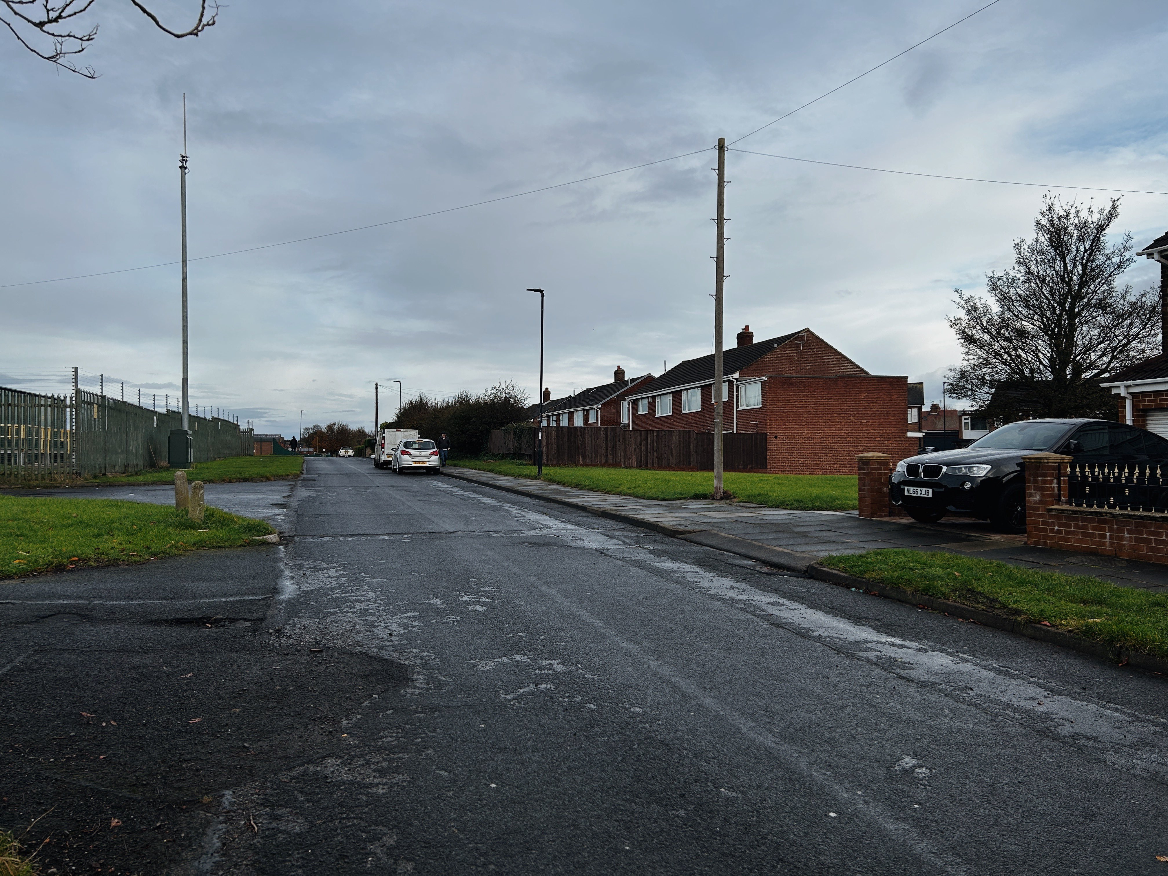
If anyone living on this street was dumbfounded by the guy standing in the grass trying to get these comparison shots, my apologies
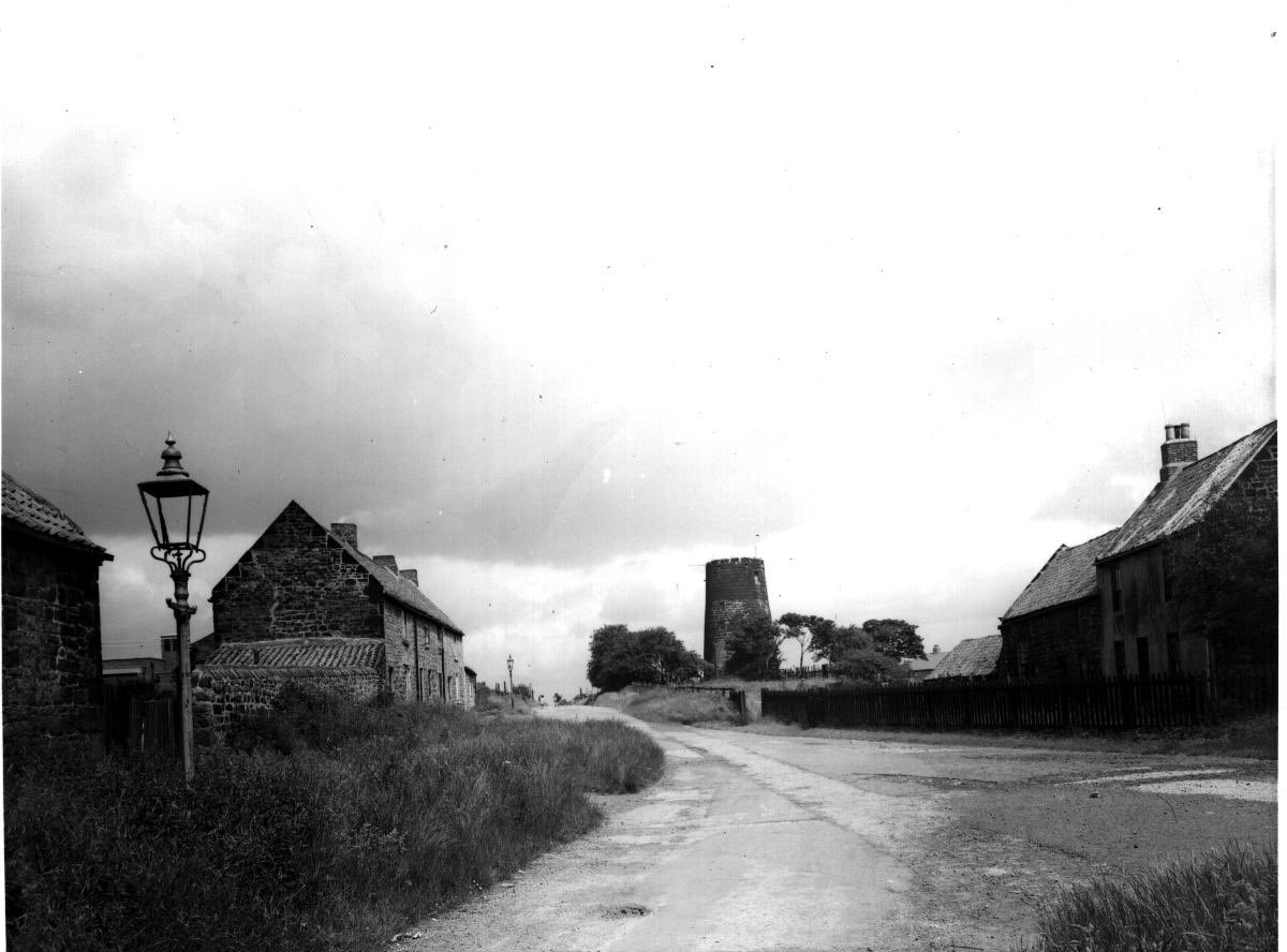
This is Billy Mill, which gave its name to the wider area. There was a windmill here from at least 1320, when a “Billing’s Mill” was granted to the monks of Tynemouth Priory.
It was later rebuilt in the late 16th century with timber from the banks of the Tyne and millstones from Barnard Castle - a long way for those horses to carry on those carts! At this time it was on land owned by the Earl of Northumberland.
The mill we see on these photos dates from 1760. It was still running, to some extent, into the 1840s when it was listed for let by the Duke of Northumberland. The windmill was attached to a dwelling house, cottage and small garden. There was a kiln and stables some decades earlier.
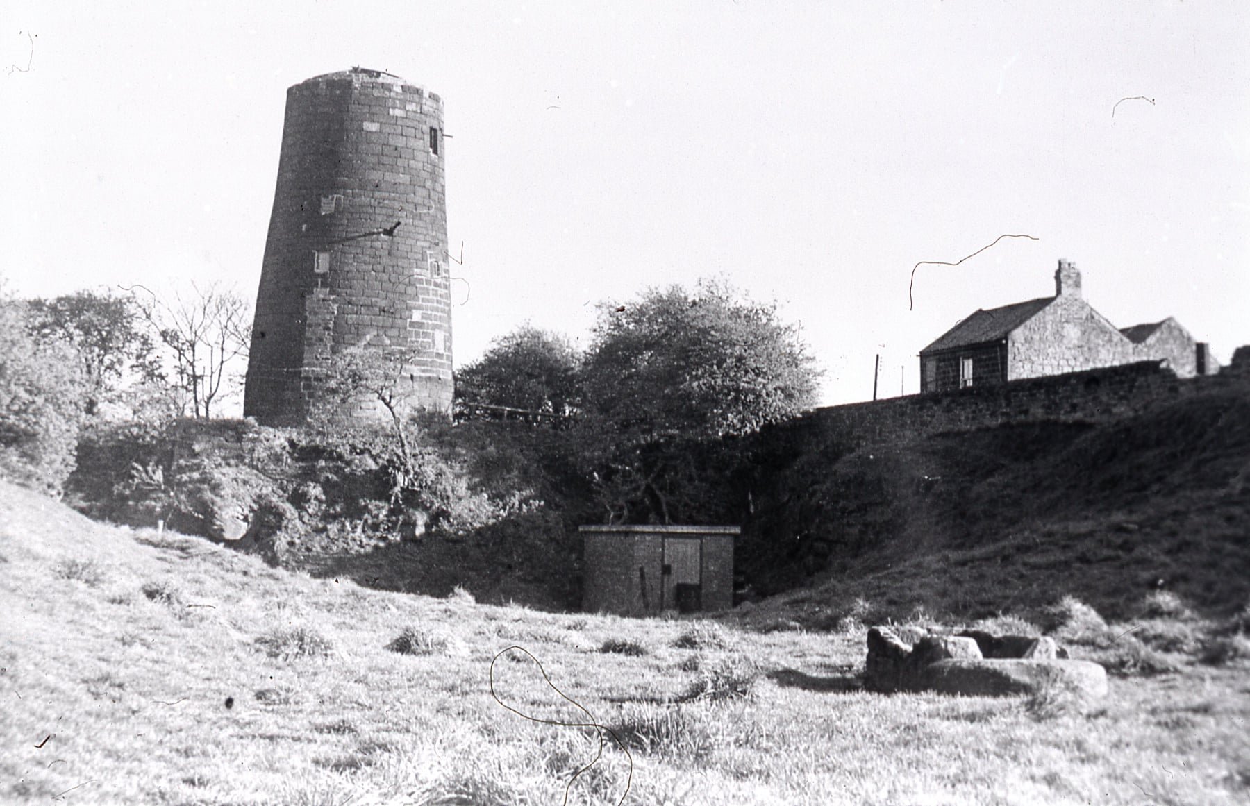
It seems this was the tipping point though - it fell into ruins by the late 1850s, though survived well into the1960s in a state similar to that at Heaton Park before it was renovated. Contemporary evidence seems to suggest that after falling into disuse in the 1850s, the mill was renovated with a steam engine inside, with the surrounding estate including a bakery, gas works, stabling, cart sheds, grocers shop and dwellings. It was used as a granary, chicken house and as an observer post during the war, with the sails and cone removed long before.
A piece from the Evening Chronicle of 1962 reports on the considerations to save or demolish it, with the costs adding up to £2k to restore it (around £47k in todays money). Land around it was sold to J H James & Sons Ltd for 46 semi detached villas, though the mill remained under the ownership of the Collingwood Estates which may explain why nothing has been built here since.
Listing Description


The above maps illustrate the Billy Mill area in the latter half of the 19th century. The area developed around the Chirton Hill farmstead, with a quarry, public house and the windmill comprising the area. The windmill featured its own small reservoir, and it looks like a gin gang was situated 50 metres south. A gin gang is a horse engine, similar to what you can find at Beamish with a revolving arm.
The 1890s map bares few changes, though Preston Colliery was resited nearby. The disused quarry became a rifle range, utilising the excavated land for target practice. This later became a rubbish dump and potential piggery. It doesn't look like this ever took place.

The map published in 1946 was surveyed in the late 1930s, before the advent of WWII. North Shields suburbia soon enveloped the area, consuming the semi rural fringes of the town. Other amenities were also required to lift the living standards of the population - reservoirs, cemeteries and the isolation hospital were all opened nearby given the land was much less densely used than the centre itself.

An undated photograph of the mill from the bottom of Billy Mill Lane, featuring a number of the surviving farm buildings and cottages. Unknown original source.

A photograph taken from Billy Mill Quarry immediately north, which is all covered by housing. You can see the dilapidated state of the mill. Unknown original source.

The mill was situated in the vacant plot behind the telegraph pole. The land has been re-landscaped so it bares little resemblance from the photos above.