WW08
Rising Sun Colliery Railway
Battle Hill, North Tyneside
55.008043, -1.541010 to 55.010546, -1.488760
Opened:
Closed:
1906
1969
Entry Created:
1 Aug 2022
Last Updated:
1 Aug 2022
Alignment Partly Preserved
Condition:
Owners:
National Coal Board
Description (or HER record listing)
NEHL - The railway linked Rising Sun Colliery, opened in 1906, to the staiths near Percy Main via a straight stretch through to the Blyth & Tyne. The reopened Bigge Pit also utilised the stretch and had a number of sidings in use. Aerial photographs show the railway was single track throughout. Part of the railway still exists as the line onto the North Tyneside Steam Railway, and the bridge over the former line to West Allotment is still used.
WALKABILITY: ★★★★☆
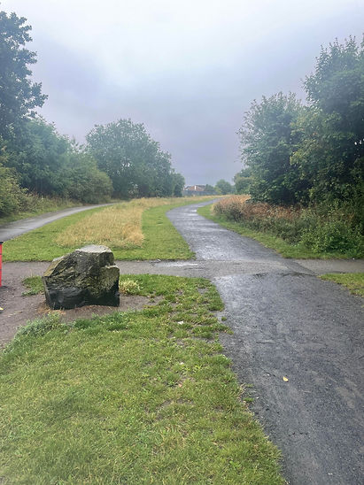
The trail is excellent to work, and is suited to anyone with additional needs. Veering from the Rising Sun County Park, the length of the line is flat and straight to the Silverlink area. For a short walk, it is certainly one to consider.

Ordnance Survey, 1953

There are two paths here, presumably one for cycling. This section accomodated sidings for the rejuvenated Bigge Pit.
Have we missed something, made a mistake, or have something to add? Contact us

Aerial shot from 1947 showing the railway (from left to right) reaching the Blyth & Tyne to Percy Main. The bridge visible still exists. Much of the land directly south is now Silverlink. Source: RAF_CPE_UK_2352_FS_2155, Historic England
Historic Environment Records
Durham/Northumberland: Keys to the Past
Tyne and Wear: Sitelines
HER information as described above is reproduced under the basis the resource is free of charge for education use. It is not altered unless there are grammatical errors.
Historic Maps provided by

