shil01b
Shilbottle Colliery
Shilbottle
55.364765, -1.662774
Grange Pit
Opened:
Closed:
1925
1982
Entry Created:
9 Jan 2023
Last Updated:
21 Jun 2024
Reclaimed
Condition:
Owners:
Co-Operative Wholesale Society Ltd. (1925-1947), National Coal Board (1947 -)
Description (or HER record listing)
NEHL - The Grange Pit was the last of the Shilbottle Collieries operating, through to 1981. It was a substantial site linked to the East Coast Main Line near High Buston, and became the main centre for operations after the Longdyke Pit closed in 1924.
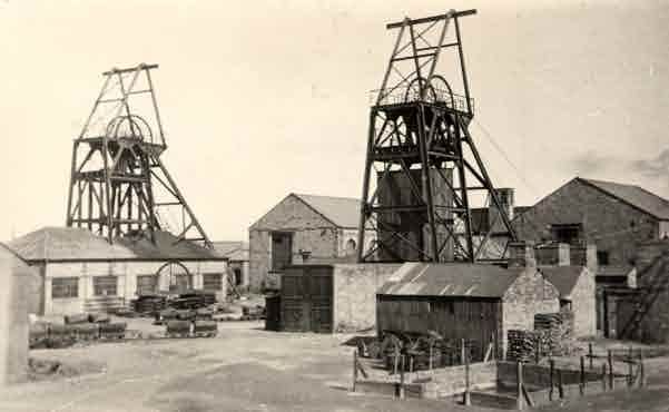
The pit is shown on mid century Ordnance Survey maps with its extensive spoil heap and modern colliery complex. There were two pit head gears.
Though the site boundary can still be seen today, little remains of the colliery itself.

Ordnance Survey, 1966

Undated photograph of Shilbottle Colliery, presumably 70s or 80s. Source: Northumberland Archives, NRO 8693/10
Have we missed something, made a mistake, or have something to add? Contact us

Photograph of Shilbottle Colliery in 1940. Source: Northumberland Communities
Historic Environment Records
Durham/Northumberland: Keys to the Past
Tyne and Wear: Sitelines
HER information as described above is reproduced under the basis the resource is free of charge for education use. It is not altered unless there are grammatical errors.
Historic Maps provided by
