Dunston, Gateshead
Old Mining Remains, Dunston
Last Updated:
22 Jul 2024
Dunston, Gateshead
This is a
Mining Site
54.949853, -1.660975
Founded in
Current status is
Demolished, remains extant
Designer (if known):

Scheduled Ancient Monument
This hill at Dunston is home to Tudor coal mining remains and a 17th century waggonway. For both, they are considered to the best preserved in the whole country - possibly in the world.
This area has been mined as long as the sky has been blue, but this site represents and incredibly rare example of a primitive Tudor mining enterprise. Given the lack of machinery, folk exploited the coal that cropped up to the surface and dug it out with picks and shovels. There's at least 3 or 4 earthworks here, but I'm showing you what I think is the most obvious on the west side of the hill. You can see they literally dug down a few metres.
In later years the Clavering's and other such landowning families exploited these lands with deeper shafts, which were still visible here as late as the 60s and potentially still buried in the bushes.
Slightly later but not by much, we also see evidence of the Northbanks Way, an incredibly early railway established by one of the families mentioned. Hon. Charles Montagu obtained permission to build the waggonway in the late 1680s, and was built in the 1690s. This railway led from coal workings at the top of the hill to staiths on the Tyne.
It was the most expensive railway ever built at £5739 (which is about £750,000 today), and ended up carrying around 780,000 waggonloads of coal according to estimates. It was also the site of the first recorded brake-testing for the waggons, pulled by horses at this time.
It did not last long however. By the 1720s, the timbers were lifted and reused at Blackburn Colliery near Kibblesworth.
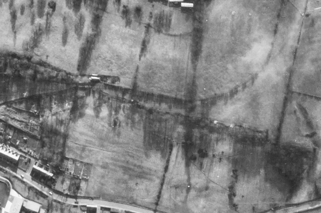
Again, I've annotated the most obvious remains of the waggonway. This hill features a cutting and embankment, despite only lasting a few decades. Perhaps its sudden closure and the steep gradient here protected it from development.
Listing Description (if available)


Though the old mine shafts date back 2 centuries before, they are labelled as prominent remains on the first two editions of the Ordnance Survey. As a result, some visual evidence must have been around at this point. There are two 'Old Shafts', signifying two indicators.
There is just one on the second edition, south of the spring.

The third edition still shows an old coal shaft in the middle of the field close to Whickham Thorns.
Upon examination on Google Maps no evidence remains. However, there is a circular patch of dried grassland which happens to be in the same location. It may be a relevant indicator.
The NAA excavated Dunston Hill recently and found evidence of the old mine workings and waggonways. There is also evidence the Bell pit combusted. See more info here: https://www.northernarchaeologicalassociates.co.uk/dunston-hill-archaeological-excavation

Aerial photograph of the Northbanks Way and Dunston Hill, 2024

A clear example of outcrop mining at Dunston Hill 2024

This aerial photograph from 1960 shows very clearly, before the dense vegetation. Source: Historic England
