D62204F
Lumley Colliery
Lumley
54.835714,-1.522672
8th Pit
Opened:
Closed:
pre-1890s
Entry Created:
2 Dec 2021
Last Updated:
5 Feb 2025
Reclaimed
Condition:
Owners:
Stobart, Bell & Co. (1850s), Earl of Durham (1860s), Lambton Collieries Ltd. (1896), Lambton & Hetton Collieries Ltd. (1910s), Lambton, Hetton & Joicey Collieries Ltd. (1940s), National Coal Board (1947)
Description (or HER record listing)
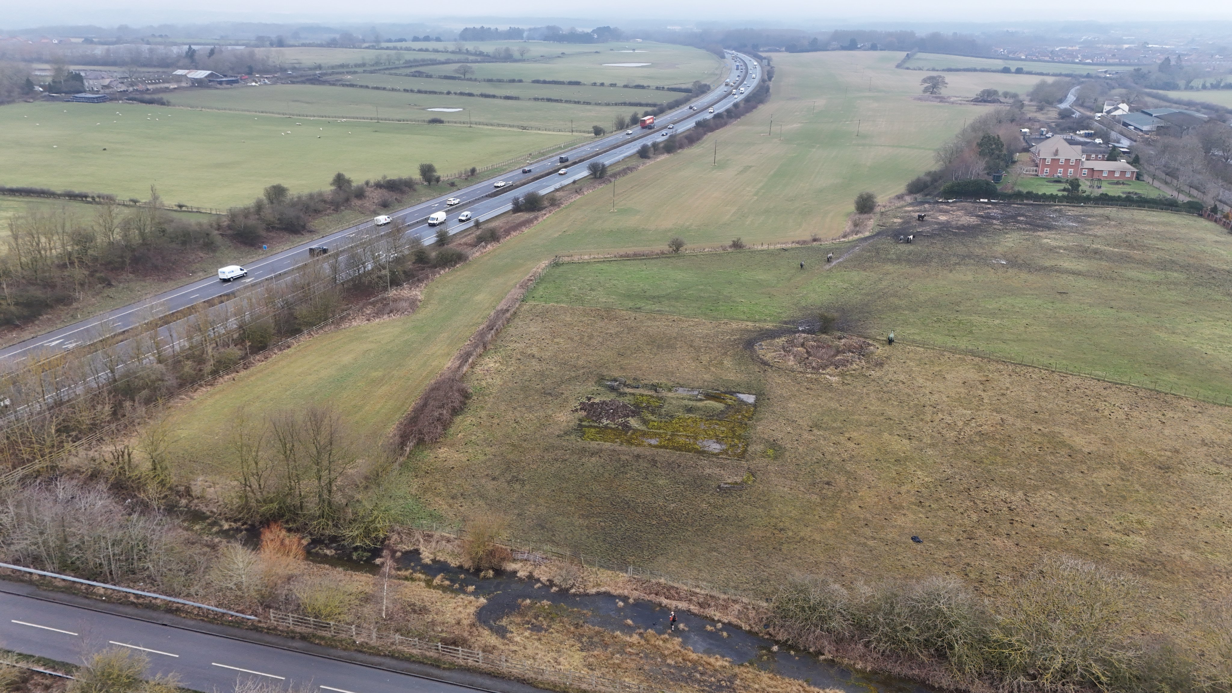
Directly next to the A1, and you can still see material remains of an early 19th century waggonway and colliery.
Between Chilton Moor and Great Lumley you can find this field - now part of a livery I think. This was once the site of the Lumley Eighth Pit. It was owned by the Earl of Durham and this was opened by the 1830s or 40s. It was ideally located on the Lambton Railway, which allowed easy transport to the huge staiths at Sunderland.
The pit predominantly provided household & industrial coal for factories and all sorts of dirty industry. Though relatively small, it was one of a string which lined this waggonway from Bournmoor all the way to Cocken Wood. This section was rope hauled, and before the A1 there was a substantial incline with two engines - one in the distance just passed the houses and another just south of Great Lumley.
This is the part of line which is very identifiable thanks to the field boundaries. That harsh curve is where waggons took on coal from the shaft and transported it northwards. In fact, see that circular earthwork? The shaft is in the undergrowth and very clearly identifiable.
The pit was out of use by the 1890s, so it's quite extraordinary to survive in this way.

Ordnance Survey, 1890s

The site of the Lumley Eighth Pit, with the shaft clearly evident, in January 2025. The field curve represents the course of the old waggonway.
Have we missed something, made a mistake, or have something to add? Contact us
Historic Environment Records
Durham/Northumberland: Keys to the Past
Tyne and Wear: Sitelines
HER information as described above is reproduced under the basis the resource is free of charge for education use. It is not altered unless there are grammatical errors.
Historic Maps provided by
